
Welcome back to our adventures on the Trail! For our final long-distance hike of the trip, we are hiking 60 miles of the Kumano Kodo, an ancient network of Buddhist pilgrimage trails in the mountains south of Kyoto. It’s not our steepest or most remote trail, but it’s certainly the only UNESCO World Heritage Pilgrimage Route on the itinerary. In fact, it’s only one of two UNESCO Pilgrimage Routes in the world, the other one being the Way of St. James on the Camino de Santiago. The trail is covered in religious and natural monuments alike, not to the mention the crazy Japanese wildlife, cedar forests, and Buddhist ghosts that distinguish the Kii Mountains in general. Like the Camino being a network of trails, there are actually 7 different Kumano Kodo trails. We obviously chose to take the most strenuous and the most famous ones, the Kohechi and the Nakahechi respectively, to get the best experience possible. So hold onto your butts, pack your ultralight rice balls, and let’s search for enlightenment!
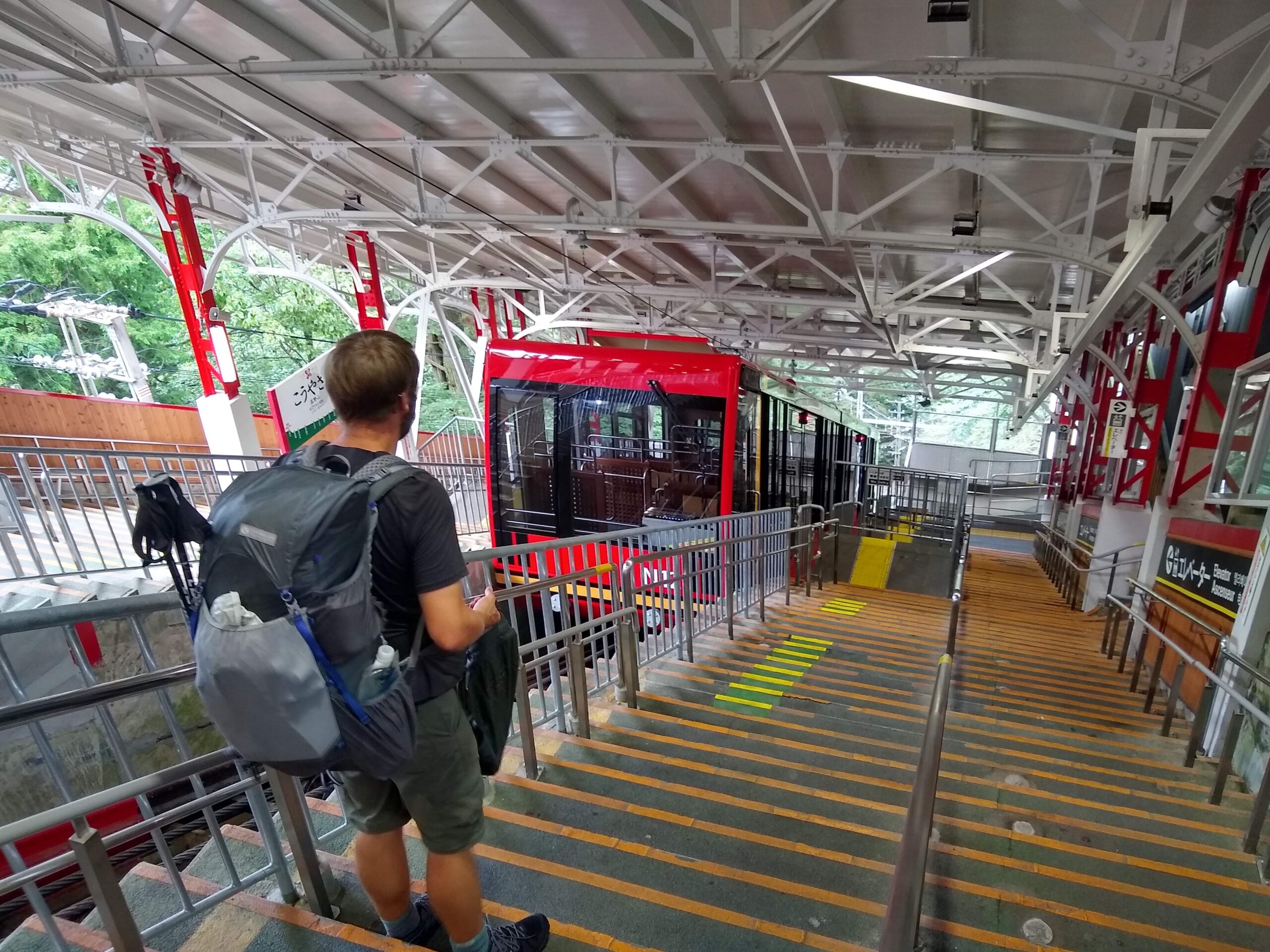
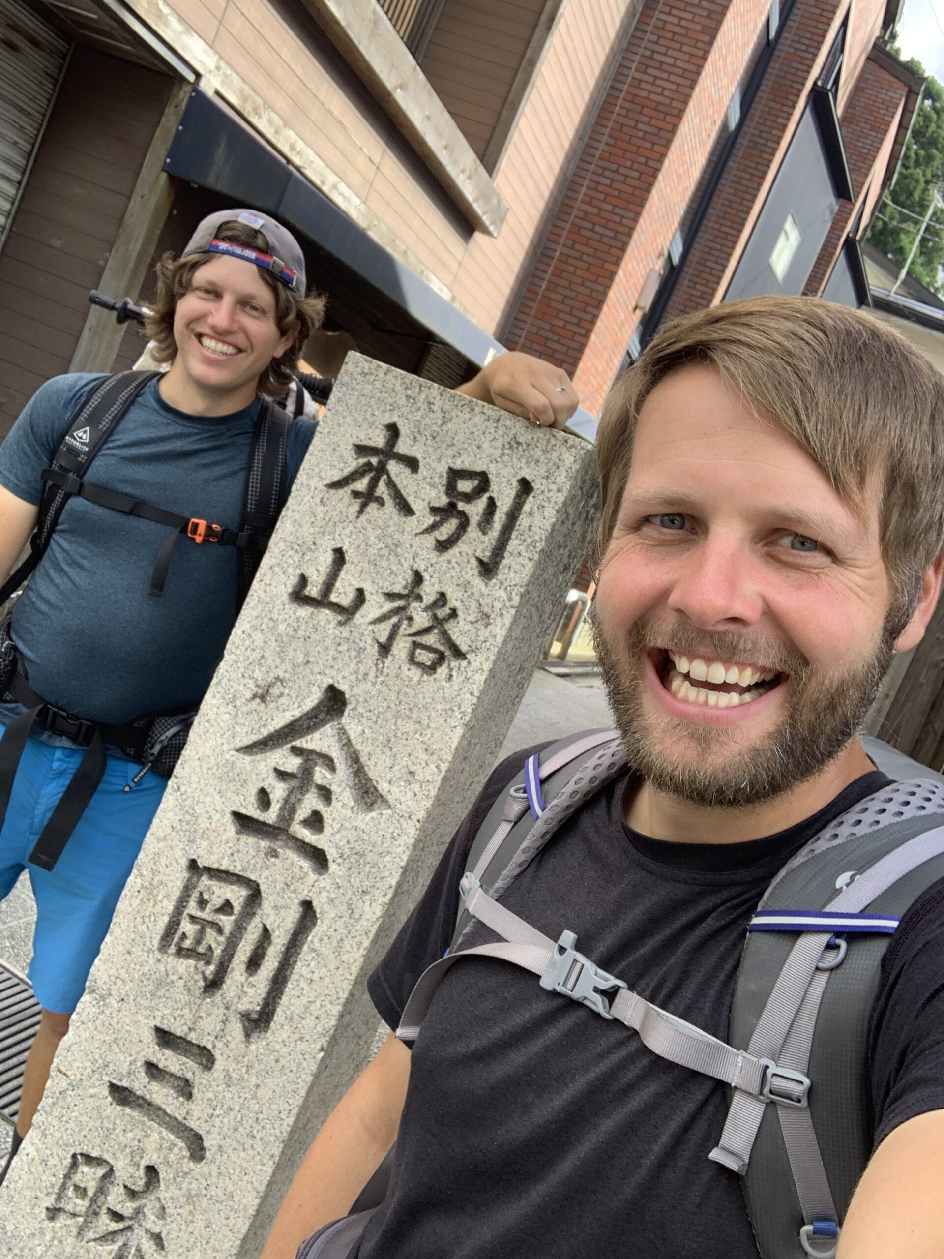
Of course, the path to enlightenment isn’t as easy and just crawling around in Buddha’s intestines. From Kyoto, we were obliged to take 3 trains, an alarmingly steep cable car, and a public bus careening around hair-pin mountain roads to eventually reach the remote little tourist village of Koyasan, where the Kohechi begins. That we successfully planned and navigated all that using only our phones and busted Japanese translations felt no less than miraculous. Anyway, we only stayed in Koyasan long enough to have a coffee and charge our phones before making our way to the official World Heritage Pilgrimage Trail Head – little more than a bus stop a few blocks from the coffee shop. Same spot as the ancient pilgrims*. (*probably)
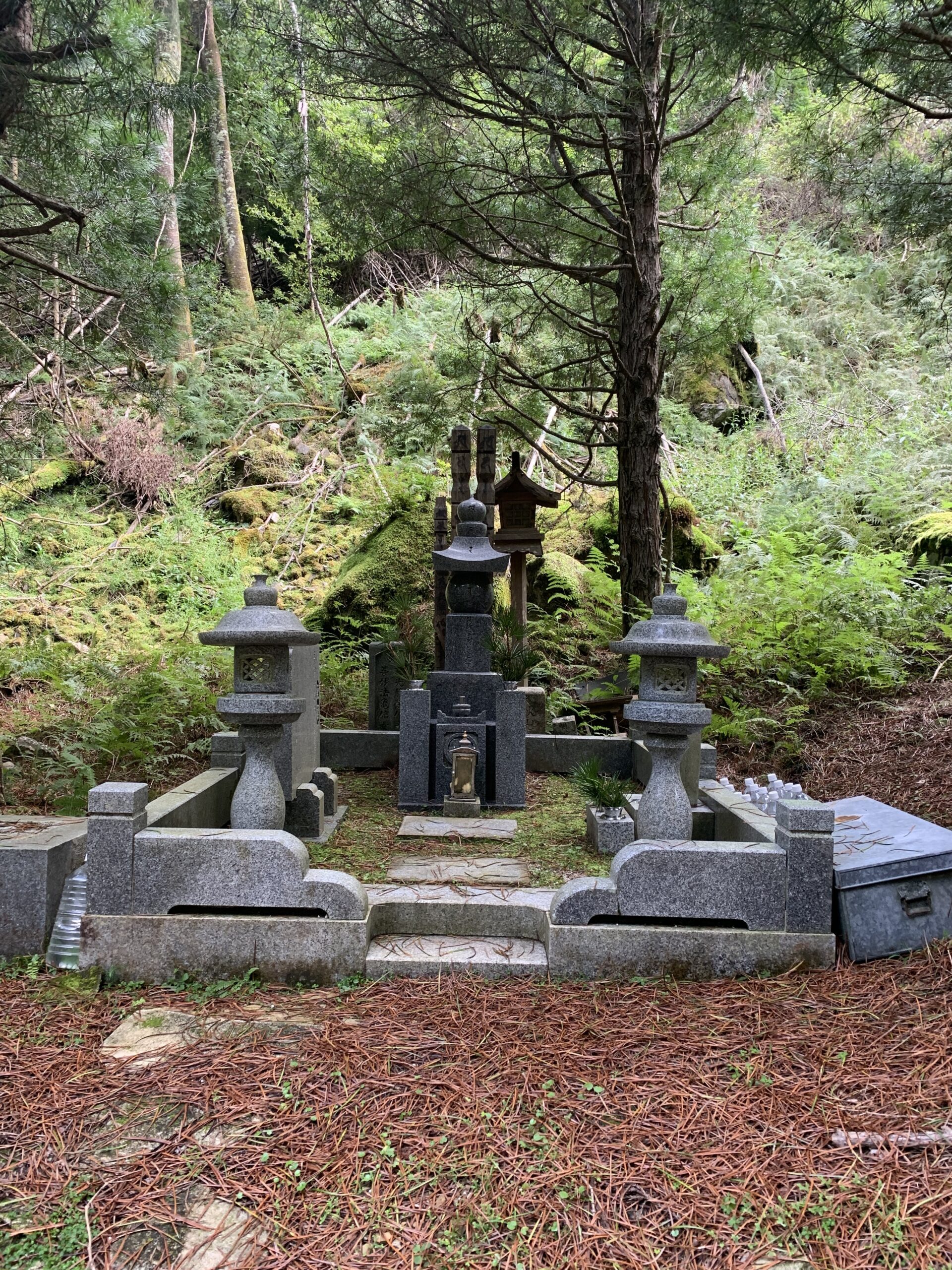
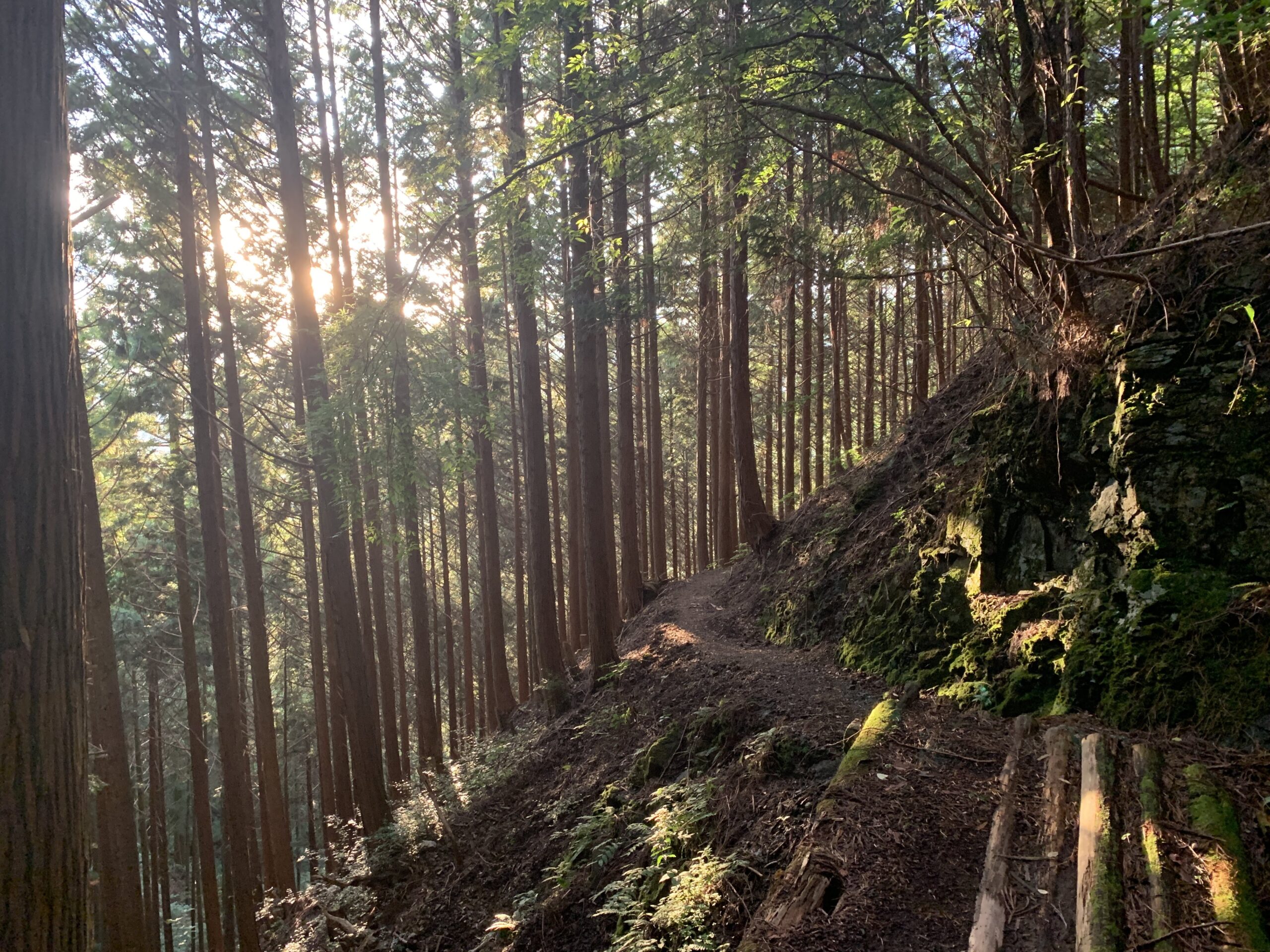
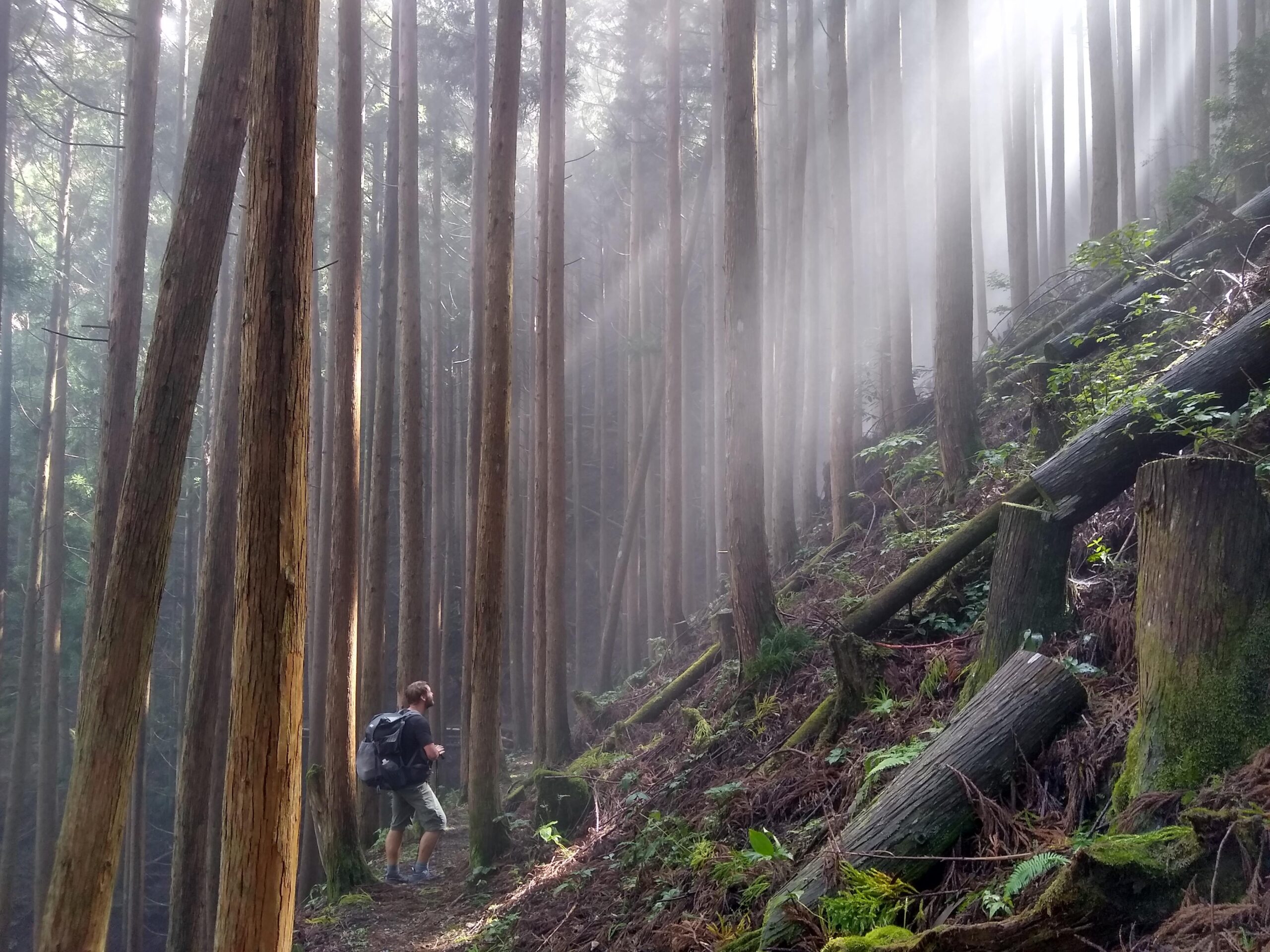
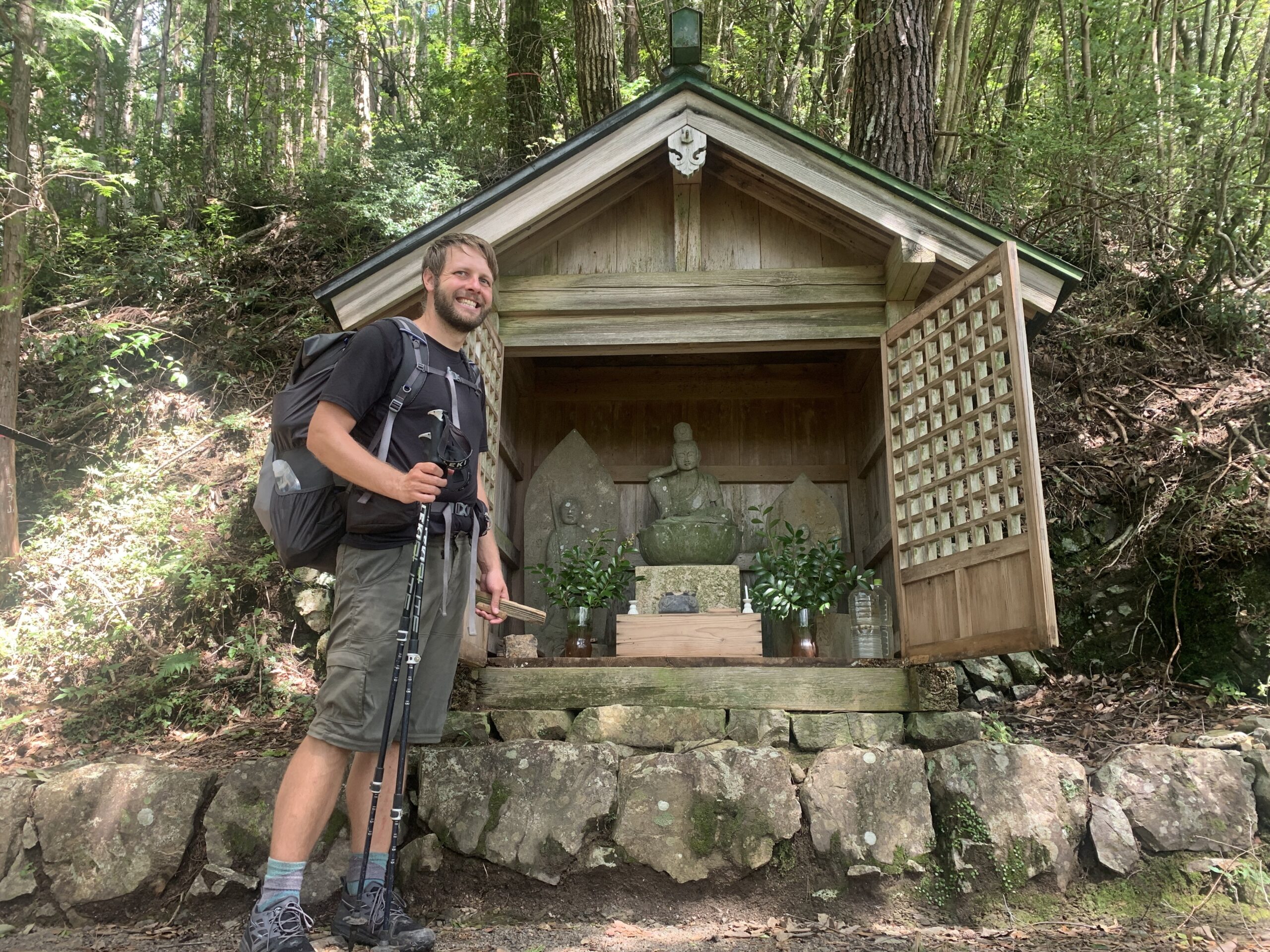
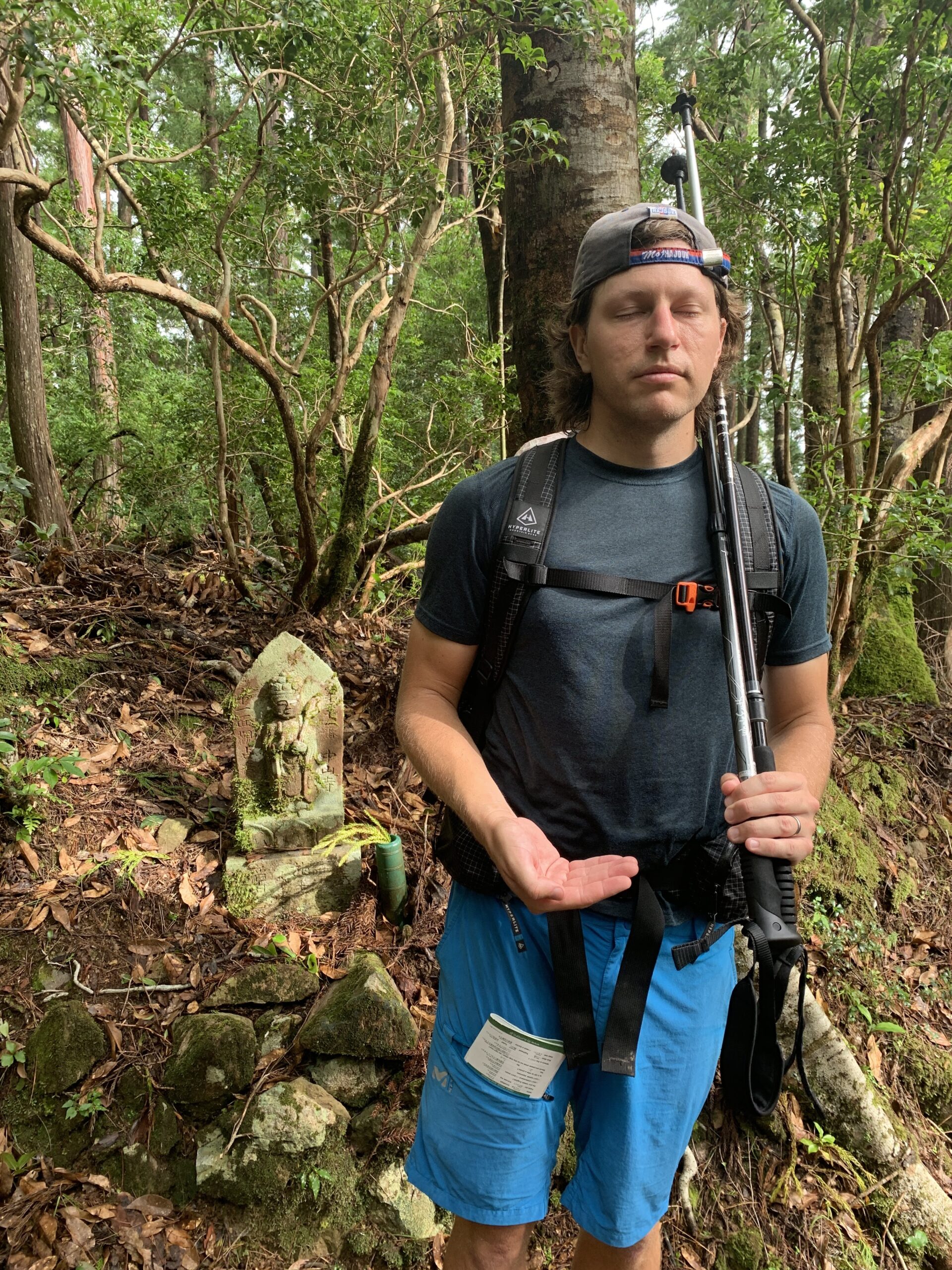
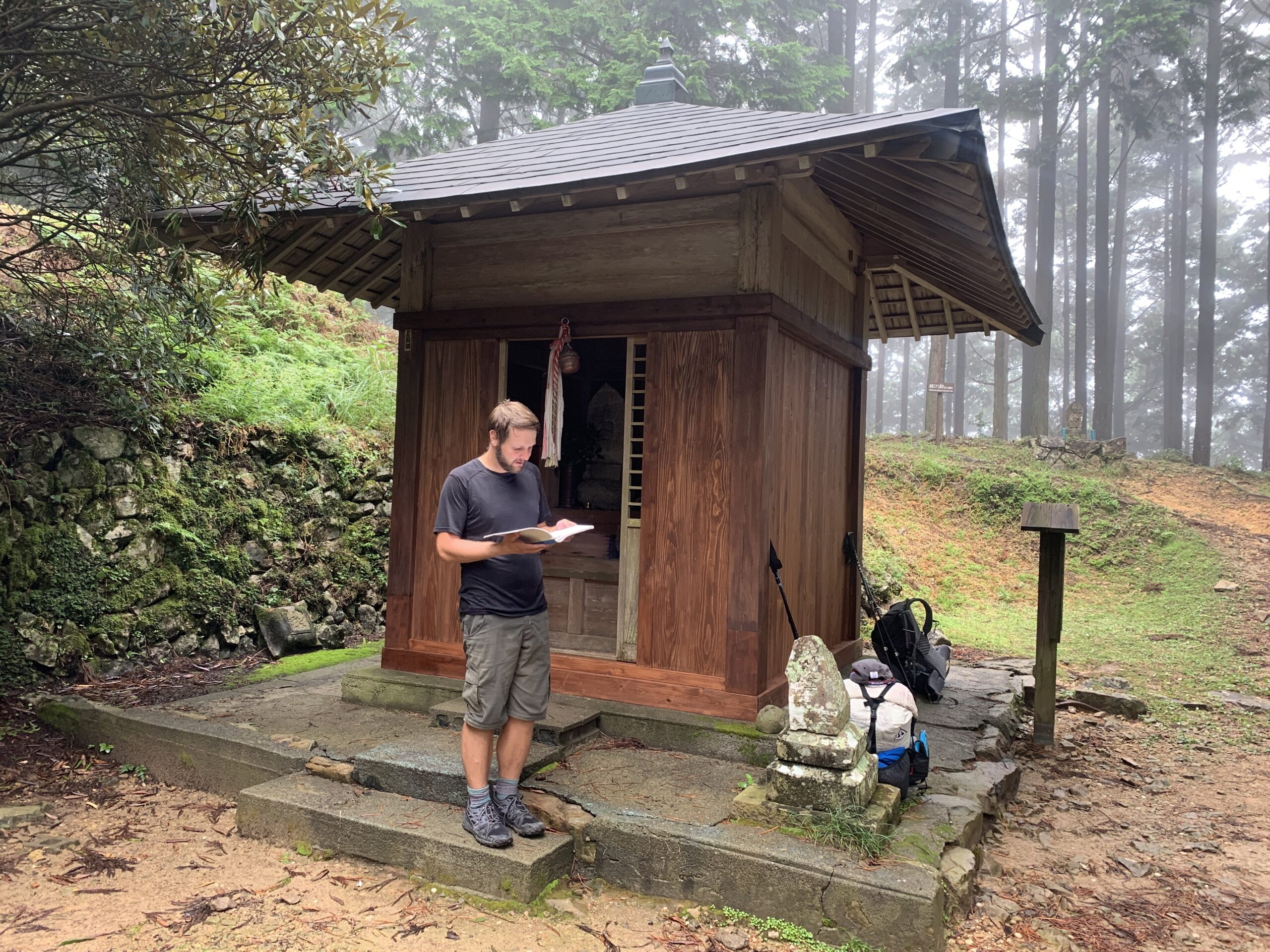
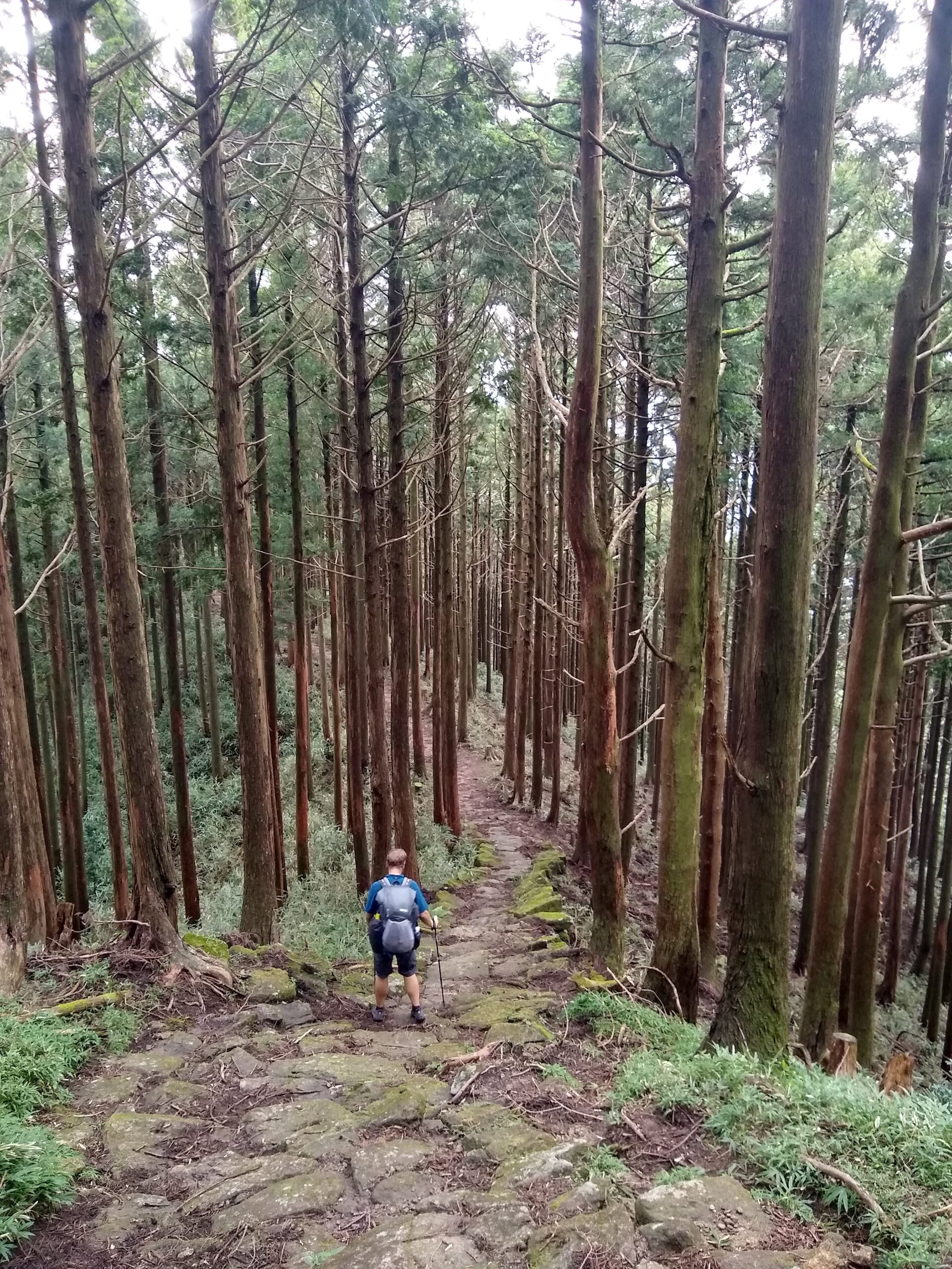
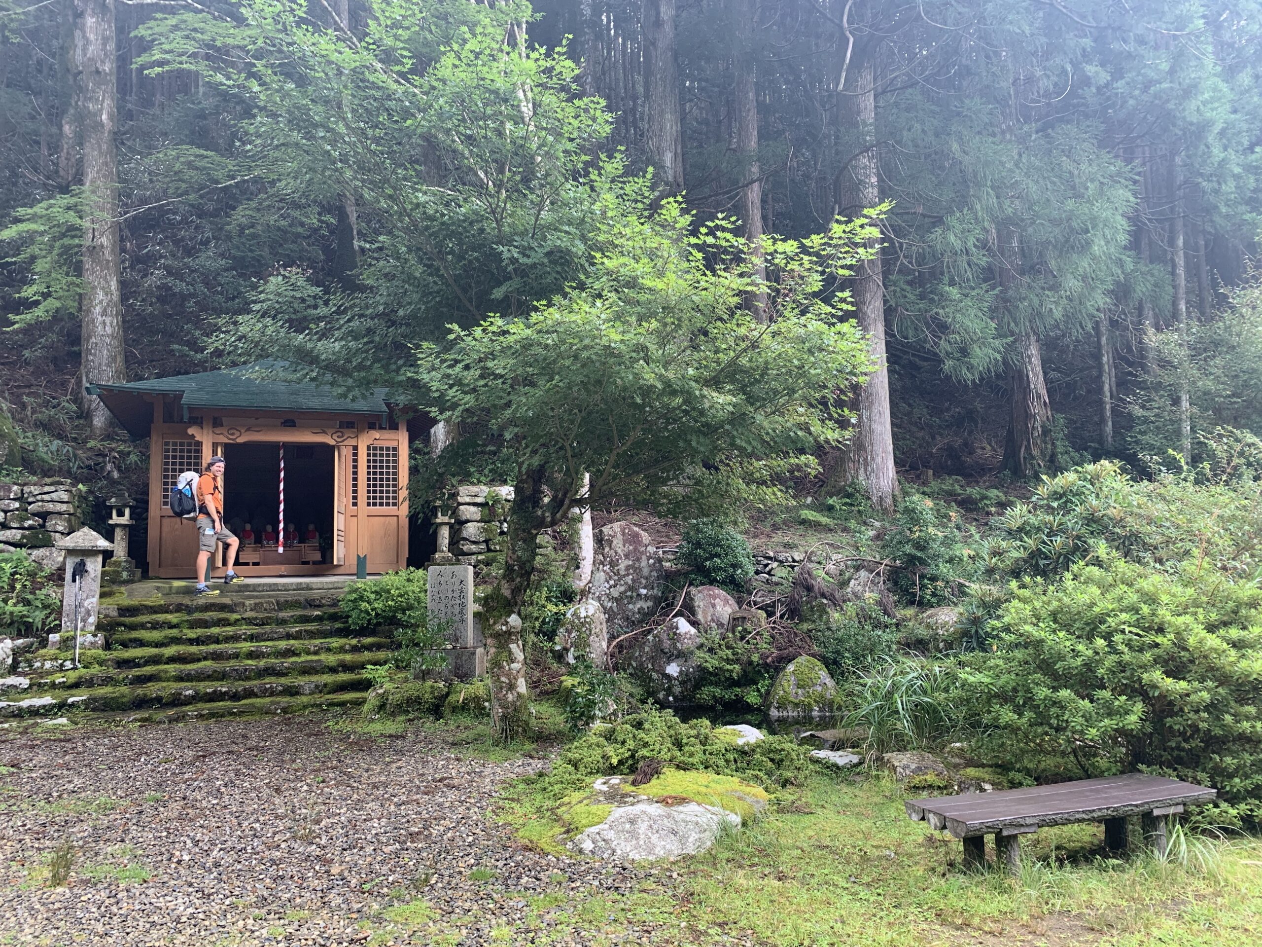
Owing to the convoluted trip from Kyoto, we didn’t actually begin our pilgrimage until around 3:30 in the afternoon, but we made the most of the good weather and made around 5 miles before dark. The weather was cool and shockingly humid, and the pretty forest was littered with all kinds of Buddha statues and informal stone shrines. We eventually found a pleasant little campsite by the road and cooked our awkward Japanese backpacking food dinner (buying trail food in Japan proved to be quite challenging). After dinner, complete darkness descended with a speed quite unlike the endless dusk we had gotten used to in the arctic circle, but the bugs weren’t bad and the forest was pleasantly quiet. Wild camping is technically illegal in Japan but nobody gave us any trouble, not even the man who drove right by our tent in his crazy little truck at 6am.
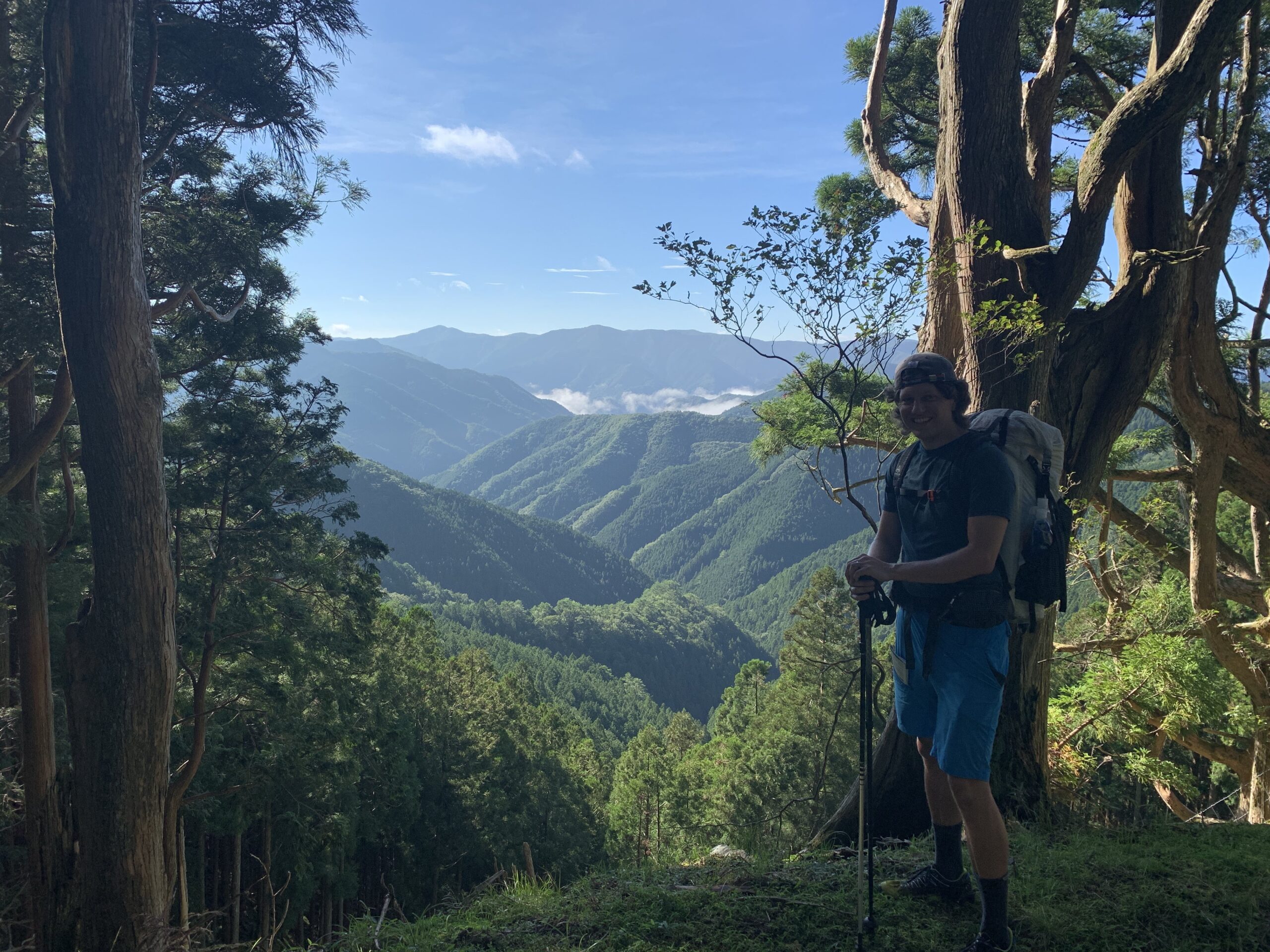
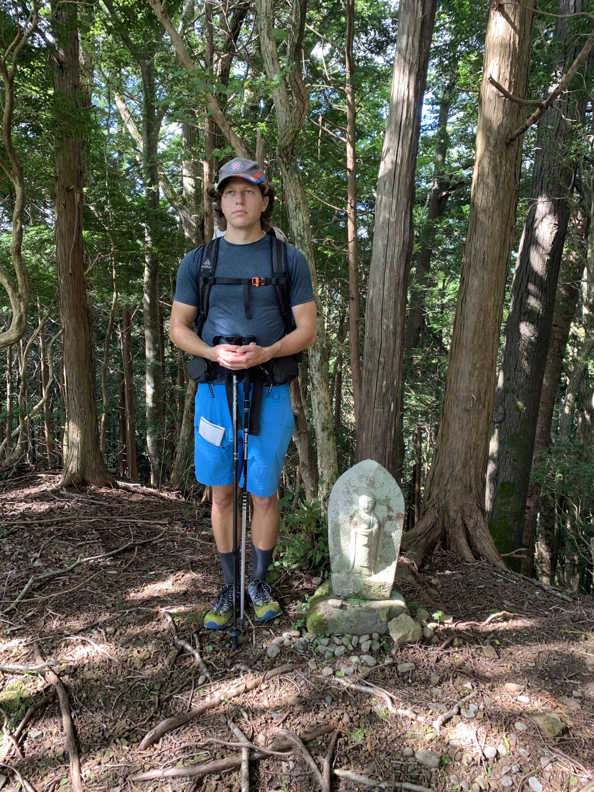
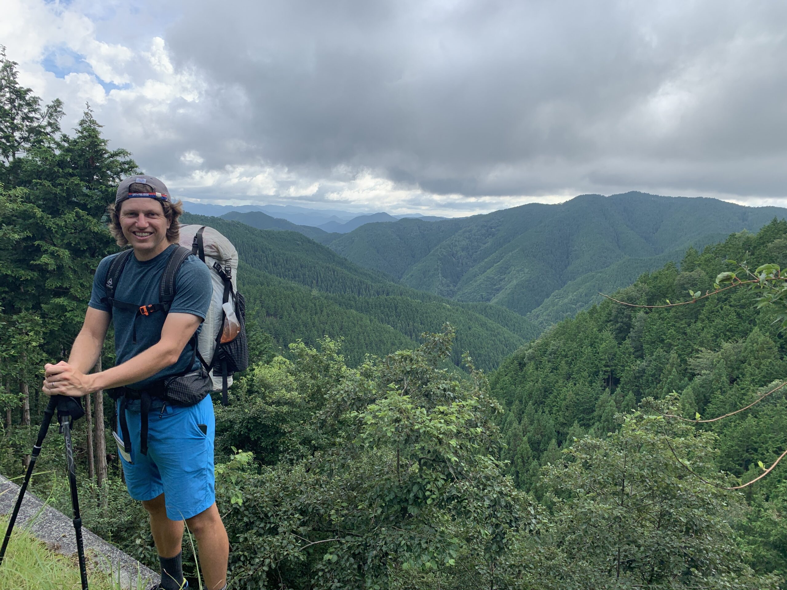
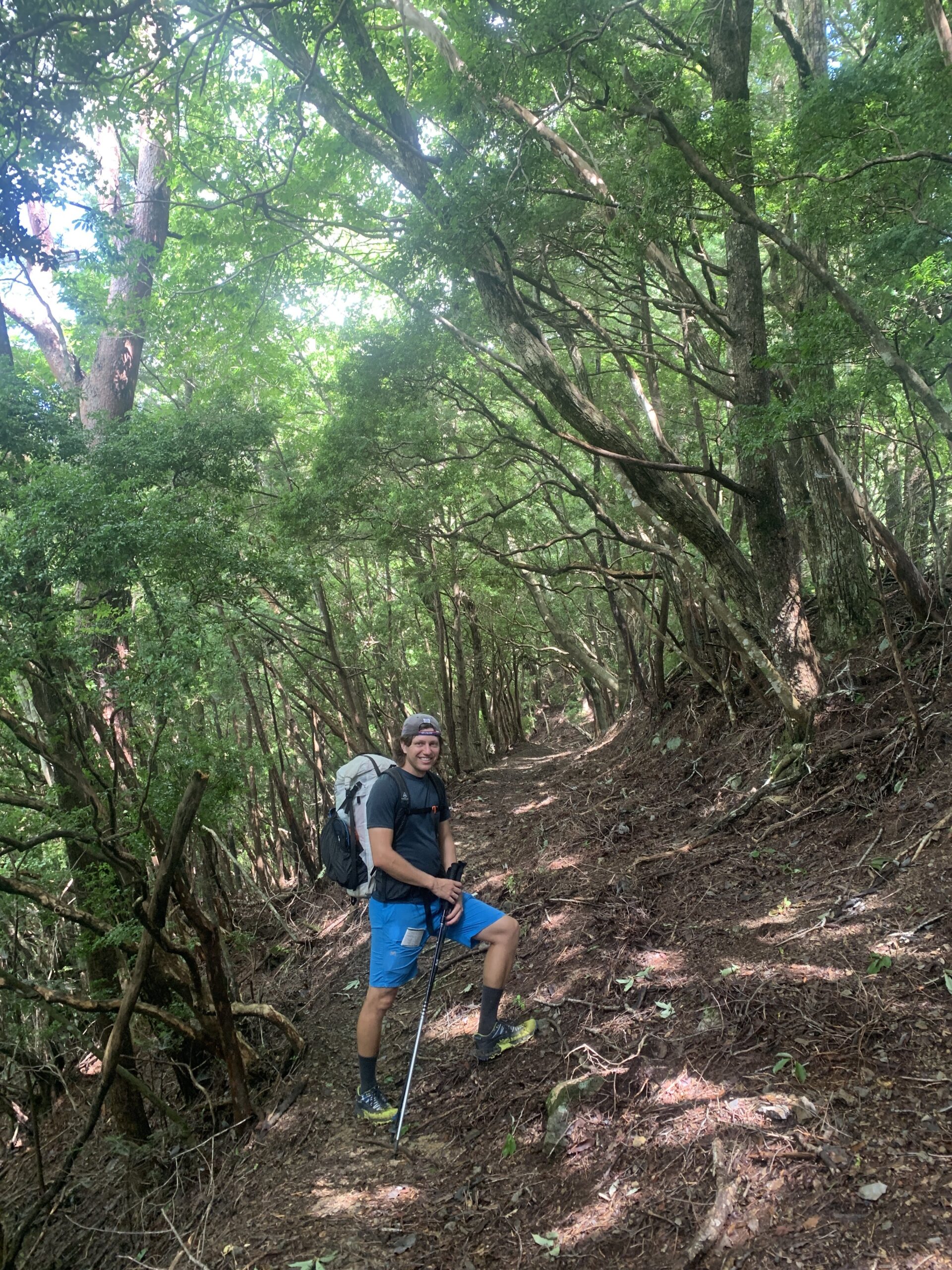
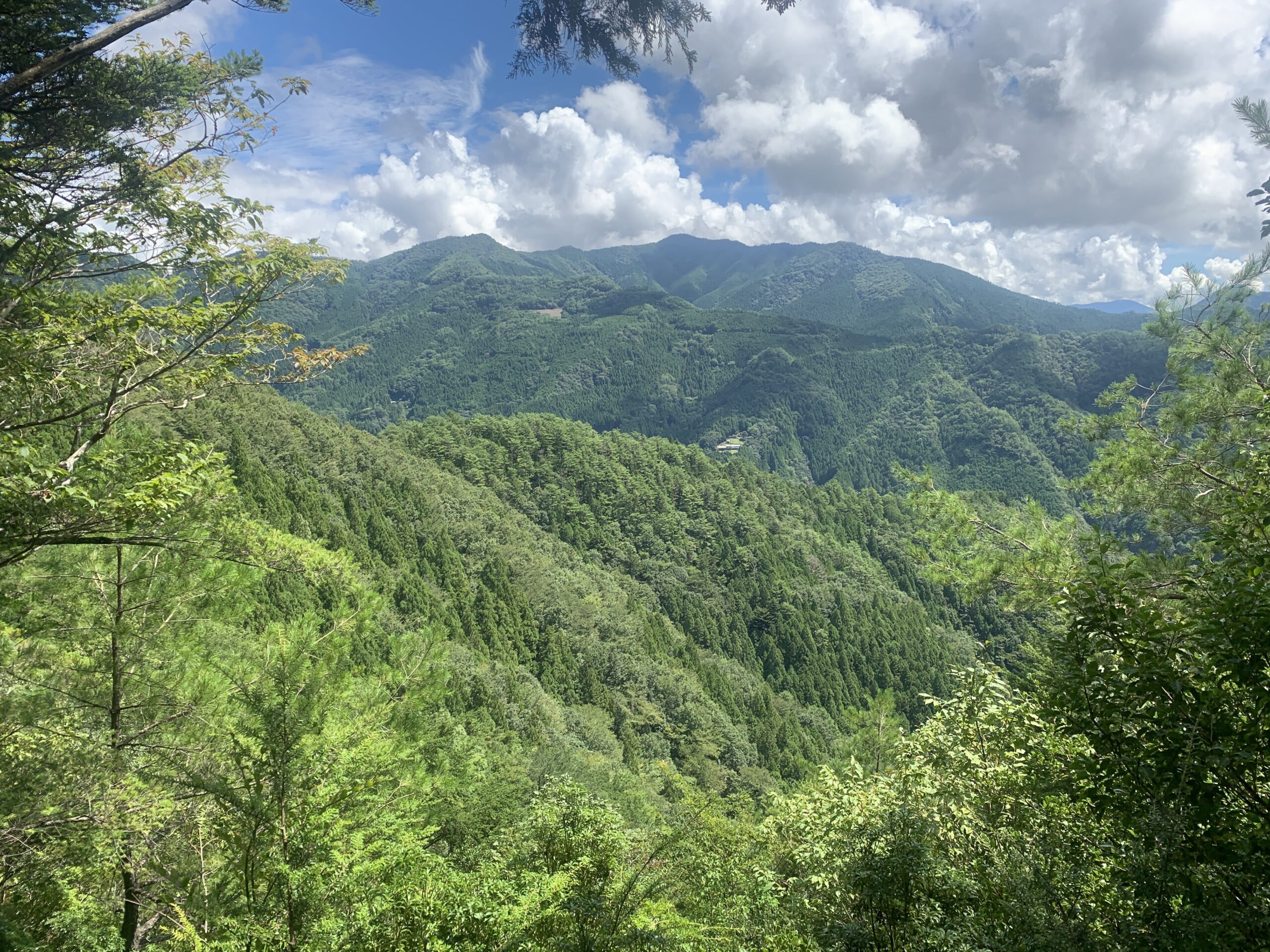
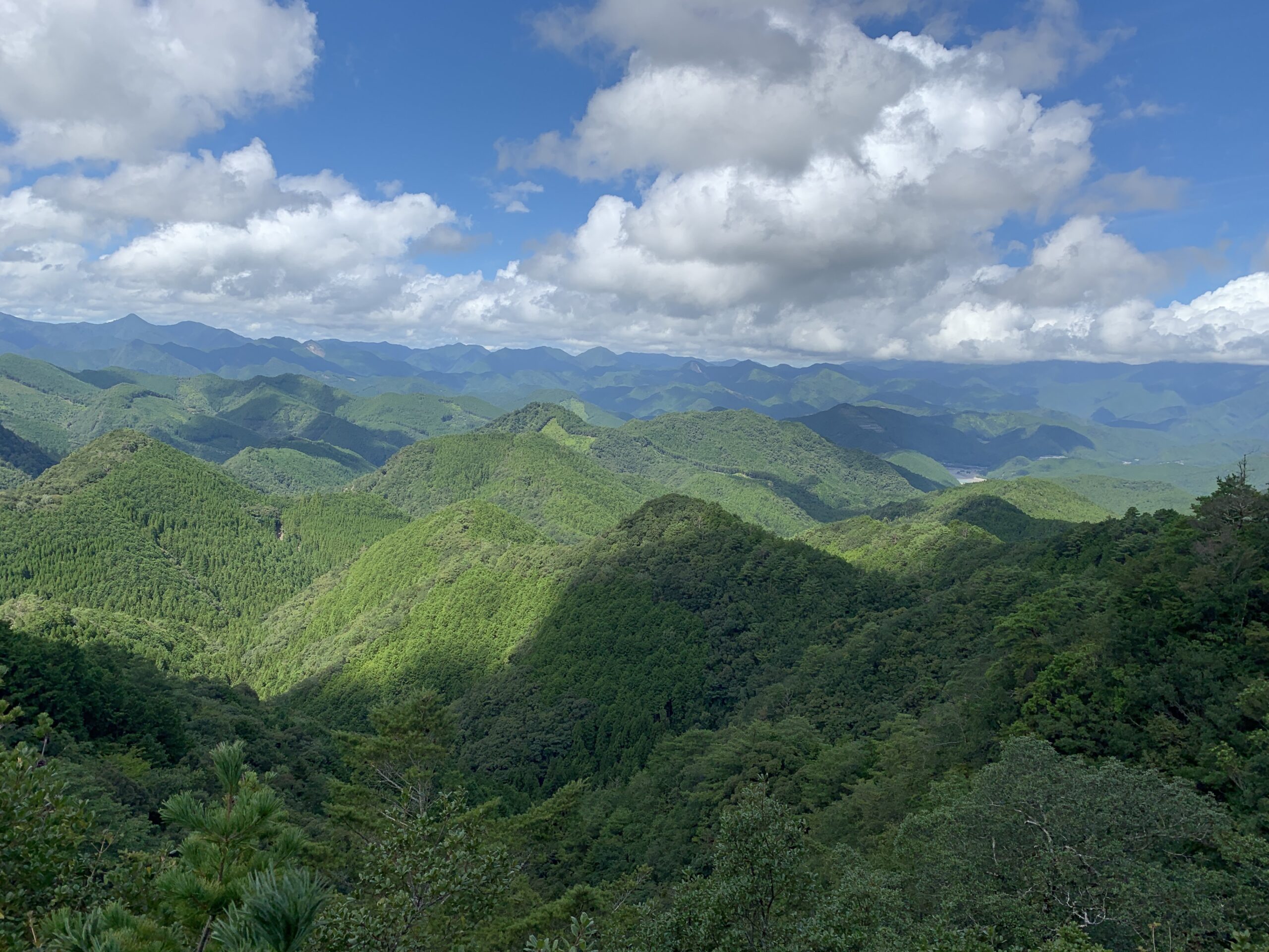
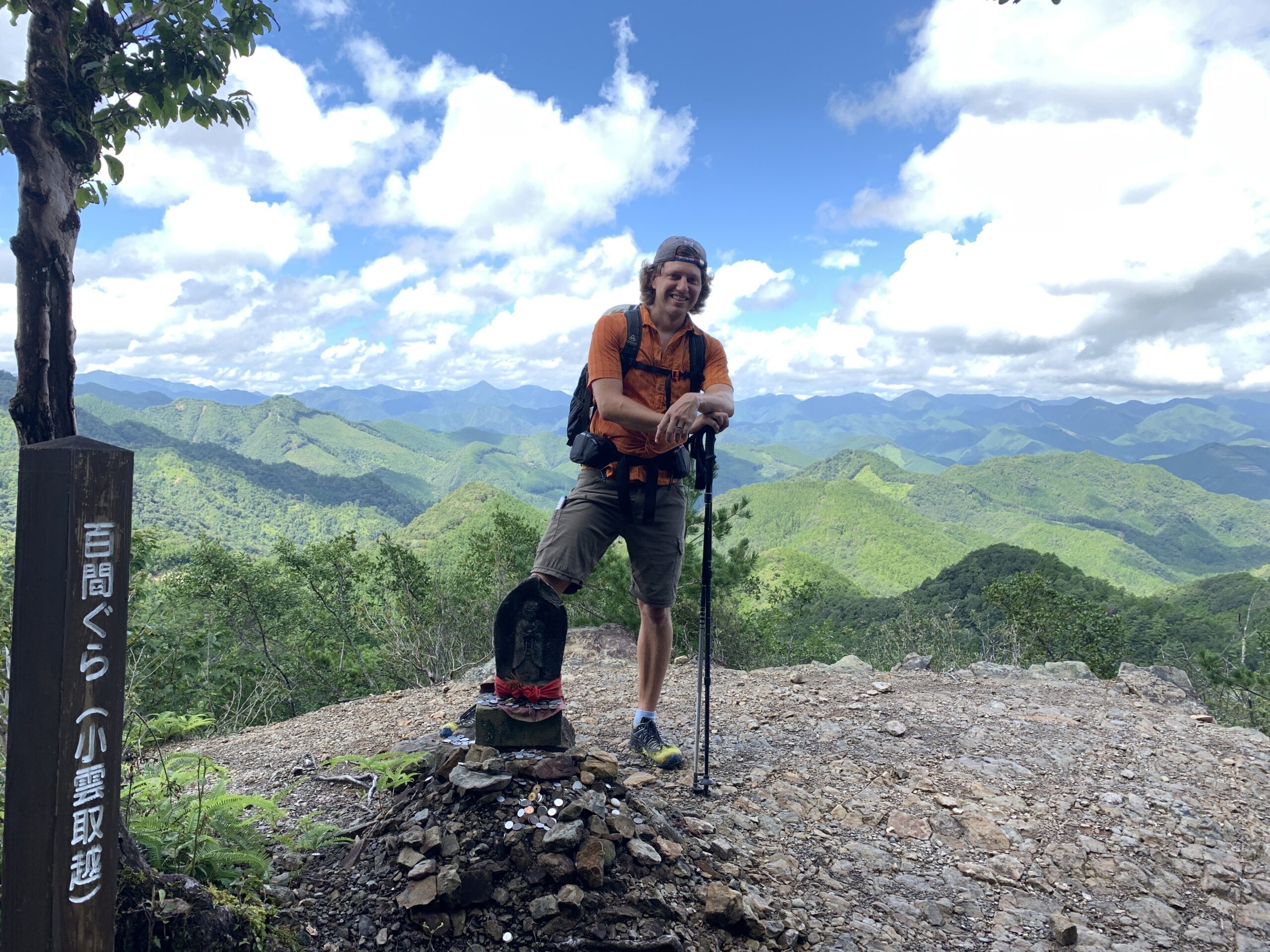
Our first full day of hiking began the next morning with easy trail – just steady ups and downs of a couple hundred feet. The trail itself had a few road sections initially, but for the most part we hiked completely alone through peaceful forest punctuated by Buddhist shrines and occasional big views. Our first real climb came in late morning, from the little village of Omata (2000ft) up to Obako-Toge Pass (4200ft) – so about 2200ft over 2.3 miles. The biggest challenge climbing proved to be the absolutely sweltering humidity, which felt like hiking in a sauna compared to Norway where we had been just a couple weeks before. Omata village itself was little more than 100 houses by the river at the bottom of the valley, and the only trail services were an emergency public phone and a surprisingly clean public bathroom. Near the top of the pass, we were forced to detour for a section of collapsed trail and climb all the way up to Obako-Toge peak itself – an addition of about 500 vertical feet. Thanks to our experience navigating illegible, handwritten detour signs and barely-marked trails in Croatia, we eventually found our way.
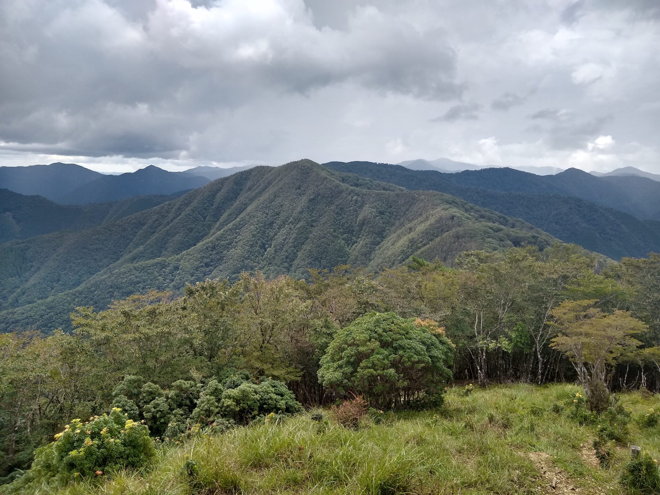
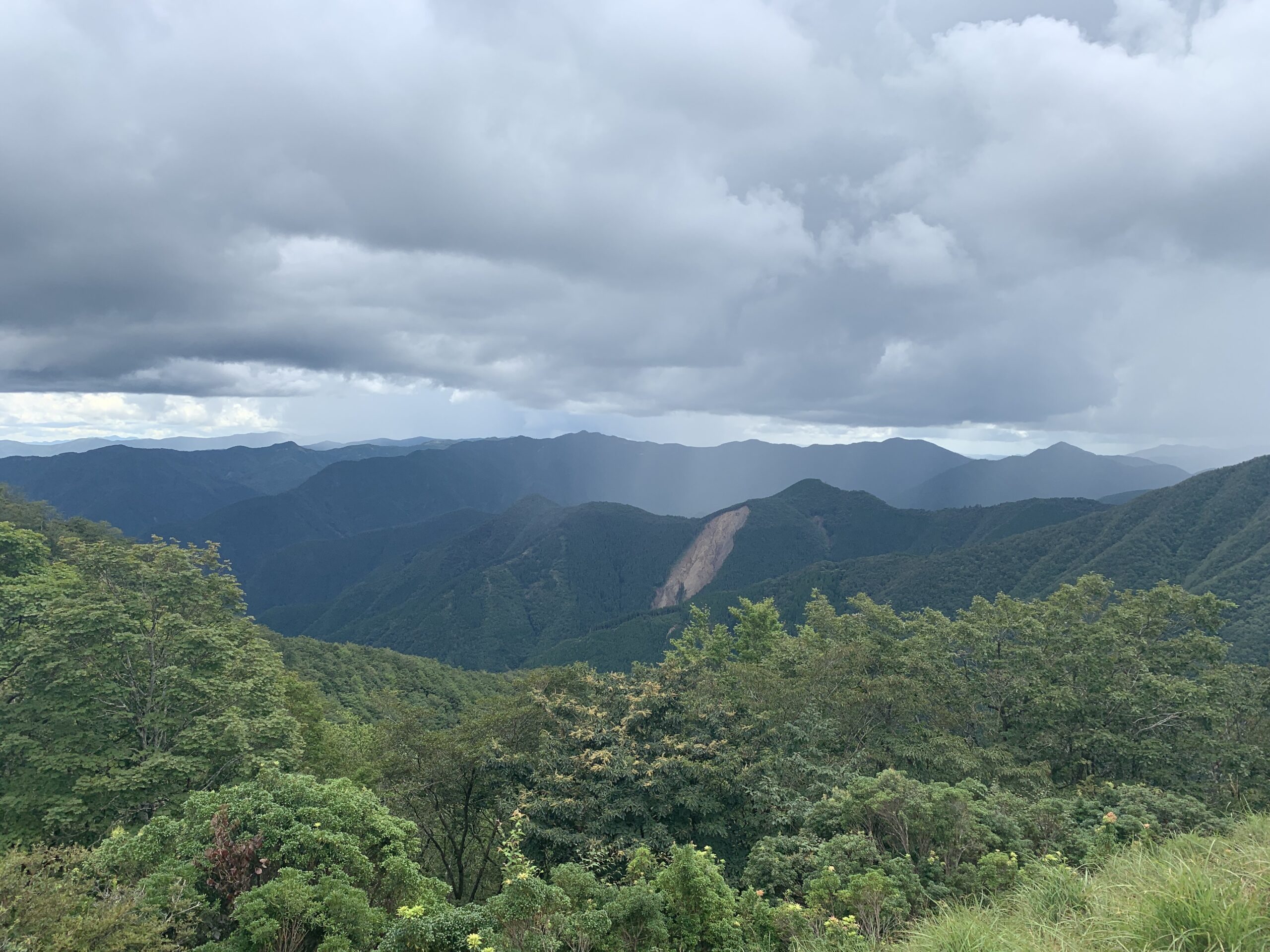
When we finally reached the summit of Obako-Toge it was early afternoon – just in time to watch the inevitable afternoon showers roll in and chase us off the peak. We spent the remainder of the day hiking in and out of the clouds and rain, and we learned both the true meaning of humidity and why Japanese artwork always has so many clouds and negative spaces. Late in the afternoon we found our very first evidence of other hikers thus far; a brand new, fancy plastic barometer just sitting in the trail. I showed it to Jon, who agreed ‘who carries a barometer?’, and we carried on. Not long after we came upon our very first other hiker thus far – an indeterminately old Japanese lady who looked better equipped for a blizzard in the Alps than a sweltering hot day in the Kii. Jon immediately realized the barometer we picked up belonged amongst the altimeter, thermometer, compass, maps, and bear bell, all hanging from her belts in easy reach. Over-preparedness for the outdoors seems to be a universal east-Asian trait, as far as we can tell.
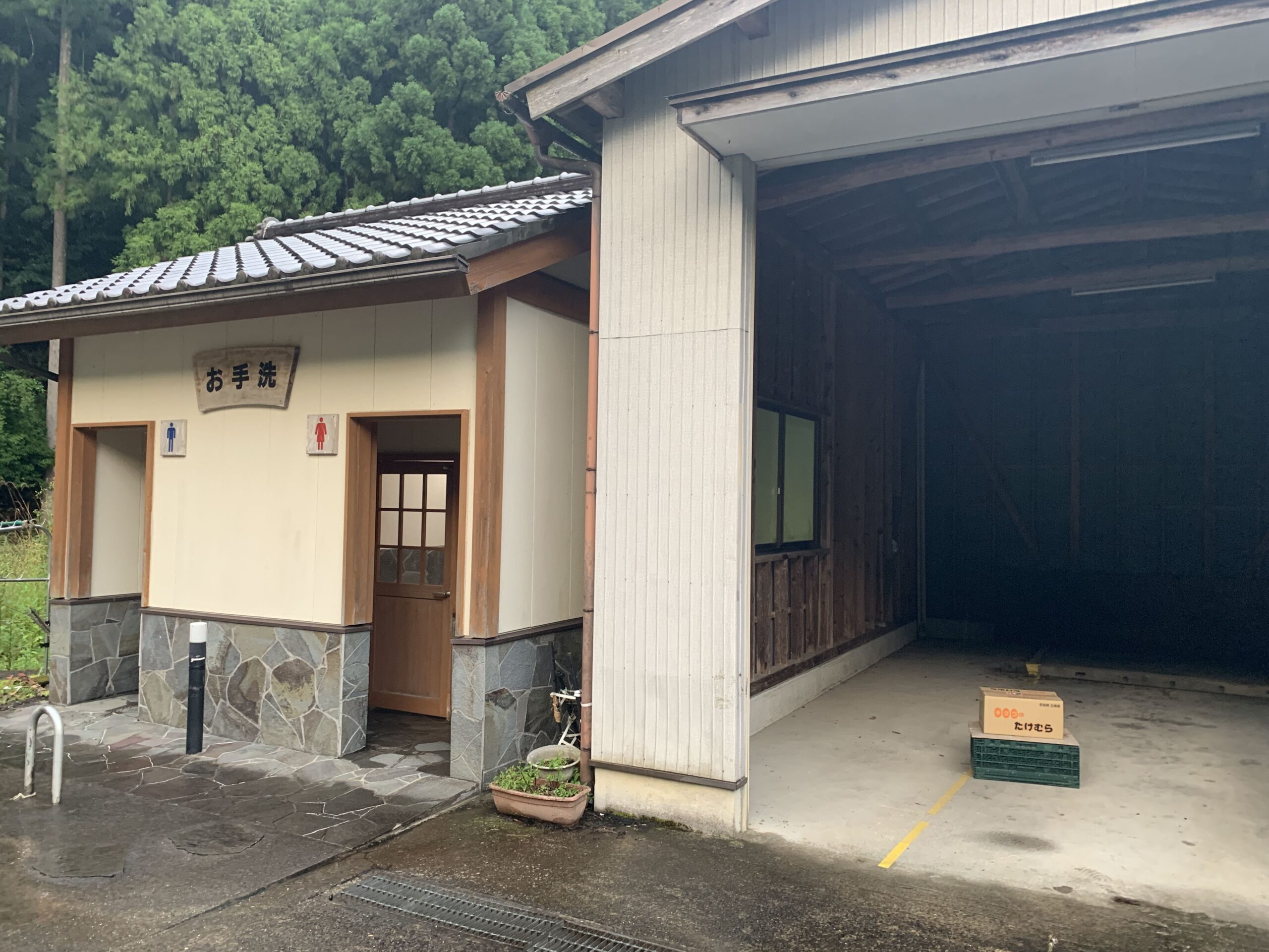
We returned it to her with lots of bowing and smiling, as neither of us spoke a single word of each other’s language, but she was obviously thankful and we all carried on. Back down at the bottom of the valley, we sheltered in a garage by the road for a while as the rain poured down, then finished the day walking through the tiny village of Miura-guchi. Finding a campsite that night proved much more difficult than the previous night. We fruitlessly searched all the typical trail-side spots until we were tired, wet, and possibly a little desperate. Eventually, we made an undignified camp in a fallow rice field on the border of town, which certainly compounded the illegality of camping without a permit. It was breathlessly humid and hot in the tent, but we had to keep the flaps down for the rain and the zippers zipped tight for fear of giant Japanese bugs. It wasn’t our best night, but we made it past the lumps and no one bothered us, despite lots of loud clanging noises coming from a nearby house.

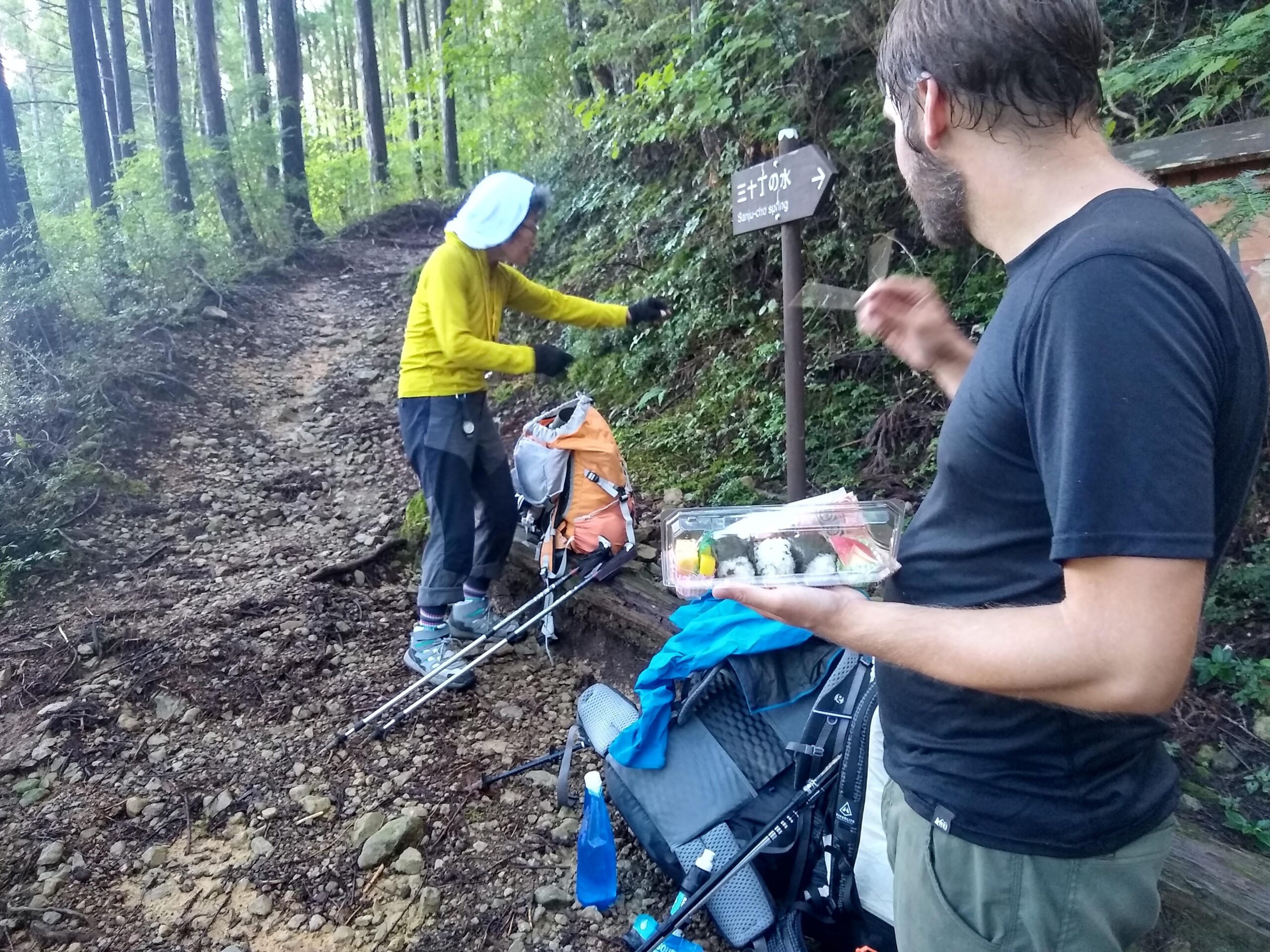
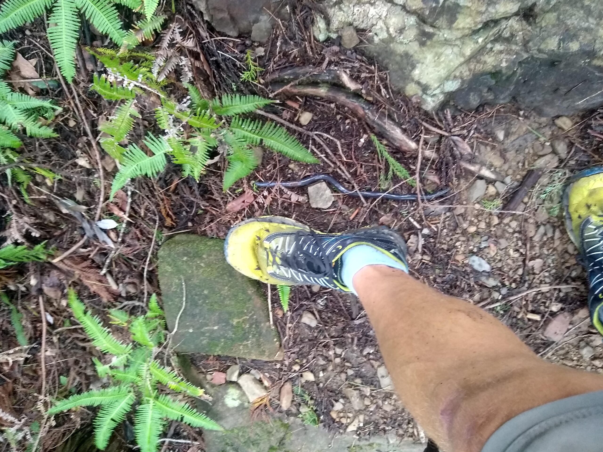
In the morning, we kicked things off with the 2100ft climb to Miura-Toge Pass. About half-way up, we were stunned to run into the old Japanese lady from the day before, filling up her water bottle at a spring. She was thrilled to see us, and explained in broken English that she brought us rice balls as thanks for returning her barometer the day before. Bless that woman, she actually packed in a plastic to-go container for us – how she had time to buy it between 5pm the day before and what was certainly her start time of 6 am, only Buddha knows. With new friends made, we hiked on to find giant frogs, more Buddhist shrines, and another beautiful day in the weird Japanese forests.
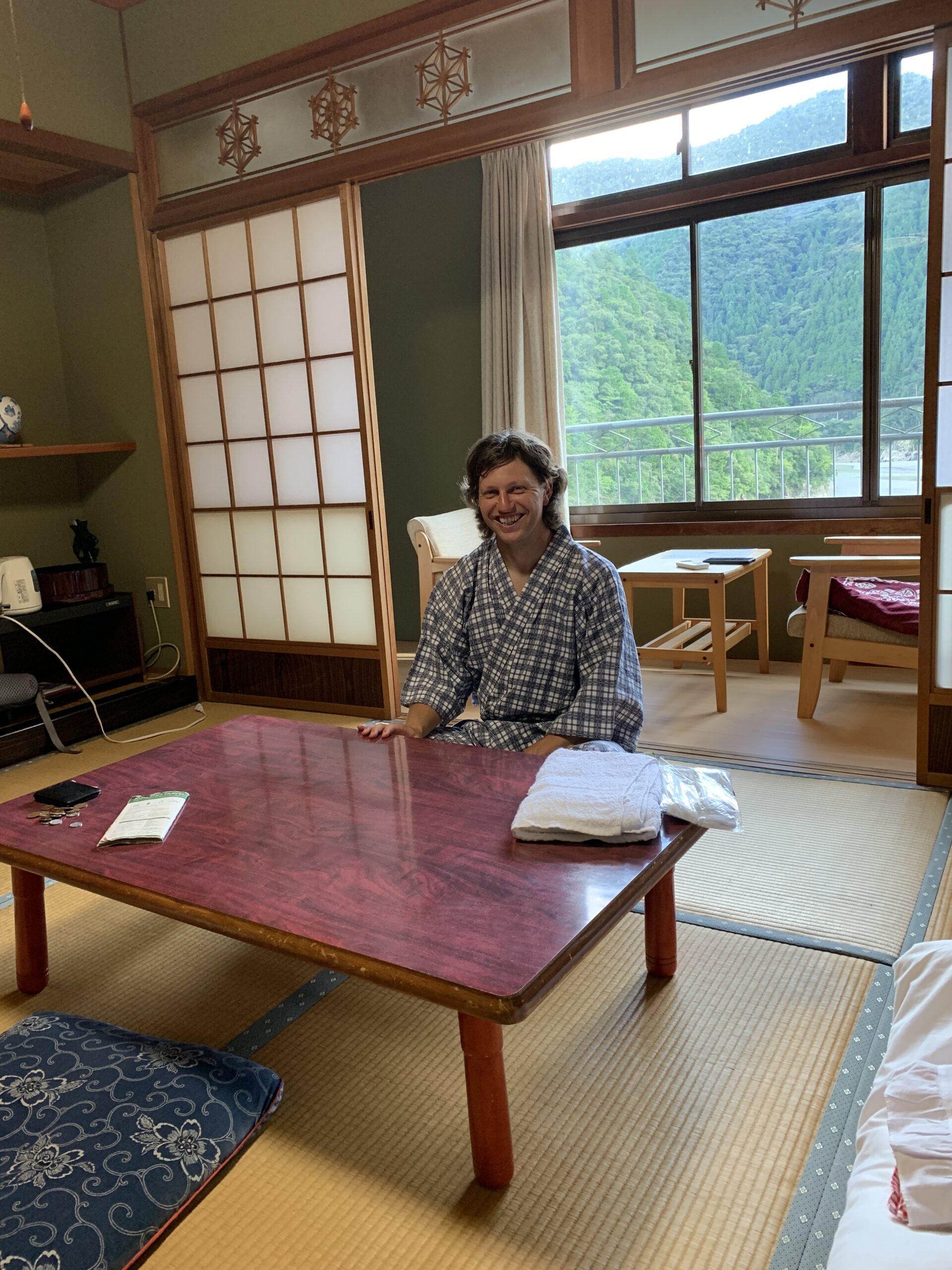
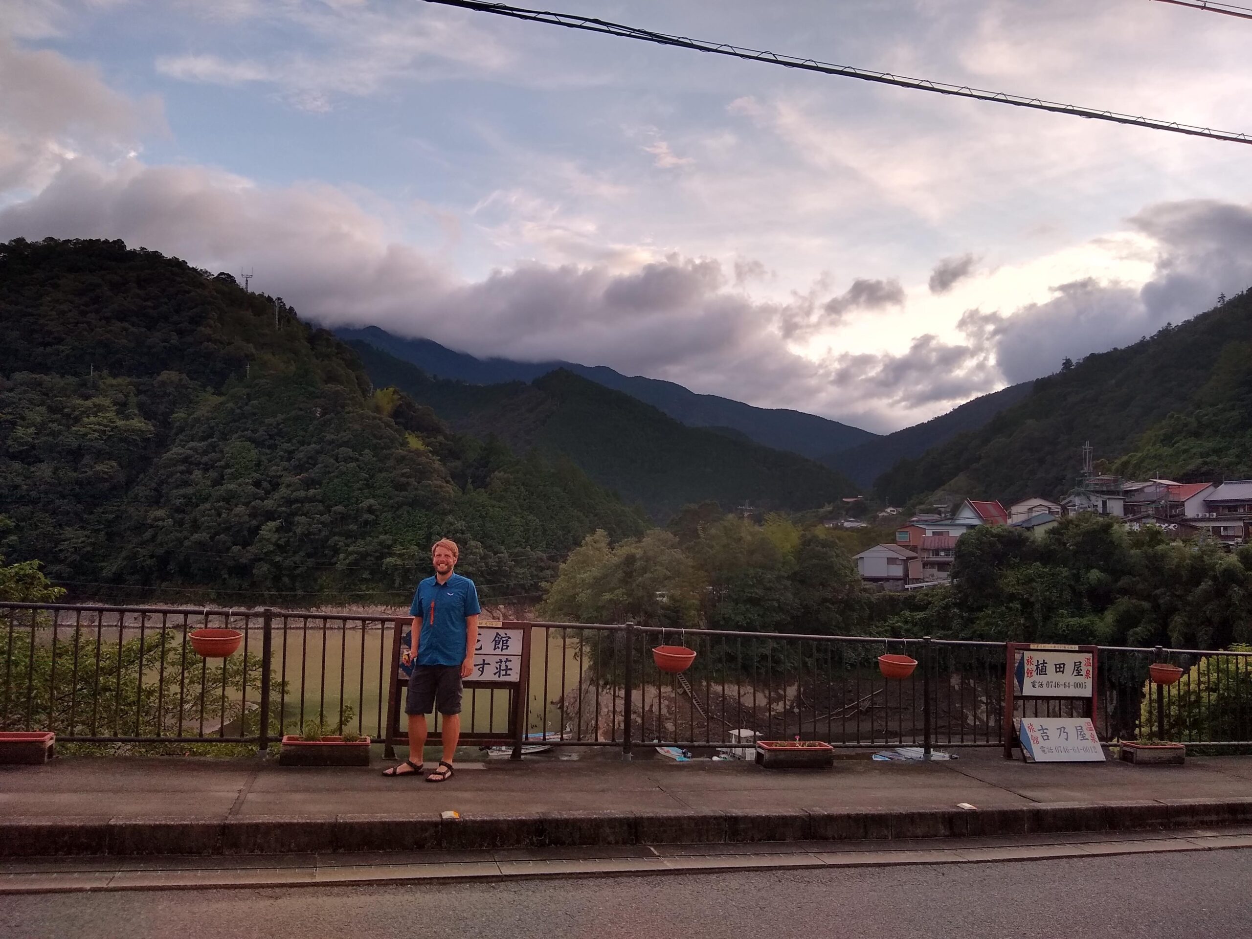
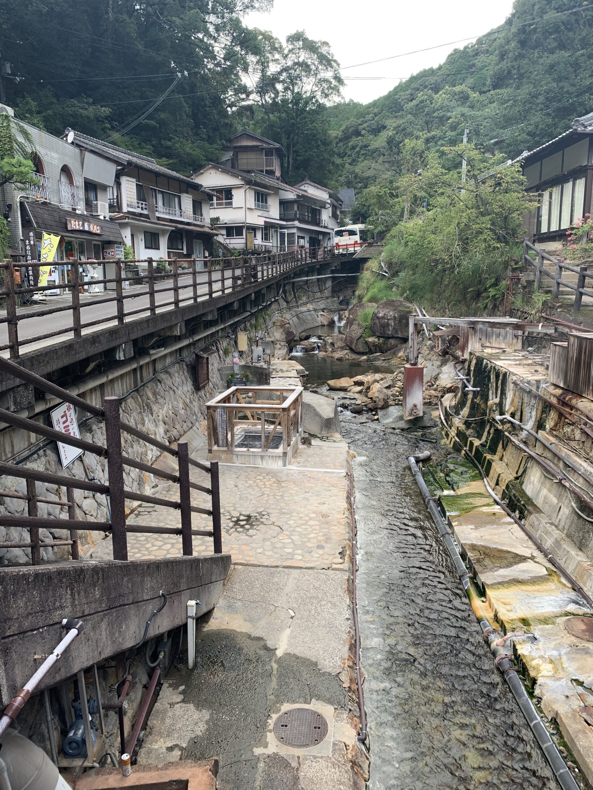
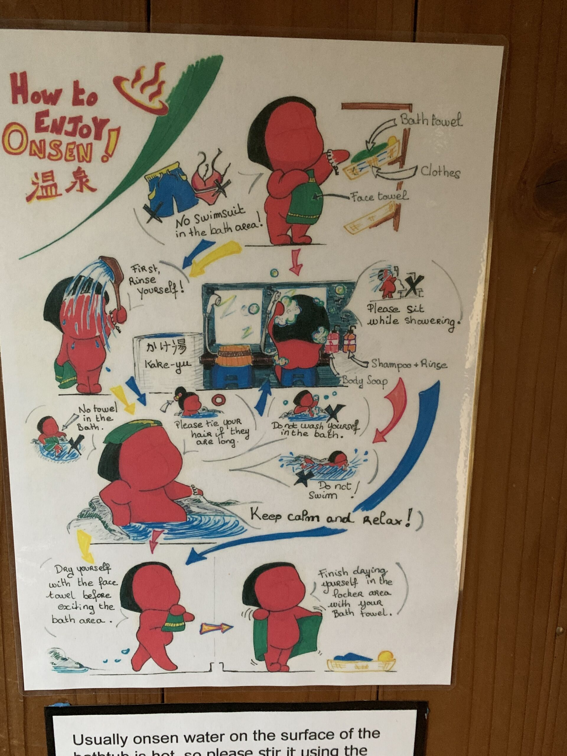
We reached the little village of Nishinaka around mid afternoon, after descending the same 2100ft all the way back down to the valley. The next 6 miles of the trail was apparently just walking along the road to the next village – thinking that sounded awful, we just sat by a vending machine (which are everywhere in Japan), and waited for the bus to take us instead. Around 2 hours later, the bus politely took us to Totsukawa Onsen, which is both the name of the village and it’s geothermal feature. Somehow Jon convinced me not to illegally camp at a nearby cemetery, and instead we blundered around the village until we found a hostel. After intense negotiations with a woman who turned out to be the cleaning staff, we soaked our sweaty and sore asses in the onsen, enjoyed the views in our complimentary bathrobes, and had ramen at a nearby noodle bar.
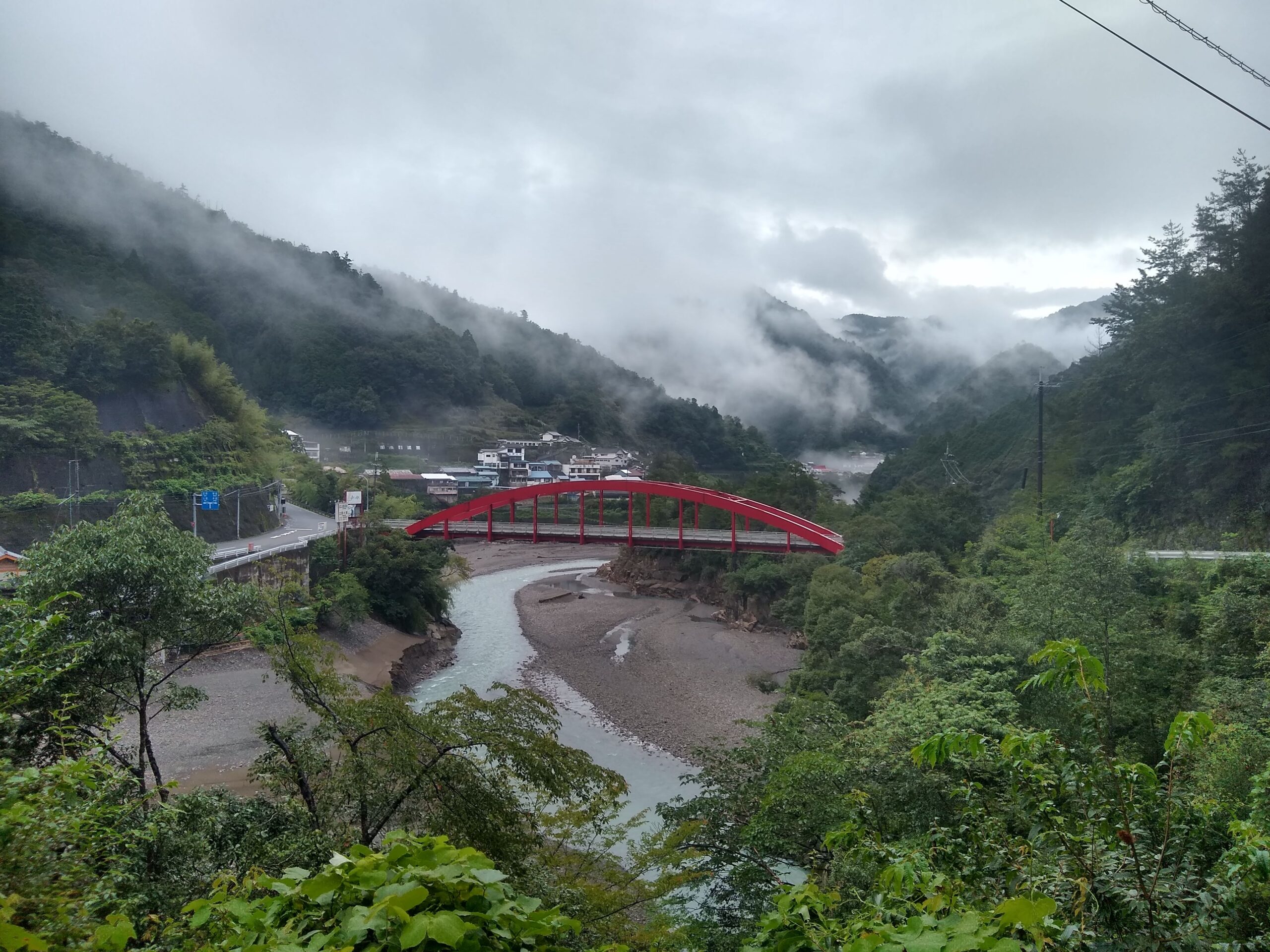
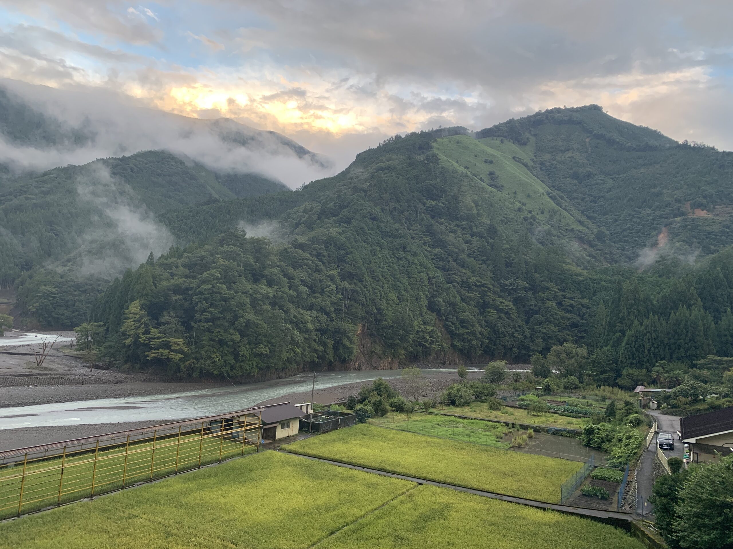
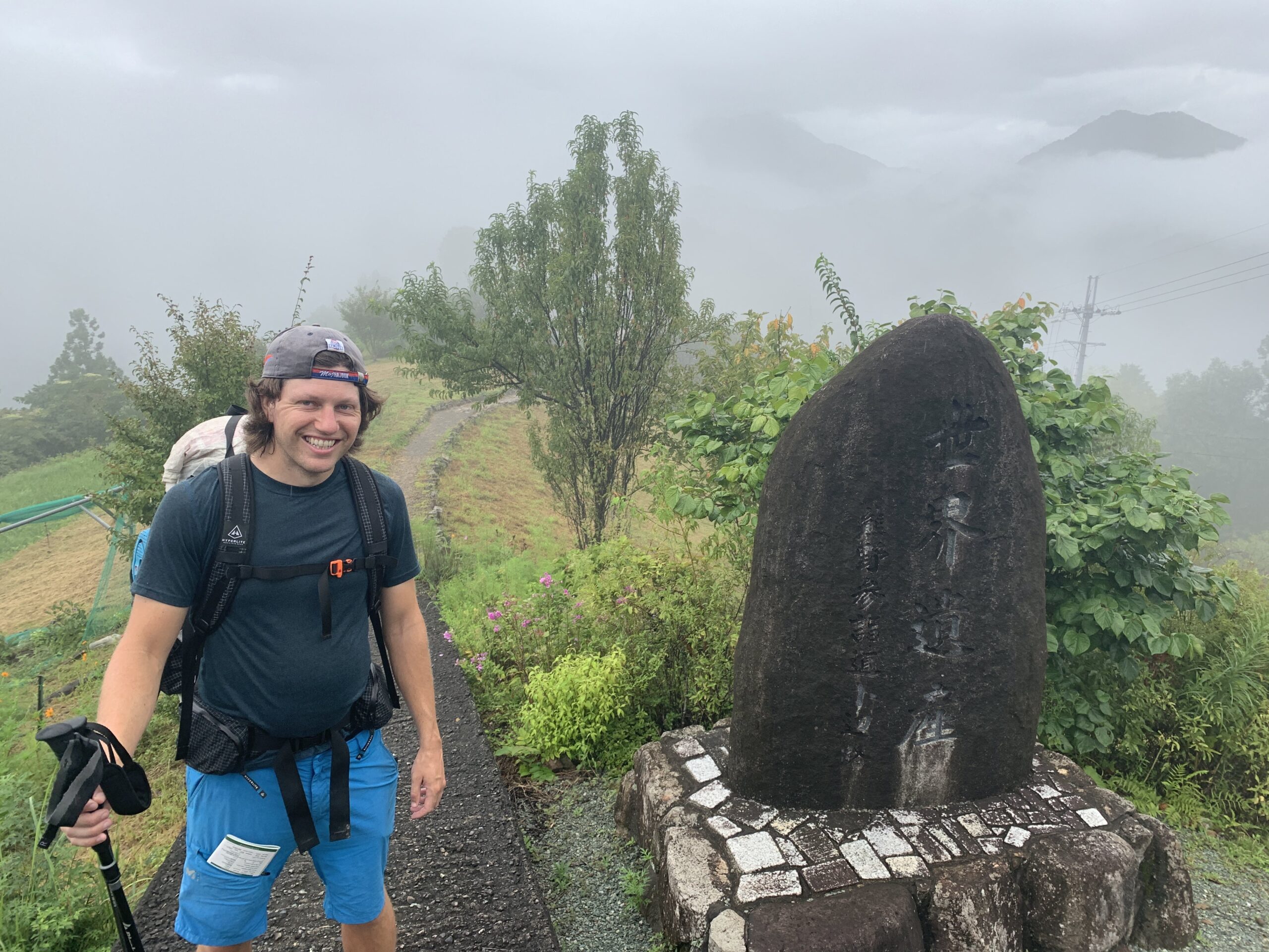
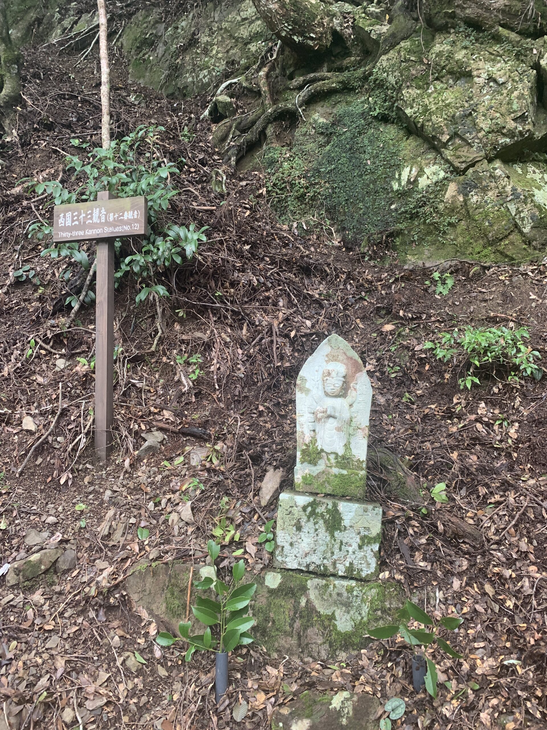
In the morning, more Japanese looking clouds filled the river valley and made the little village almost attractive. Turns out those clouds are more attractive from the outside, however. Our first and only real climb of the day was up to Hatenashi-toge Pass, about 3200ft of gain. Apparently, there are good views on the way up but we wouldn’t know – for us, all was fog and rain and torrents of sweat. But, by the power of Buddha, the trail was still fun. As if to make up for weather, this particular mountain featured a series of numbered statues of all 33 manifestations of Kannon, a Buddhist deity who sort of sounds like Buddhist Jesus except he has 33 different forms that he/she/it can assume based on the holy circumstance. Even when there’s nothing to see, there’s something to see on Kumano Kodo. So, 33 Bodhisattva manifestations and 11 very, very sweaty miles later, we arrived at one of the trails main attractions – the Grand Shrine Kumano Hongu Taisha.
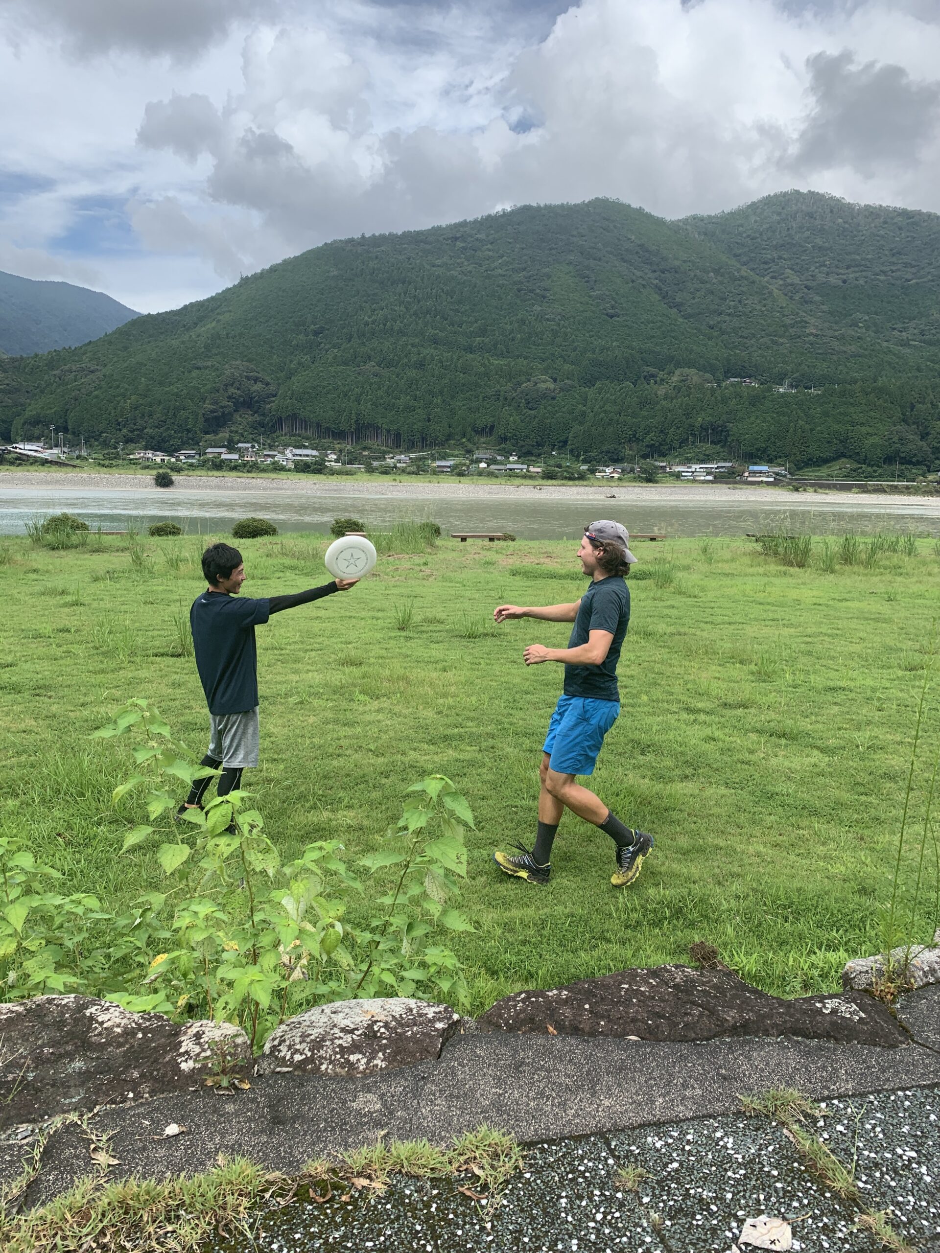
To spare everyone our terrible stench, we elected to buy some convenience-store stir fry and eat it outside before going to the shrine properly, which is how we ran into a group of Japanese college students also hiking the trail. By pure pilgrimage coincidence, they turned out to be on an ultimate frisbee team and were led by an American living in Japan teaching English. I taught them my strange, alien frisbee throws and we had fun swapping stories with the American teacher. Eventually, we said goodbye and took another strategic bus ride a short ways to Hongu Taisha shrine itself (but we will see our American friend again in Kyoto!).
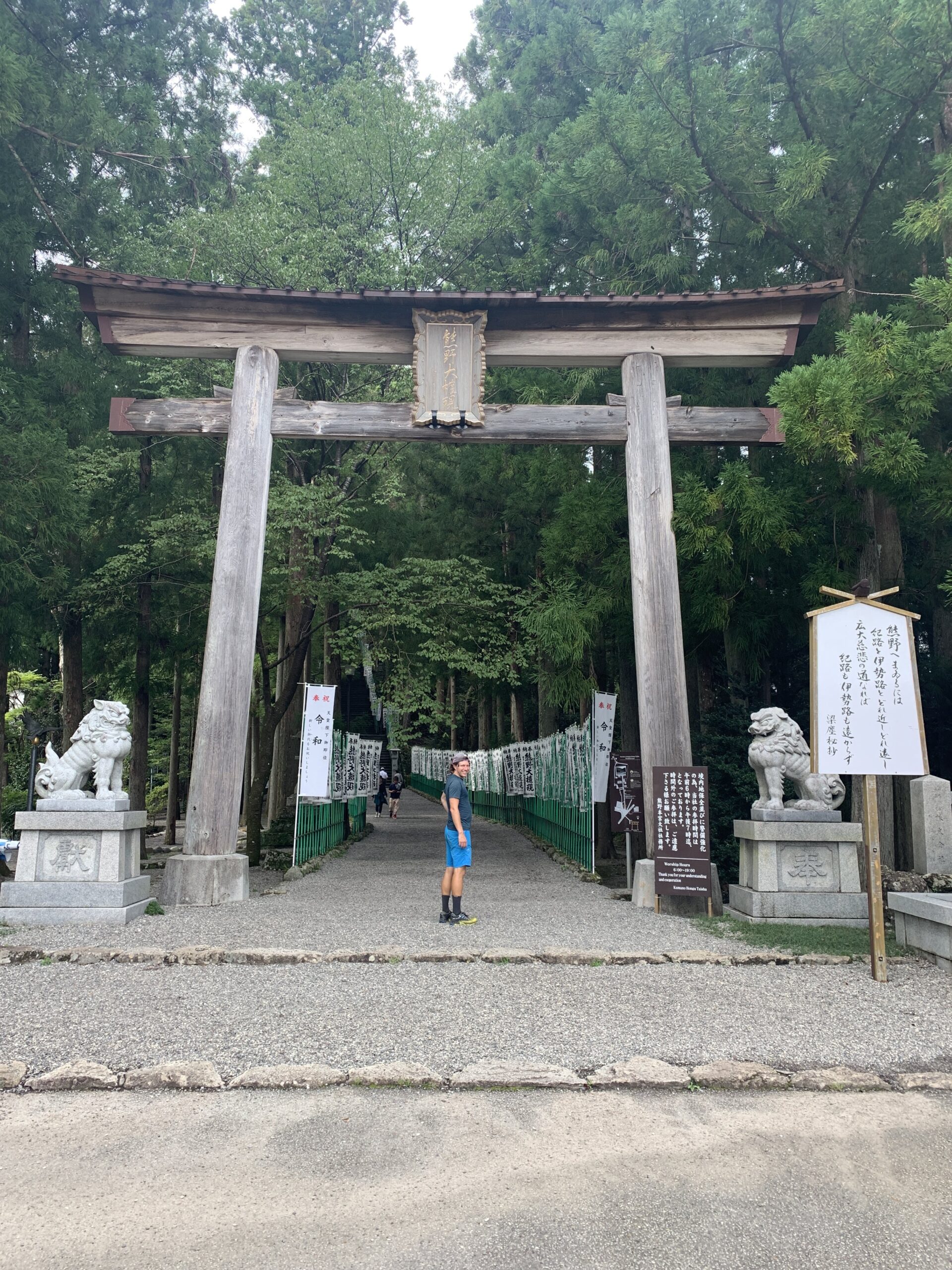
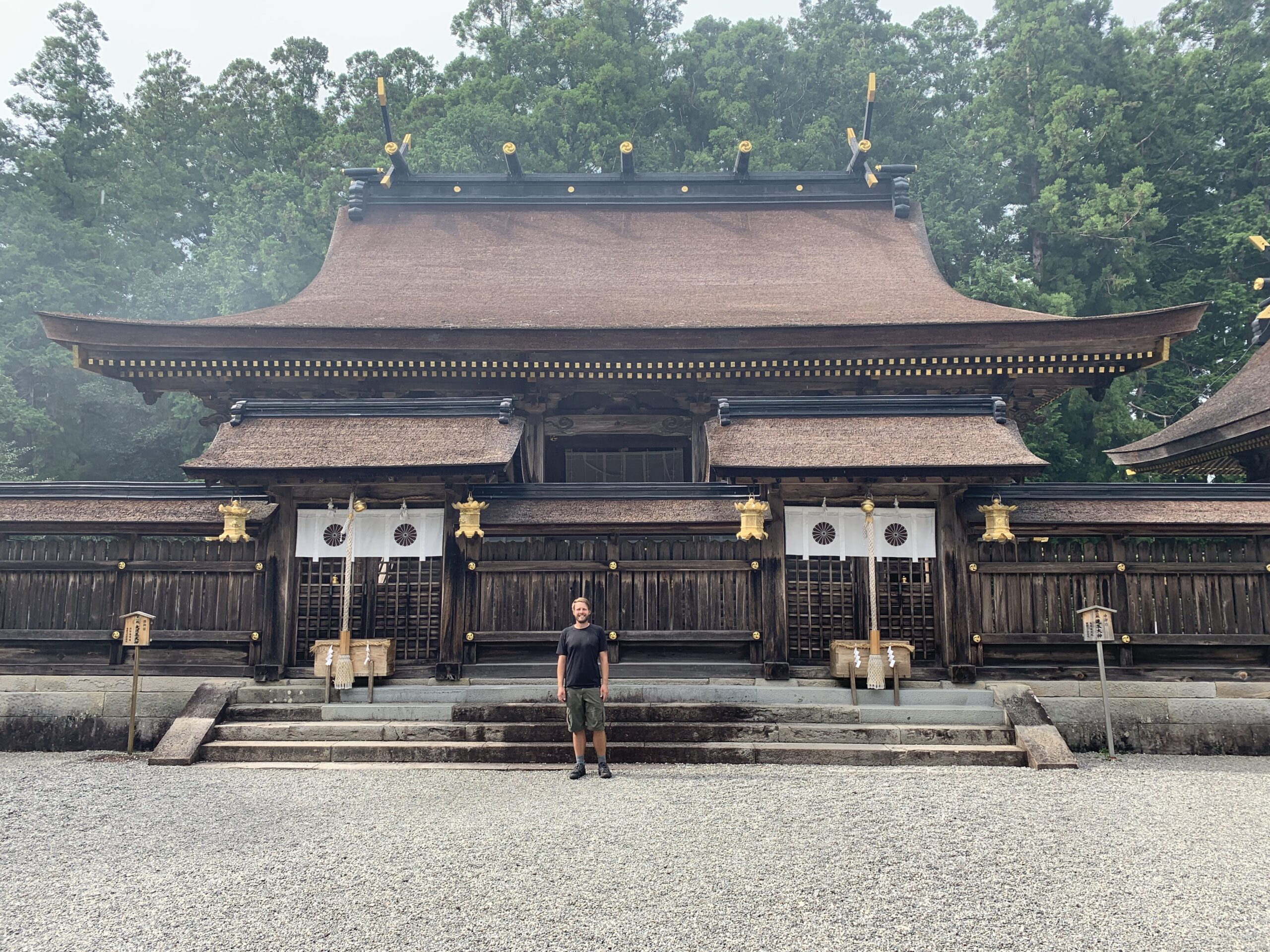
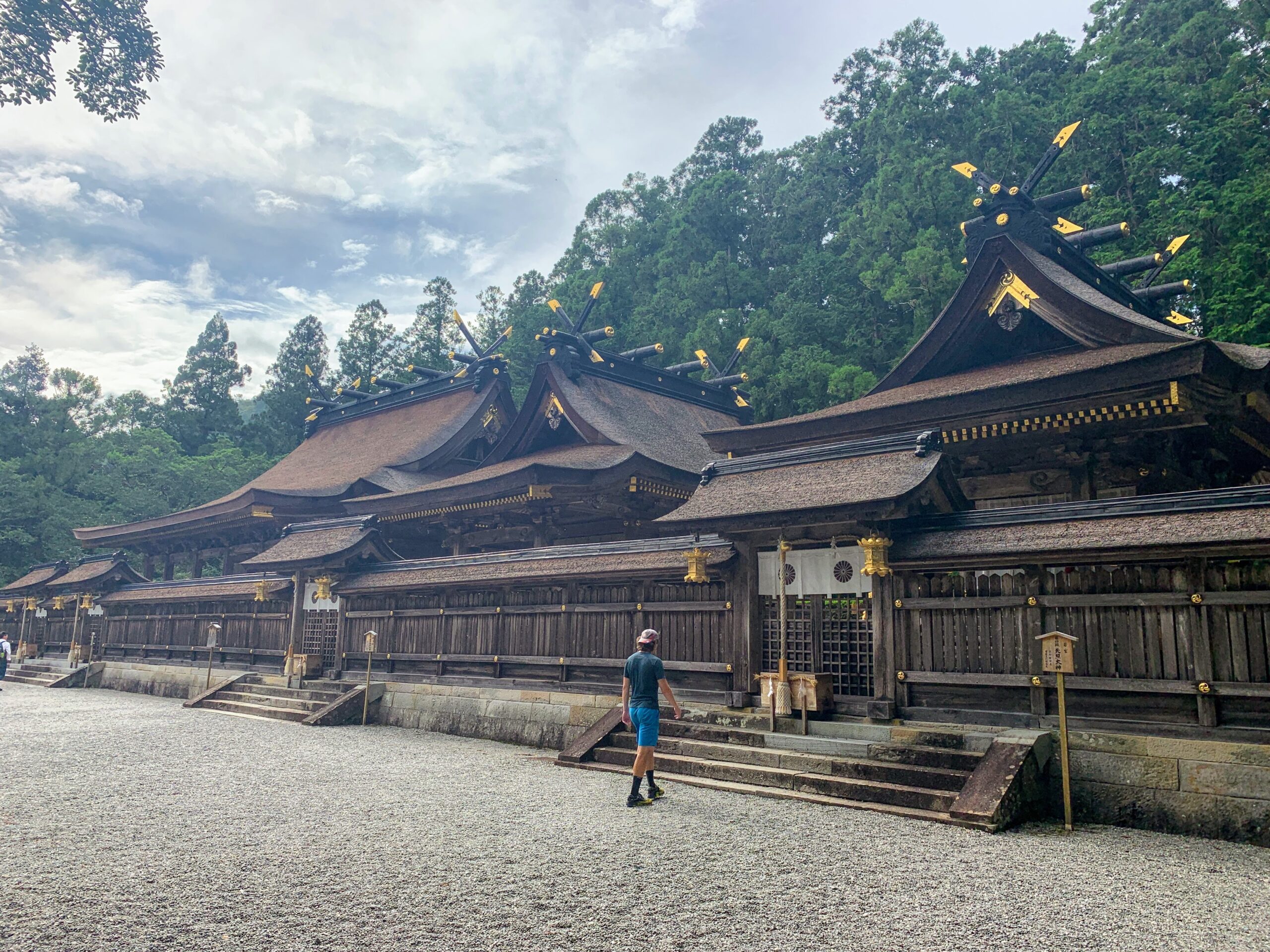
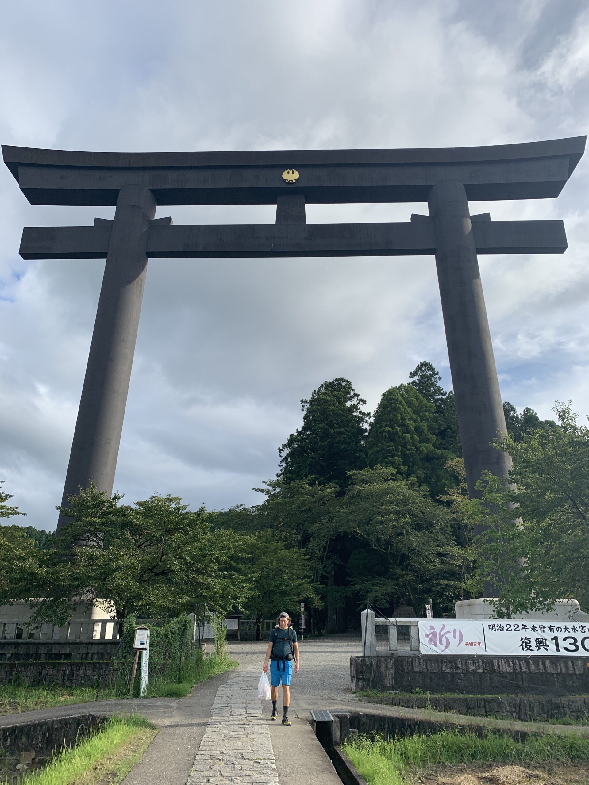
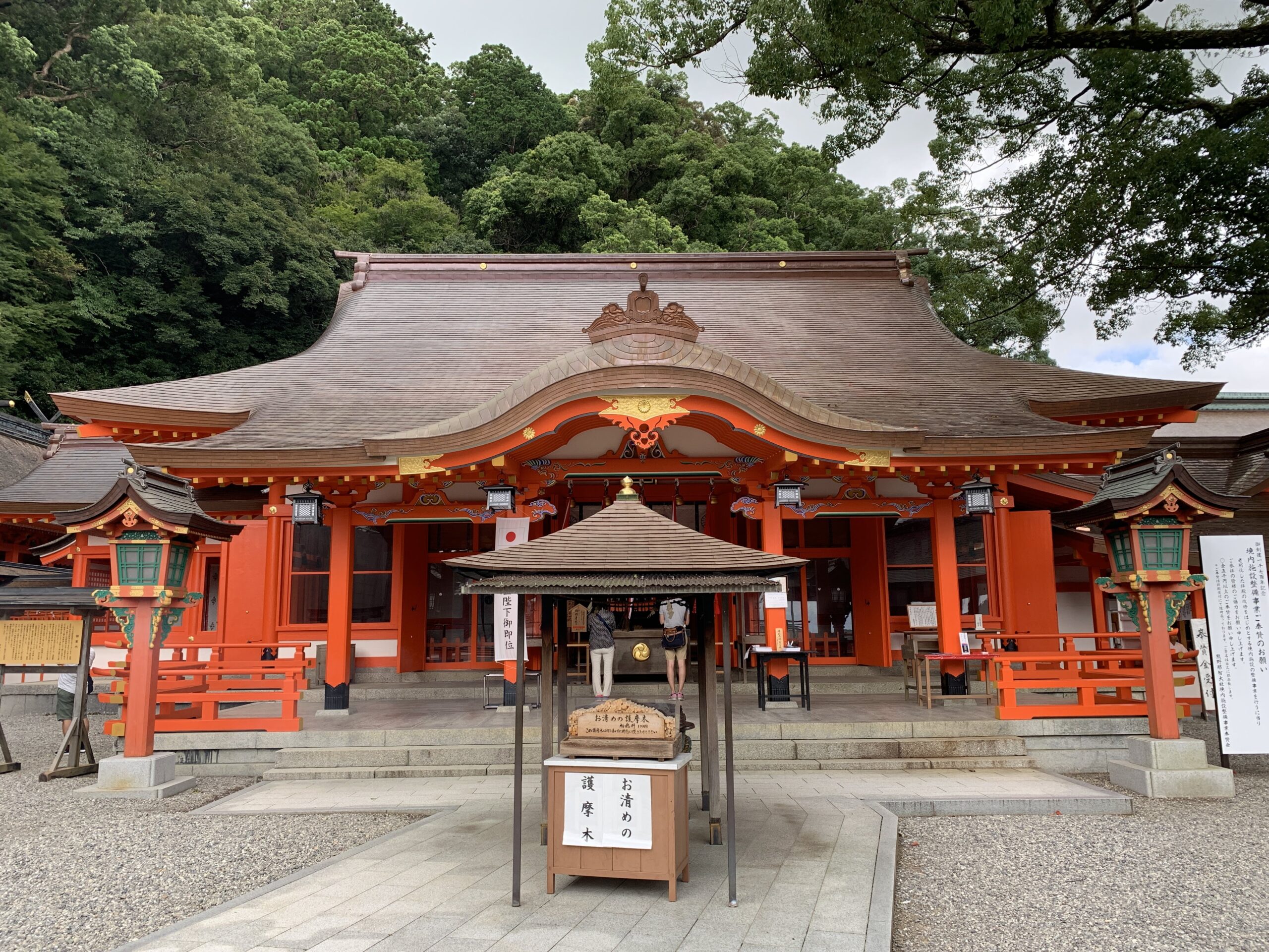
In brief summary, the Grand Shrine Kumano Hongu Taisha is awesome. More specifically, there are 3 main shrine buildings where apparently 4 deities are enshrined, and they are as beautiful as they are serene. We bowed and clapped and rang the bells, giving thanks to whichever deity was listening while generally enjoyed the peace. Back down the hill, we were compelled to explore the gigantic Torii gate visible throughout the valley. It turned out to be called Otorii – which just means big gate – and is in fact the largest Torii gate in Japan at over 110ft tall. Further, it marked the entrance to the old Hongu Taisha Shrine location, which we learned was mostly destroyed by flooding around 1890 and then rebuilt up on the high ground in it’s current location. That did explain the levies.
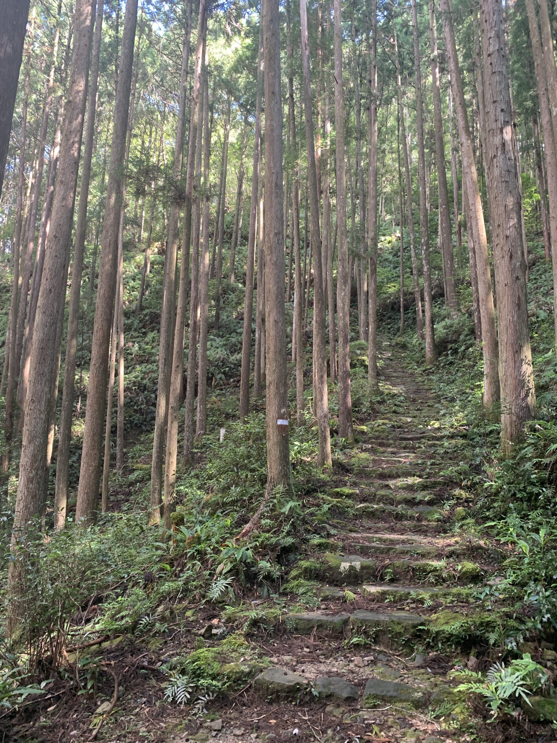
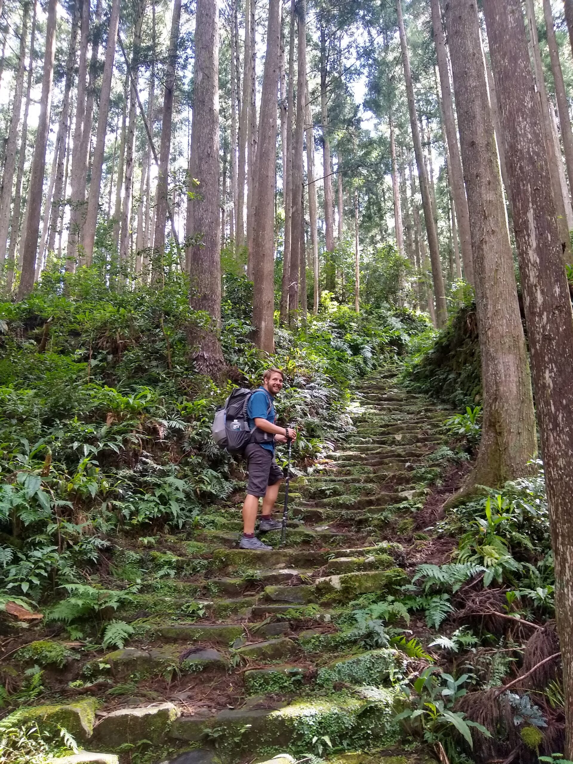
Anyway, after all our exploration was done, and after a brief stop for resupply, we took yet another bus ride to Yunomine Onsen where we would spend the night. Our hostel, that we booked on the fly with help from the visitor’s center, was without AC and so was just as humid and hot as outside. We did enjoy the Onsen though, but we don’t recommend the rice made with Onsen water because sulfur is a horrible flavor. The next morning we took the bus back to Hongu Taisha and resumed our hike. The first half of our day was basically a pleasure cruise through the Japanese countryside – nice forest, good views, easy trail. The second half was among the steepest climbs of the trail – 2900ft over 2.4 miles, from the valley floor straight up to Echizen-toge Pass.
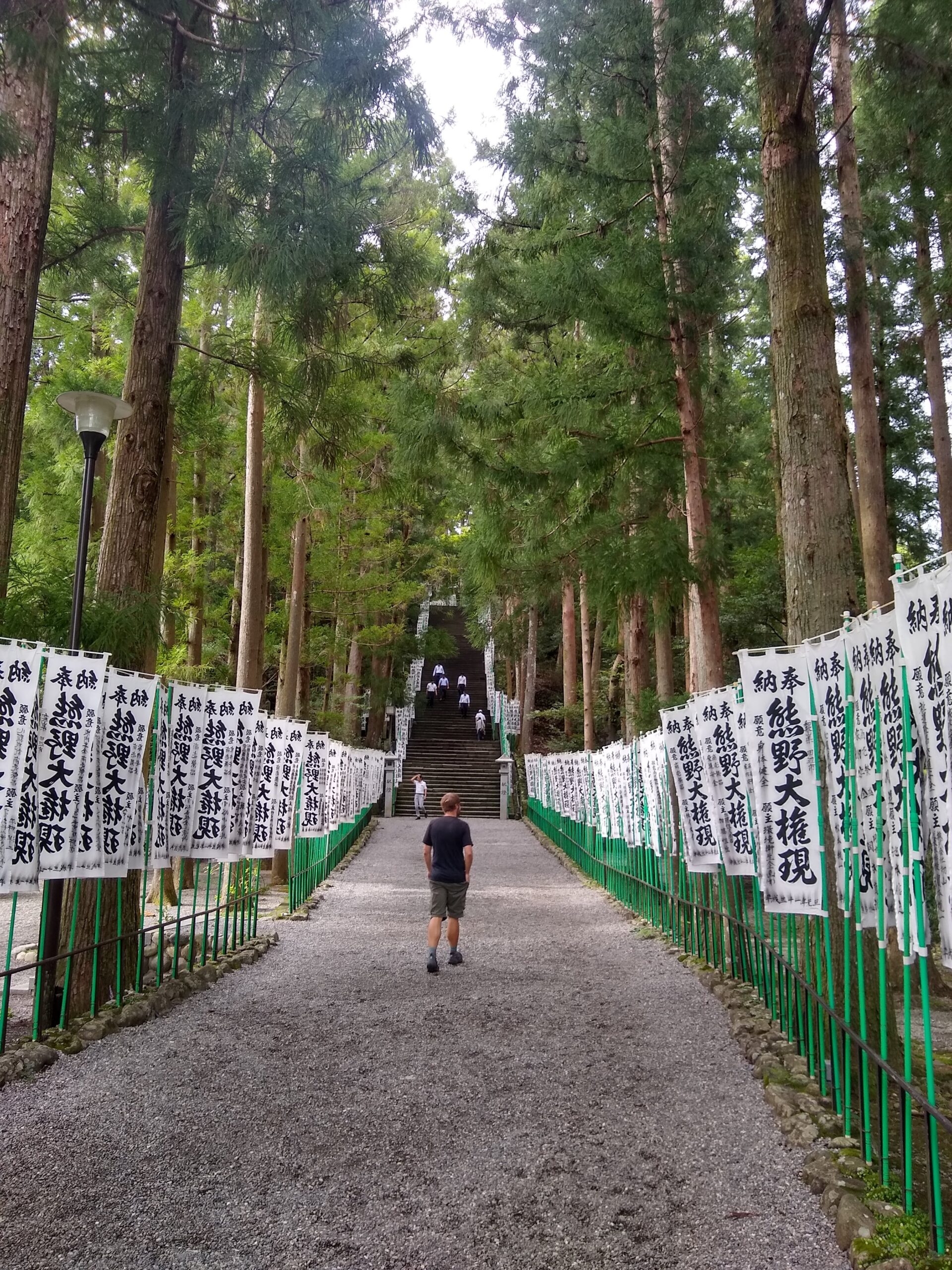
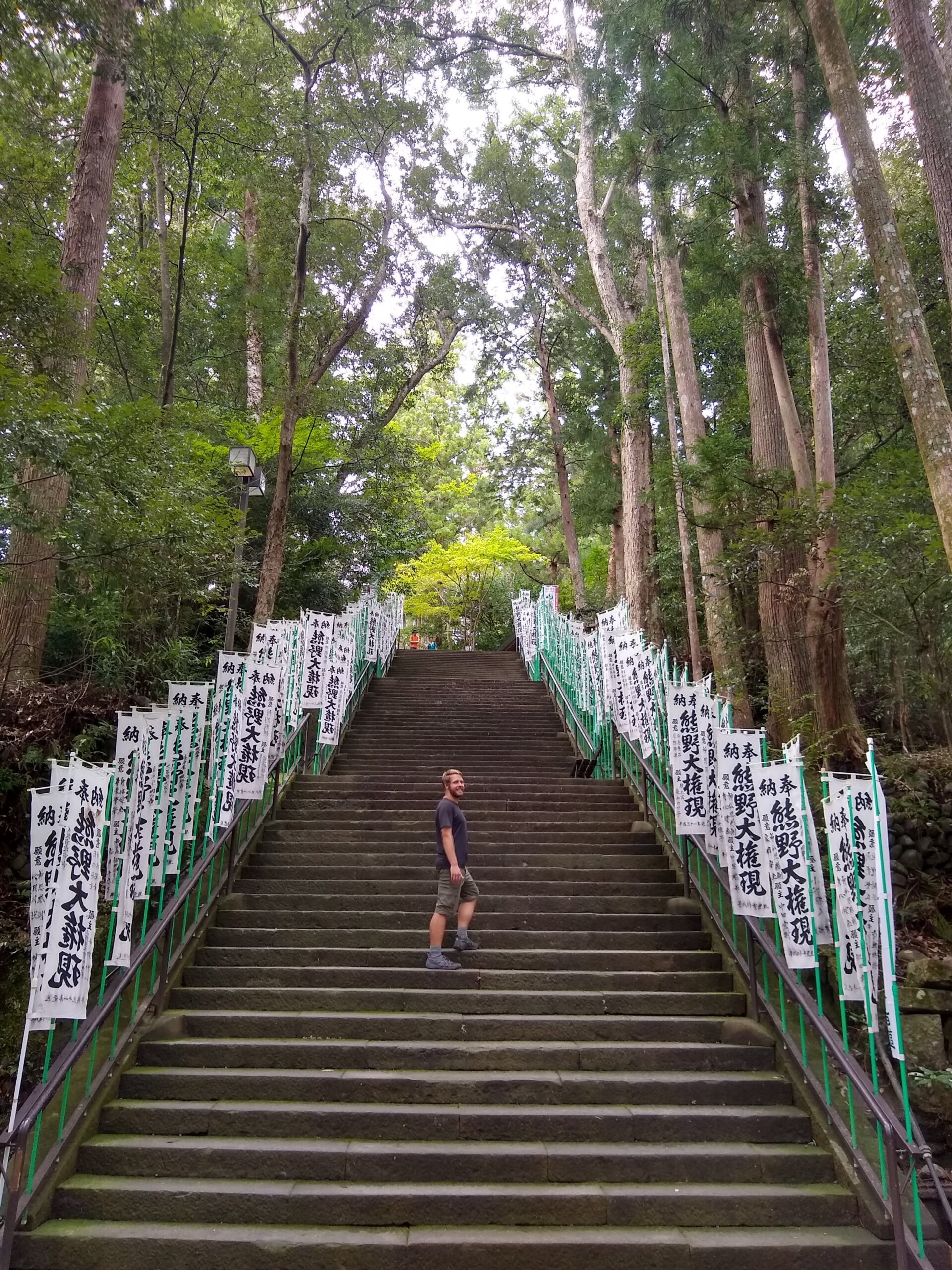
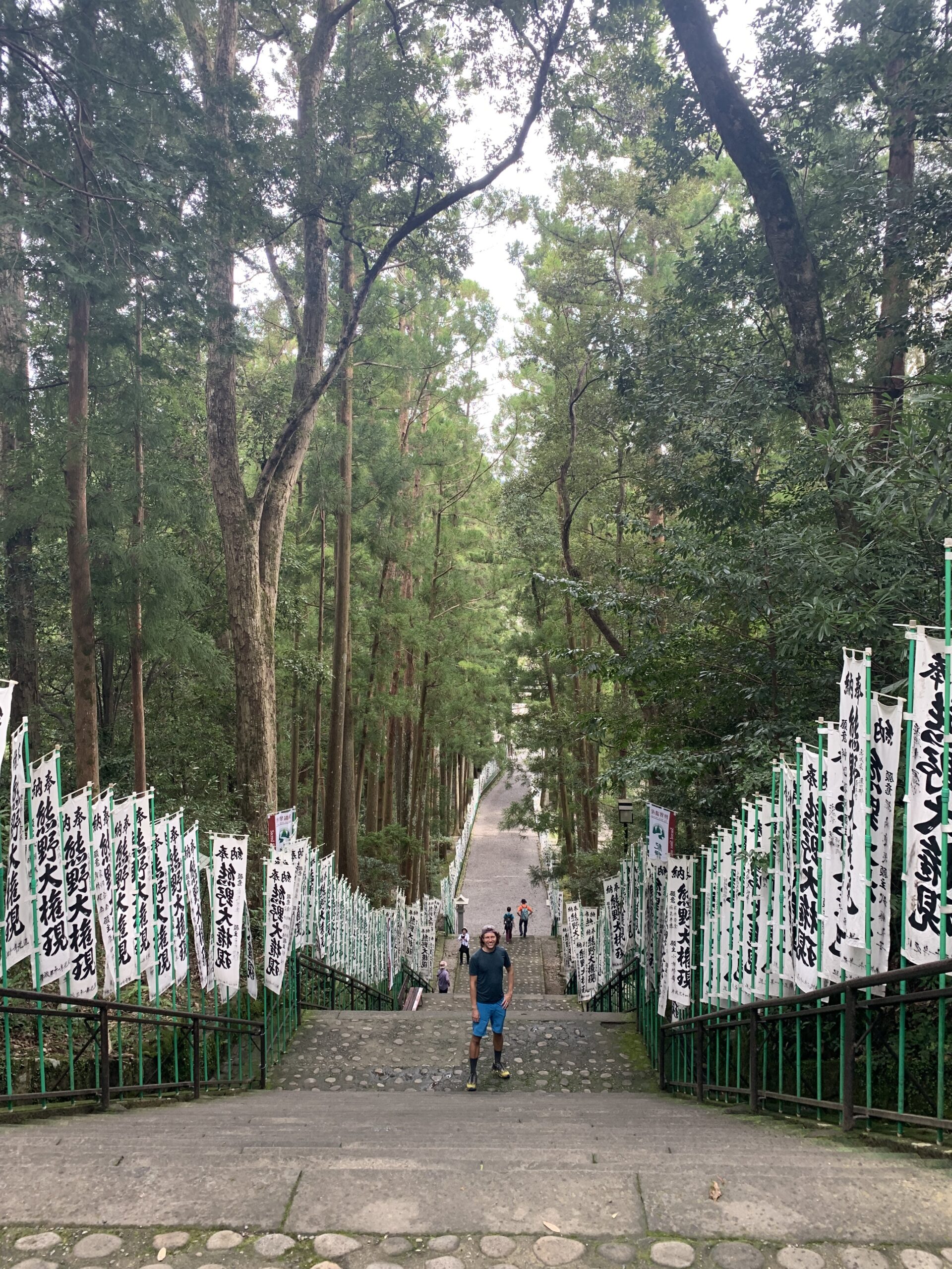
Finally, on that climb, on that endless staircase, and after all our endless toil in the mountains, we sweat our way to enlightenment. It was just the right mix of physical deprivation and beautiful forest to be truly awesome, and despite our aching everything it was among the best climbs of the whole trip. We were exclaiming about how beautiful the forest was and how cool the whole experience was all the way up, even as we labored and literally dripped sweat up the stairs. At the very height of the pass, we couldn’t help but laugh at a pleasant little sign that told the story of famous Japanese poet Fujiwara Teika. In the year 1200, he wrote of this climb, apparently unironically, “This route is very difficult; it is impossible to describe precisely how tough it is”. We found some small comfort that even a famous poet was speechless at the challenge.

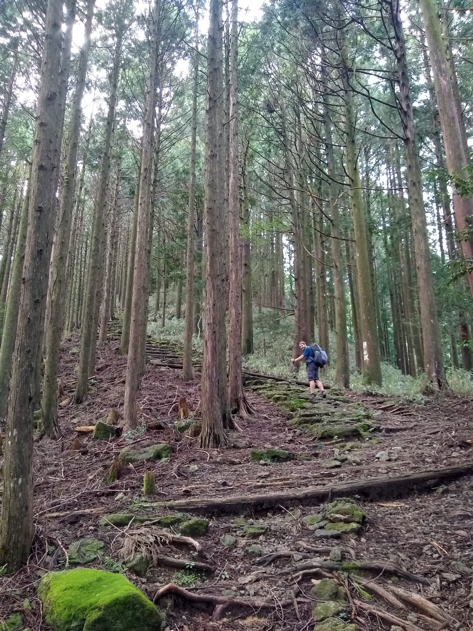
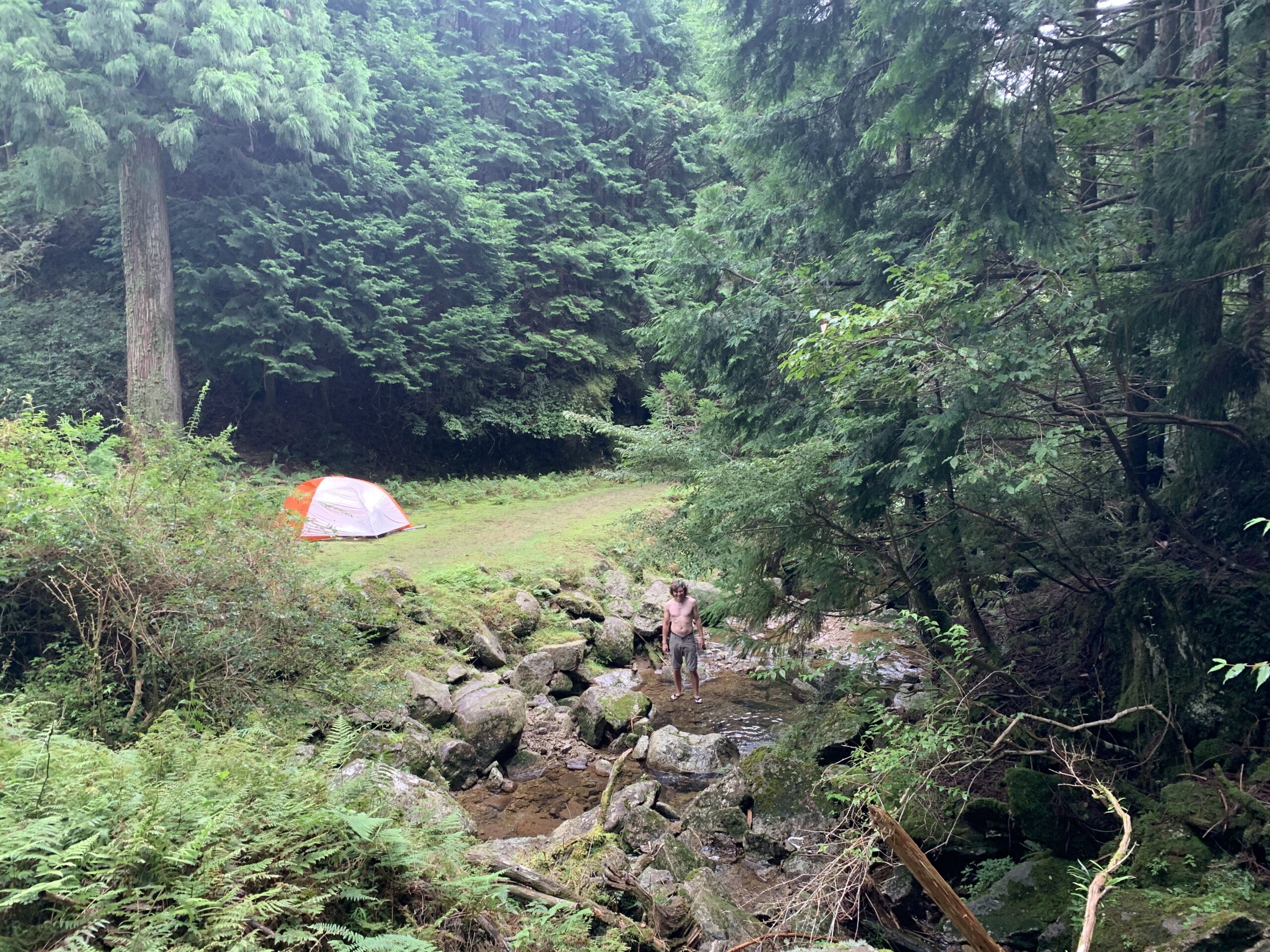
Still, achieving enlightenment aside, we would have liked it if not all the ancient tea houses that used to serve pilgrims along the way were destroyed. The ruins were interesting though, and a thoughtful reminder of all the pilgrims that had come before us. In lieu of tea however, Buddha provided us with a fabulous campsite just a short ways below the pass. After our various weather-related escapades in Norway, we were worried about the wind in the pass with our tent, but the Kii mountains proved more forgiving than the fjords, and we had a great night. I even got to take a bath in the river.

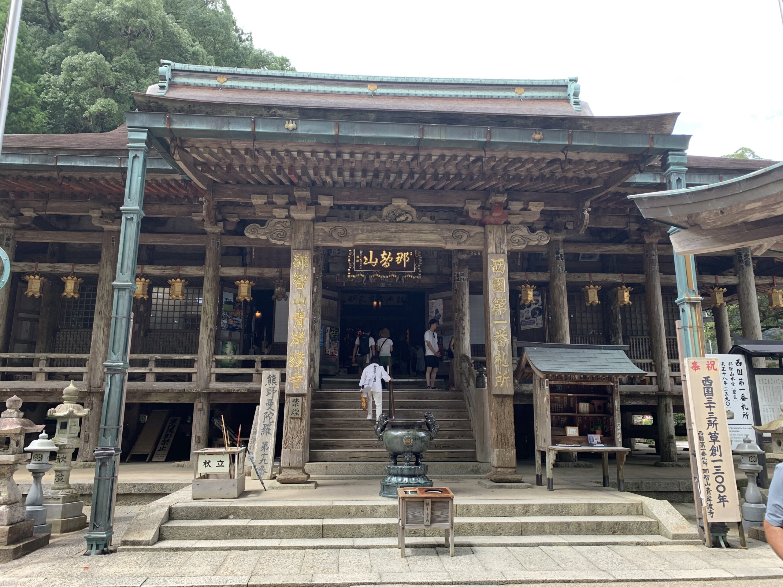
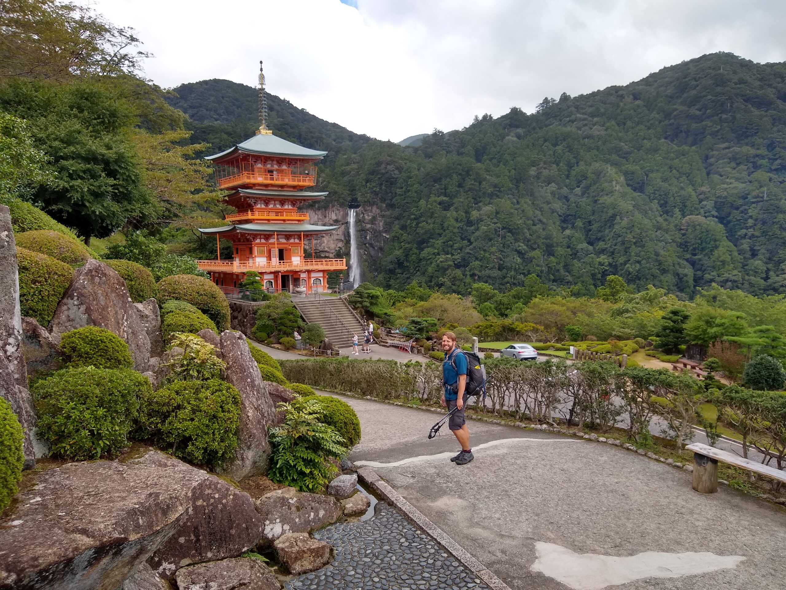
With the last remaining mega-climb out of the way, only 6 or so miles remained of the trail the next day. It was a nice enough section of trail, featuring a couple shrines and a few good views, but after the euphoria of the previous day our sweated reality had sort of come crashing down. We set a good pace on our way back down to the valley floor, and arrived at our final Grand Shrine of the hike before noon. Grand Shrine Kumano Nachi Taisha was both more and less than Hongu Taisha. It was more accessible, more informative, and much newer, but it was also more crowded. Without the natural feel and the contemplative atmosphere of Hongu, in the end it was a lot less spiritual.
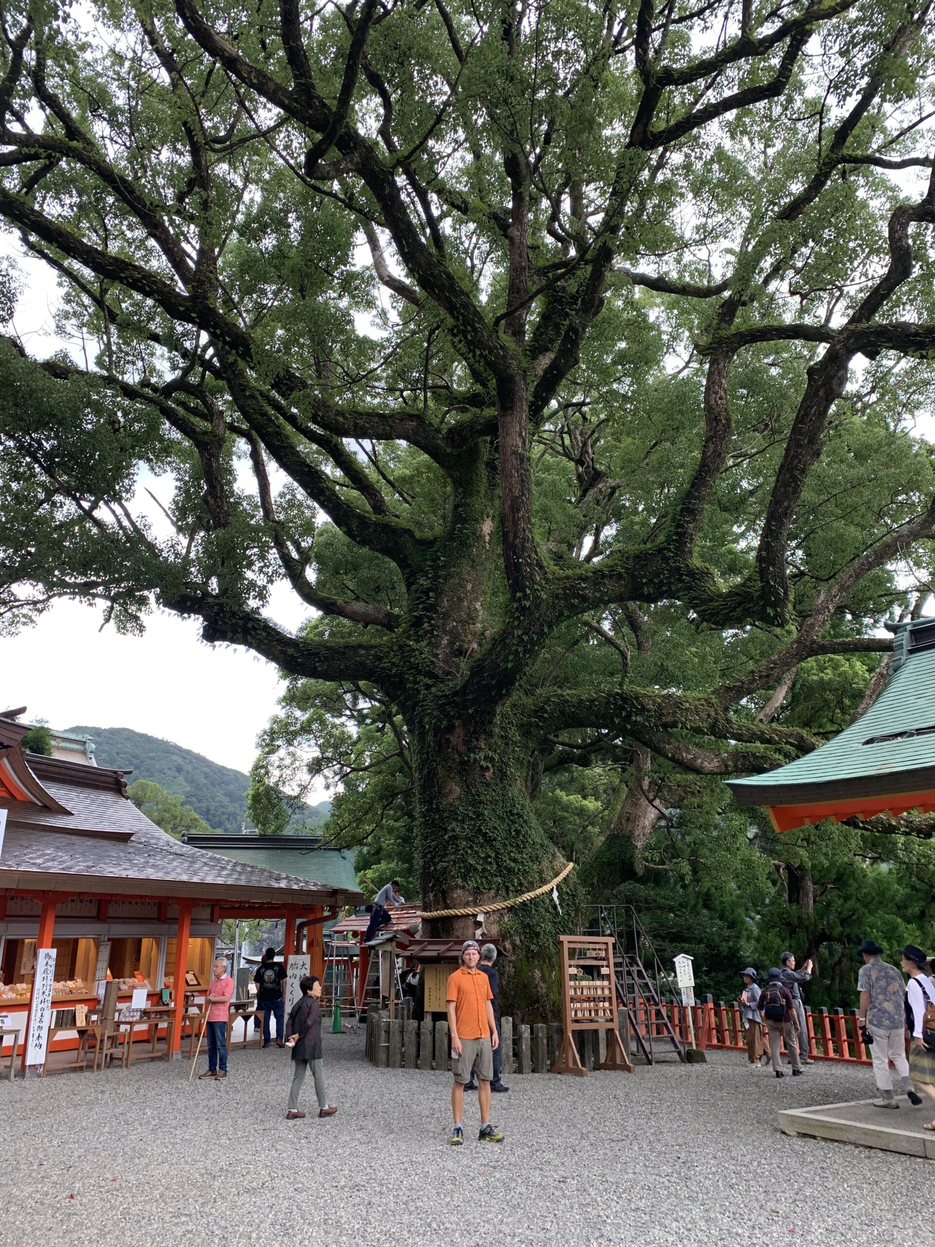
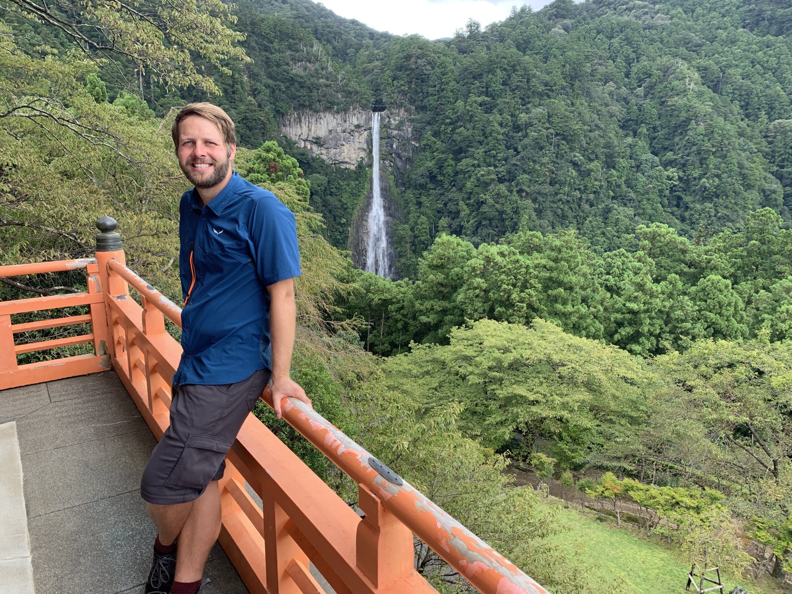
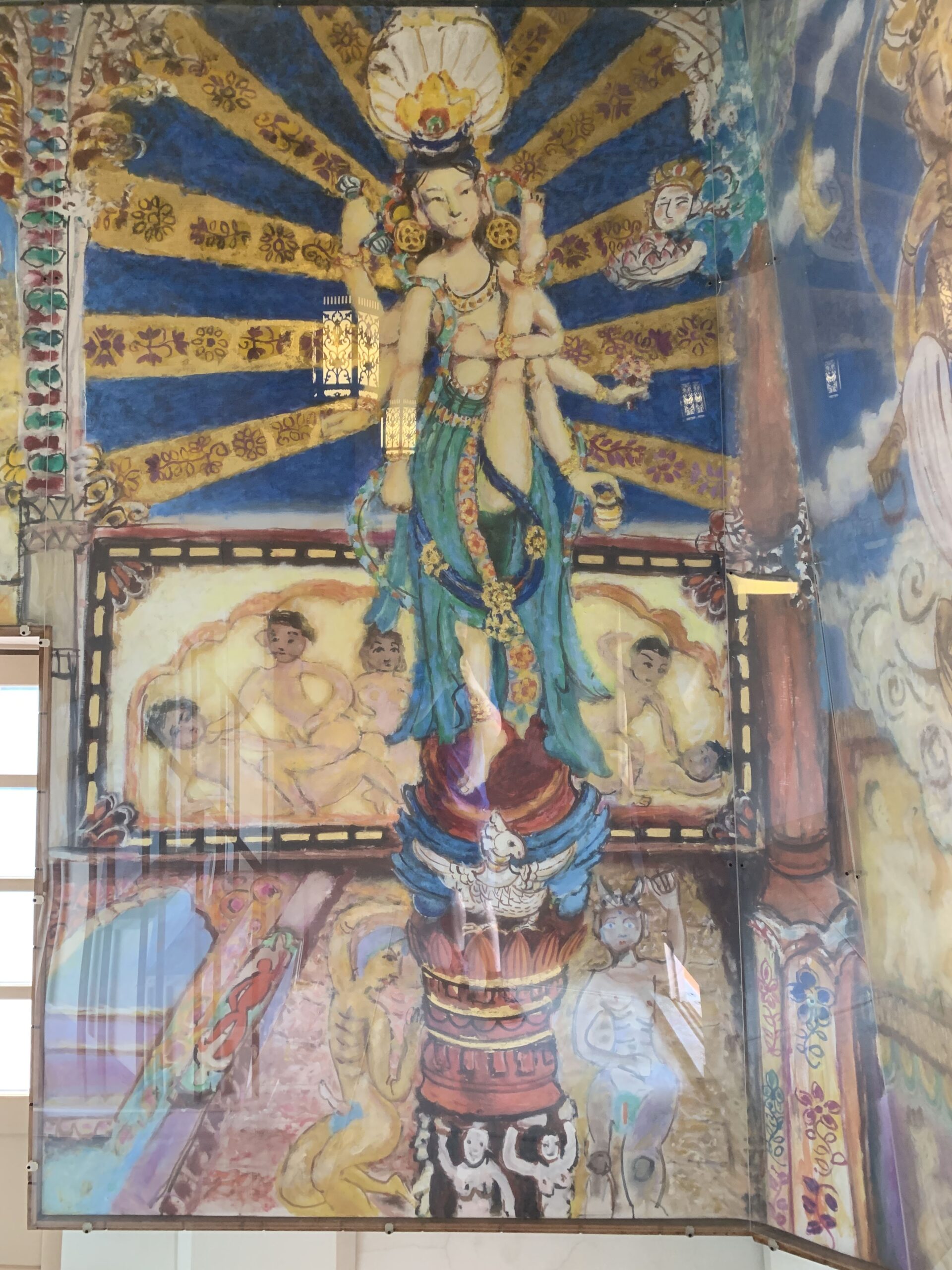
On the positive side, to make up for the tourist crowds, the temple grounds featured a massive camphor tree which is 850 years old and you can actually climb inside it and make an offering at it’s tiny, internal shrine. The area also has a rather dramatic waterfall, Nachi no Taki, that is the tallest in Japan and was worshipped by ancient peoples as a literal god of water. And, last but not least, the well-placed pagoda on the way to the waterfall turned out to be devoted to the kama-sutra, and the inside was decorated with odd, cartoony sex drawings involving super-flexible Buddha. Let’s just say our visit to Nachi Taisha wasn’t as spiritual, but it was no less entertaining.
That night we celebrated our successful hike with weird flavors of Japanese ice cream in Kii-katsuura before taking the train back to Osaka. Truly, Japan’s public transport is enviable.
That’s it for the Kumano Kodo. Next stop Osaka!