
Hiking Velebit Mountains
Welcome to the Dinaric Alps! (or Velebit Mountains, as the Croats call them). To get here from Dubrovnik it’s easy – you just take an 11 hour regional bus from Dubrovnik to Senj, take a local bus back down the coast, hitchhike up into the mountains, and then hike several hours and a couple thousand vertical feet on a barely marked trail in the rain – and you’ll find yourself, conveniently, at what you hope is the trailhead. Then, from there, follows our tale of chasing rainbows Southbound through Velebit.
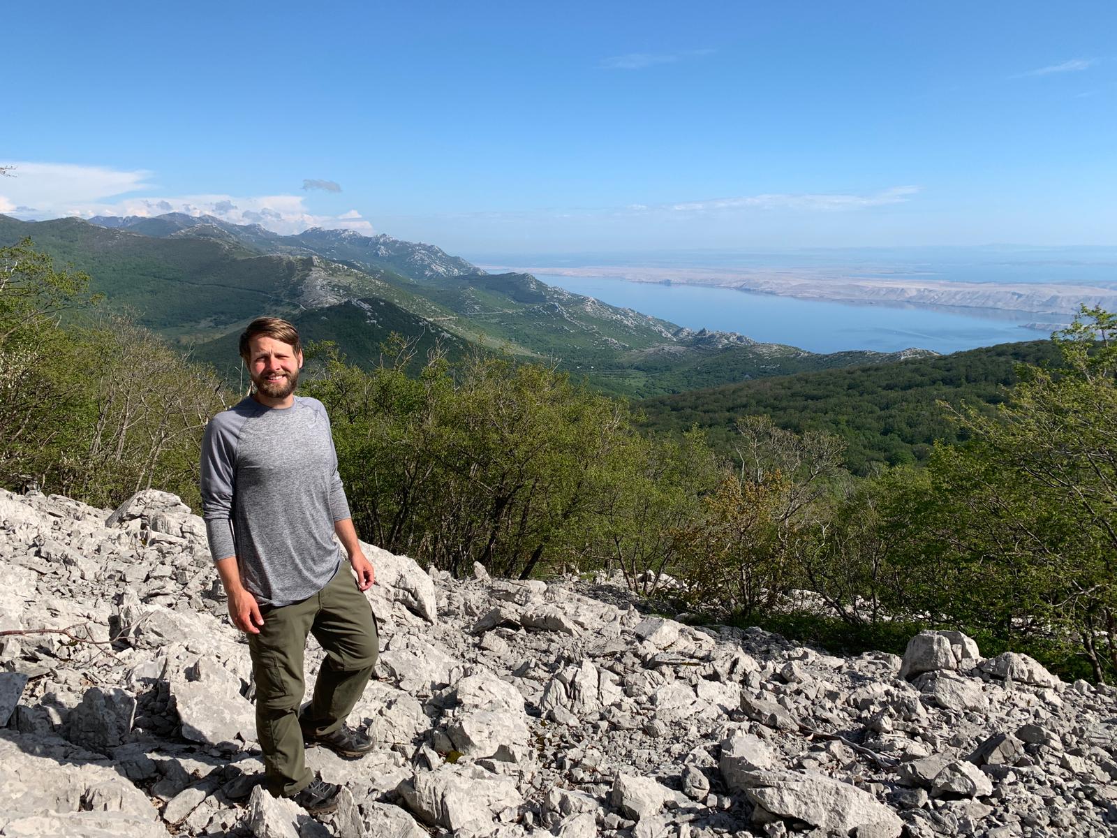
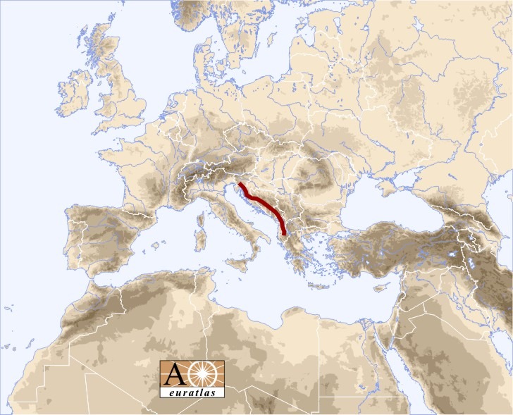
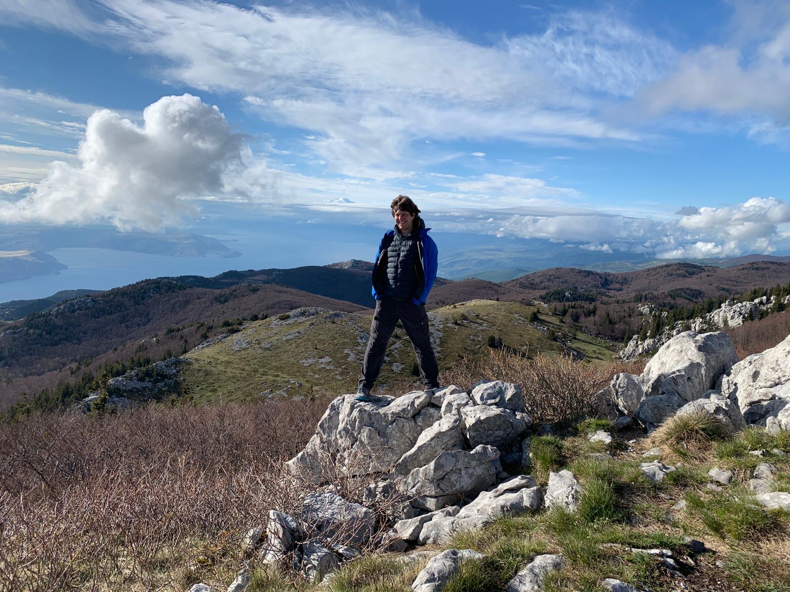
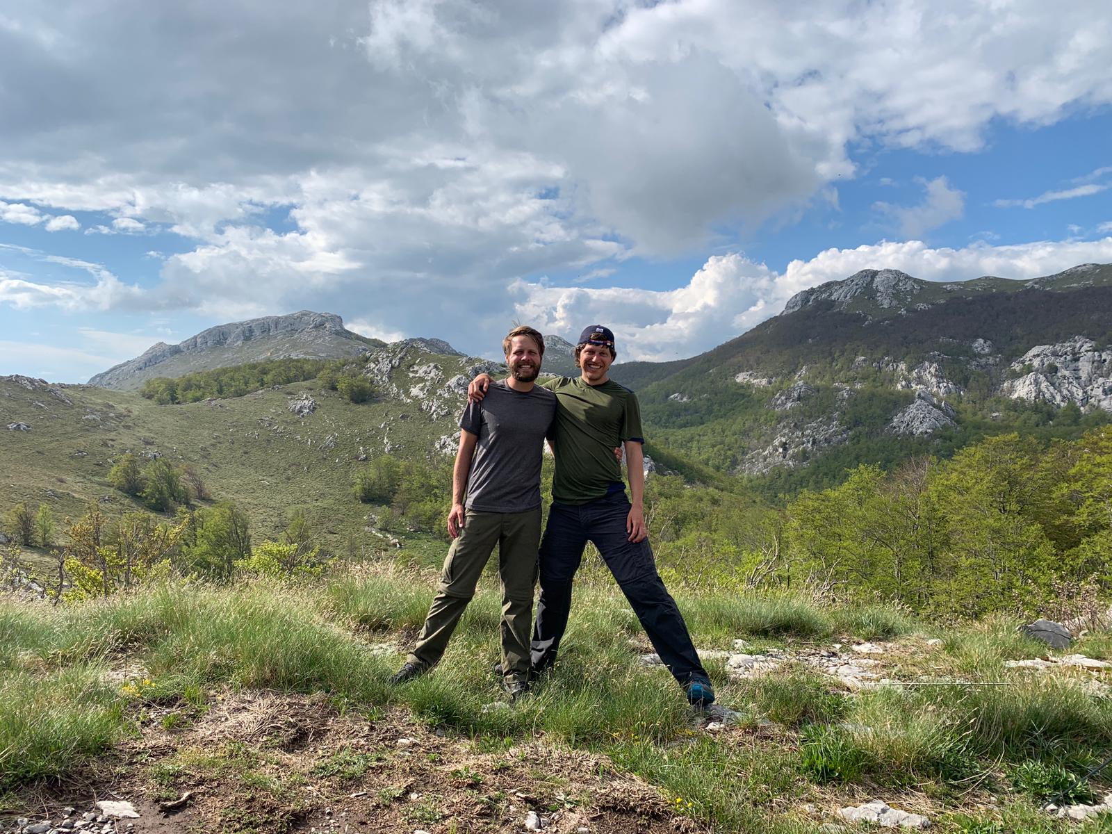
As a brief reminder, the Dinaric Alps are a Southeastern spur of the main Alps heading right down parallel to the coast of the Adriatic, just a handful of miles from the water. They are much shorter and less traveled than, say, the French Alps, but thanks to that we were able to hike in May with only a few sections still in the snow and almost nobody else around. So hold onto your butt, dear reader, cause the Slavs do things a little different in the backcountry.
Day 1 – Road to Zavizan Hut, ~5 trail miles
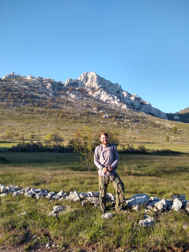
As mentioned, getting here proved a bit of a challenge. For posterity’s sake I will document that we took a regional bus to Senj, then a local bus to Sveti Juraj, hitchhiked with a friendly lumberjack to Oltari (the sole way to get there, I assure you), and finally hiked up to Zavizan Hut and the trail head. In the end though, the weather ended up being more critical than the logistics.
It rained more or less from Oltari onwards, only getting wetter, colder, more windy, and more cloudy the higher we climbed. By the time we reached Zavizan at 1600m (having started from literal sea level camping by the beach that morning), visibility was perhaps 50ft and it was in the 50’s F.
It was a truly disheartening start to what we planned to be a week of hiking – cold and wet with views only of the inside of a cloud. And the forecast called for more of the same (or even worse). It sucked so bad that, even after all the work of getting there, we strongly considered turning around and bailing out the next morning.
But then, as we sat dejected in the empty Zavizan Hut contemplating our cruel and moist fate, the clouds began to part. Briefly at first, with just glimpses of a valley or a ridge, but by sunset the tiny cloud windows had gradually transformed into mighty vistas. Naturally, after we got a load of that, we decided to press on the next day. No thanks to the grumpy hut keeper.

Day 2 – Hut Zavizan to Hut Alan, ~10 miles
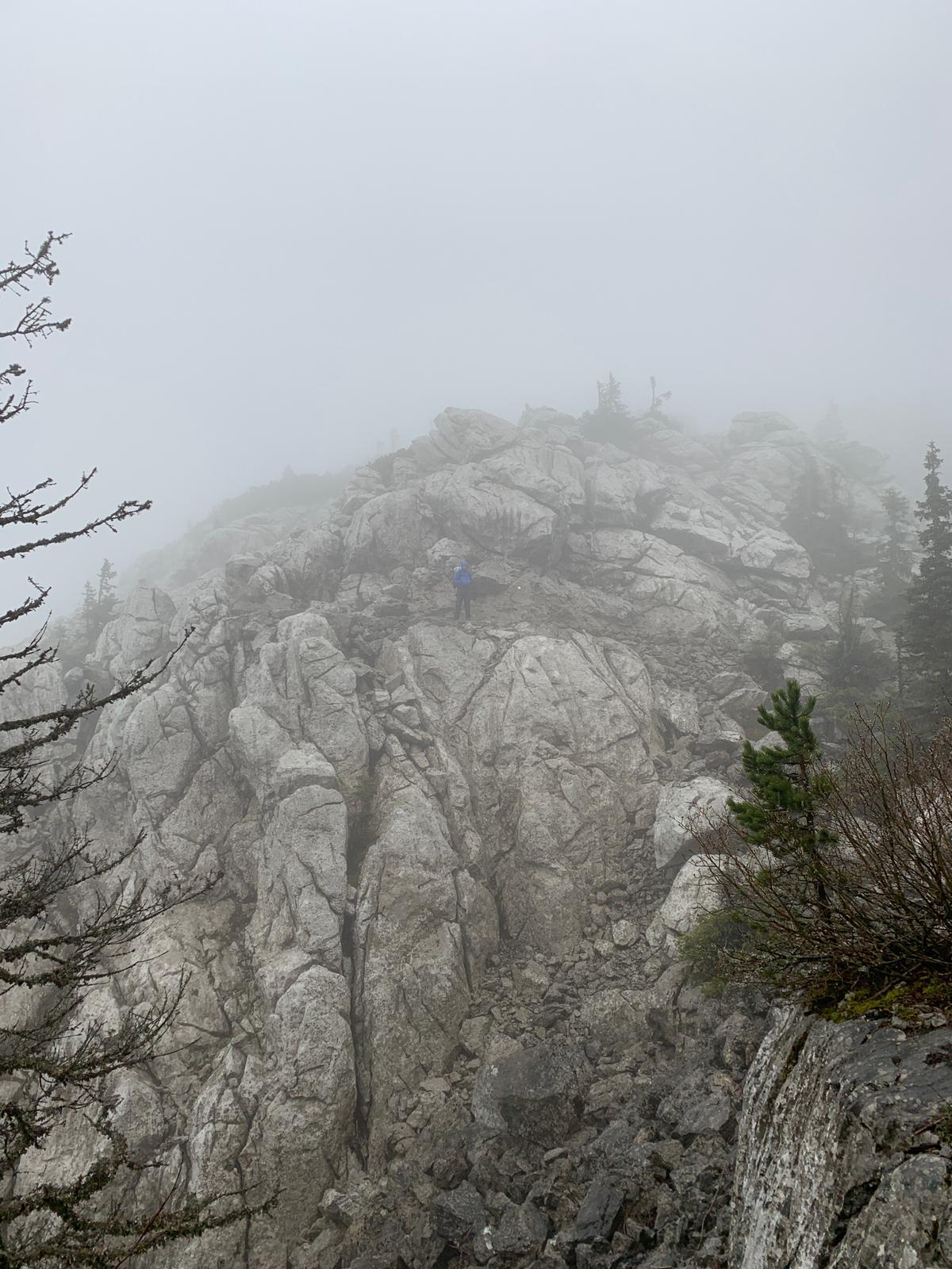
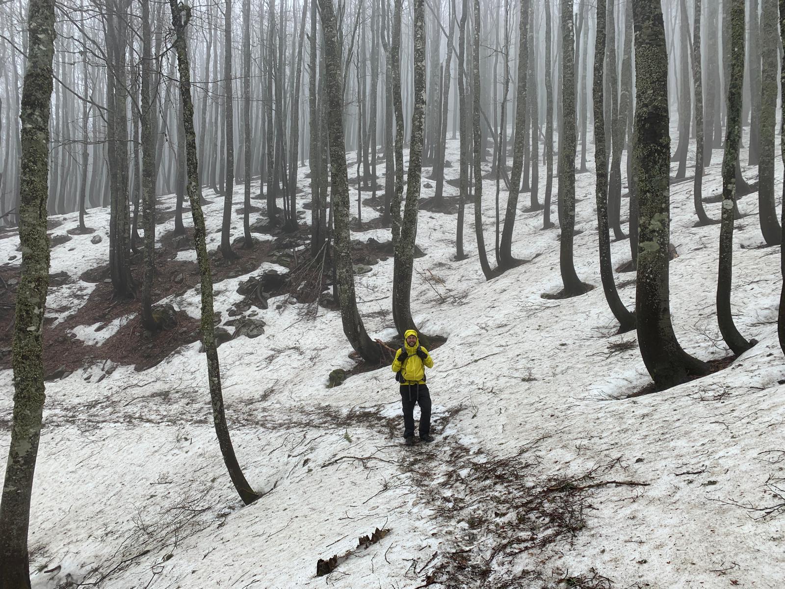
We hiked out of Zavizan the next morning deeply within a cloud, which didn’t make following the Croat trail signs any easier. They say this is among the most beautiful hiking in all of Croatia, but we can’t rightly say. In hindsight, we wish we could have delayed and done this section in better weather, but food supplies and bus schedules are what they are.
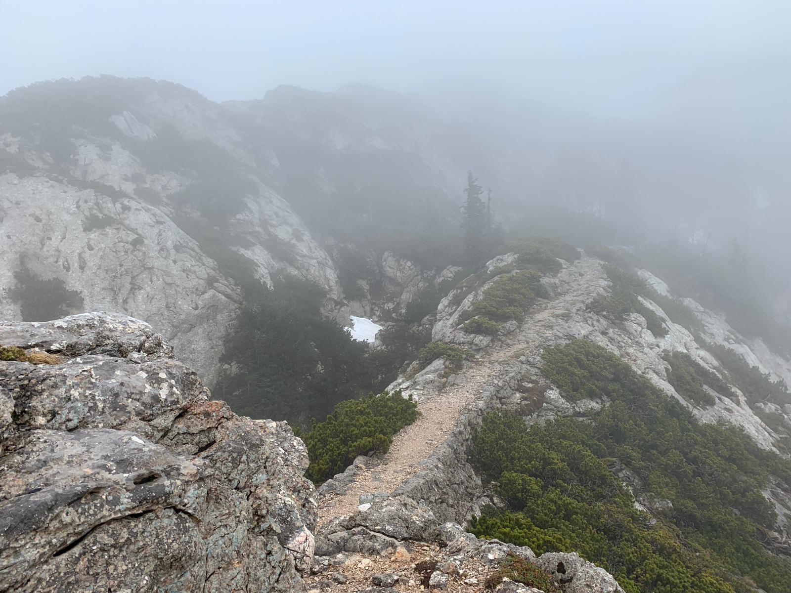
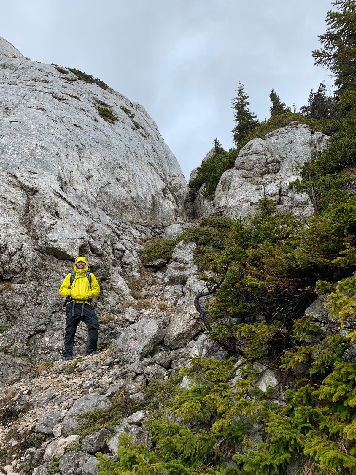
The trail itself is an impressive construction though, being nearly flat despite winding past sheer cliffs and steep rock faces on all sides. We suspect the rumors about it being fabulous are true. Luckily it wasn’t too windy, but it did rain on and off all day.
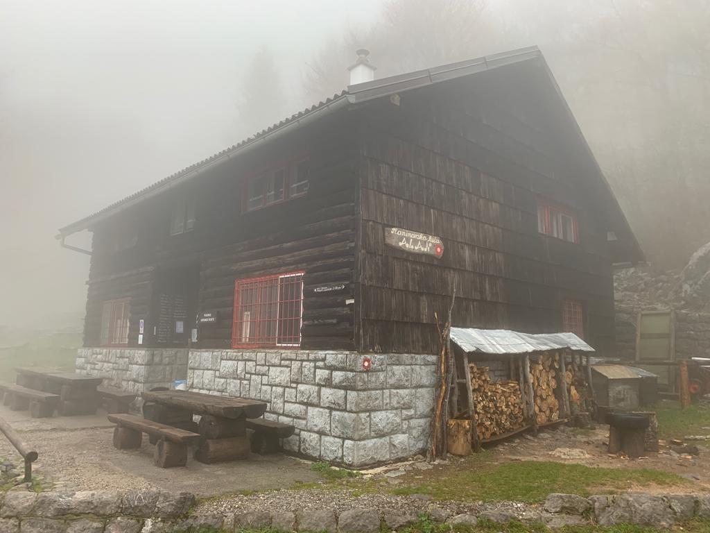
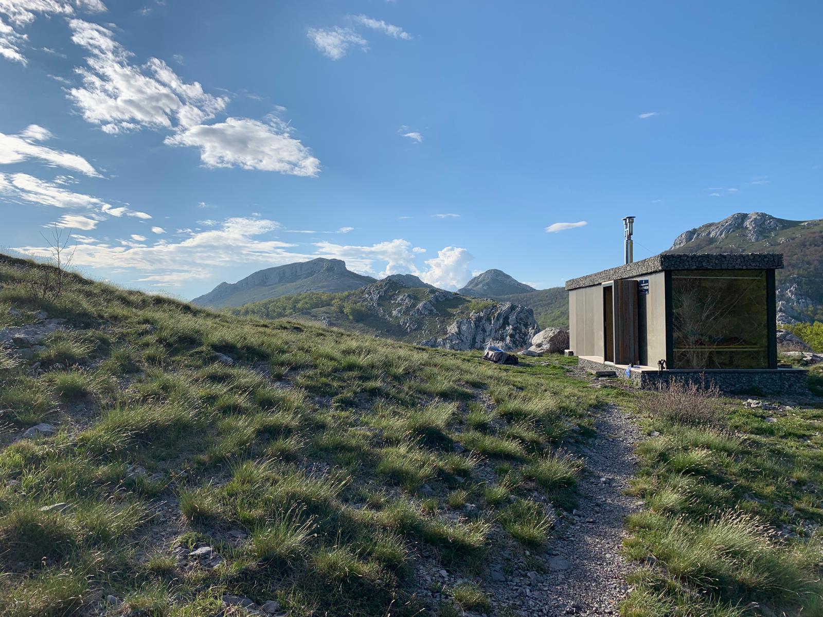
Hut Alan was lovely and the keeper was much friendlier. We cooked dinner on a woodfire stovetop and the keeper even started a fire to dry our socks! Both huts had communal bunk rooms, cistern water, and very limited electricity, not unlike a cheap hostel on a mountain top.
Day 3 – Hut Alan to Baske Ostarije, ~23 miles 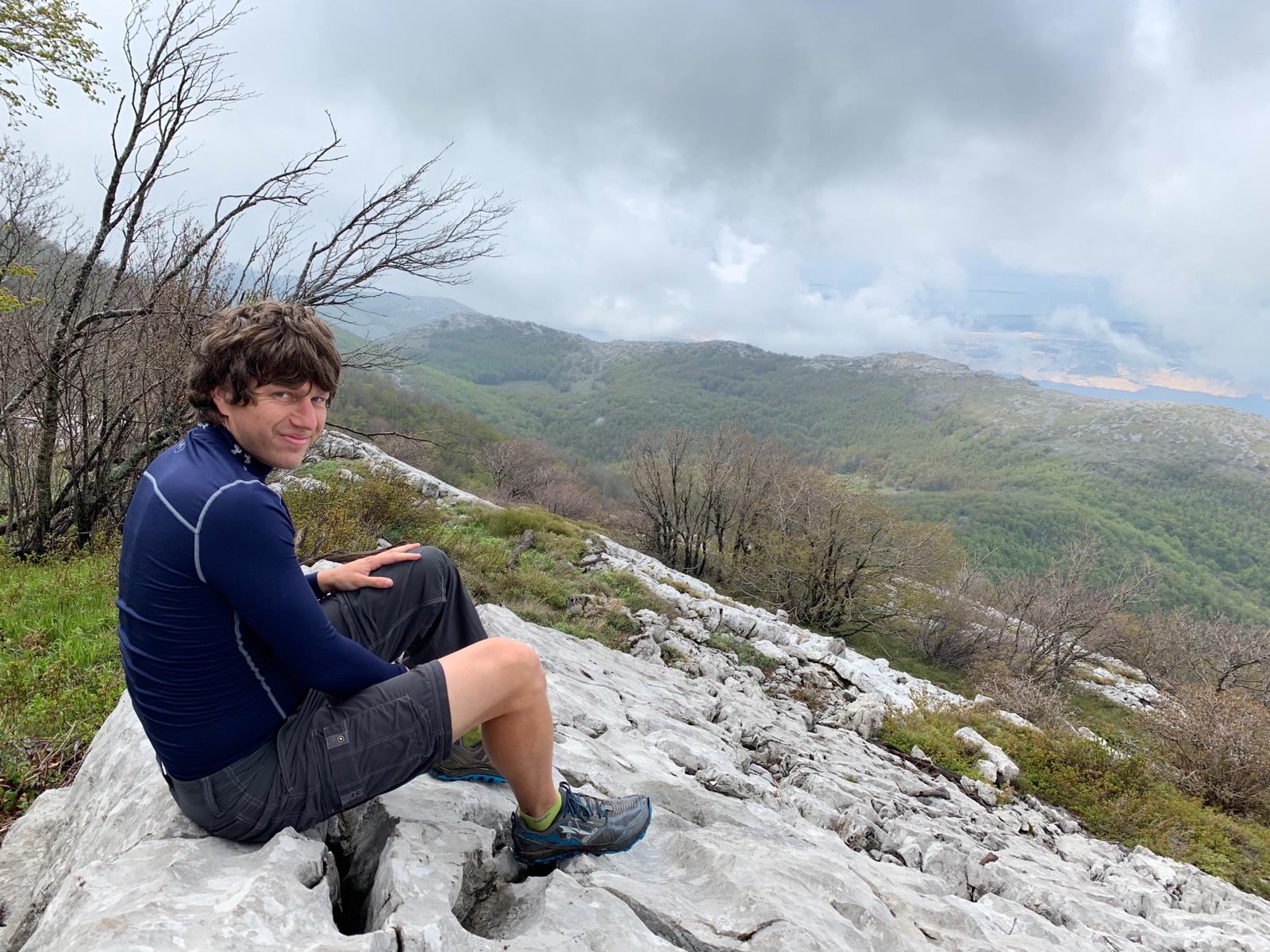
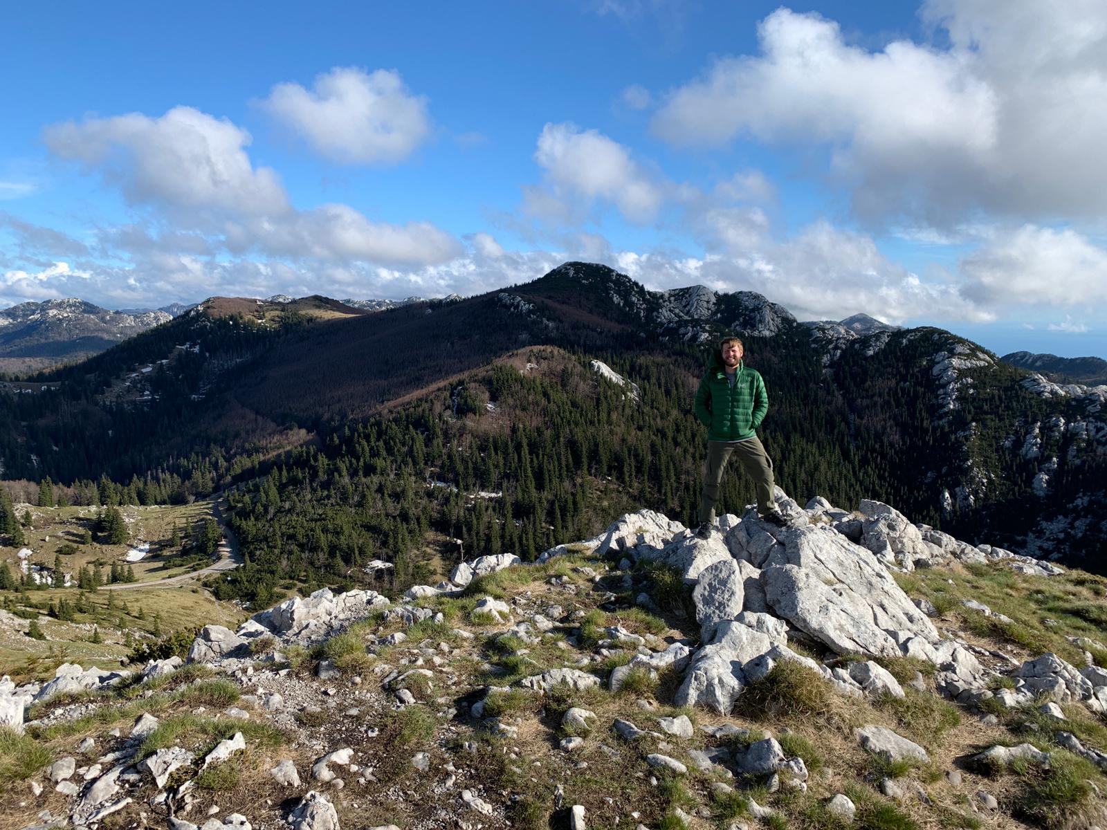
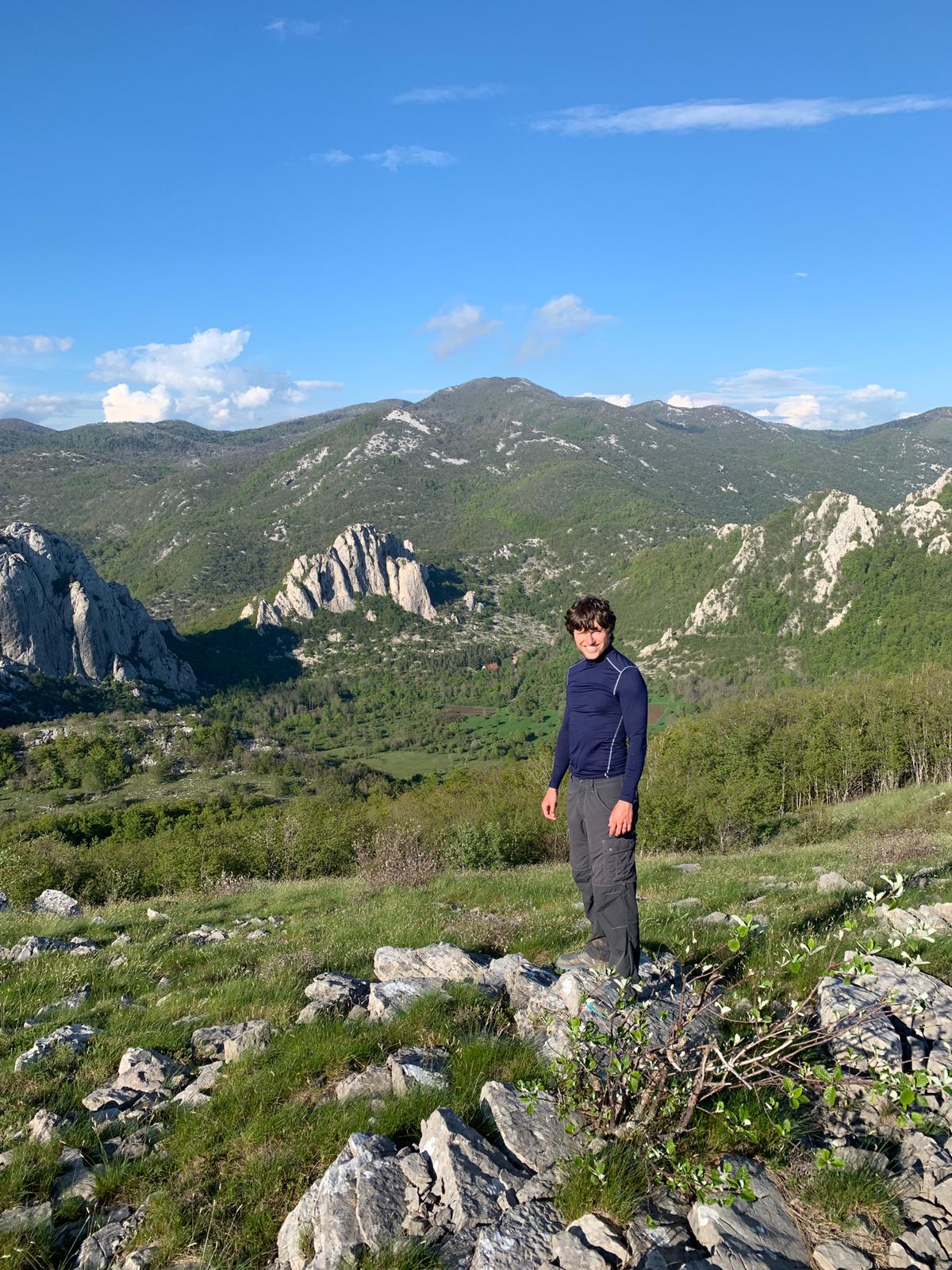
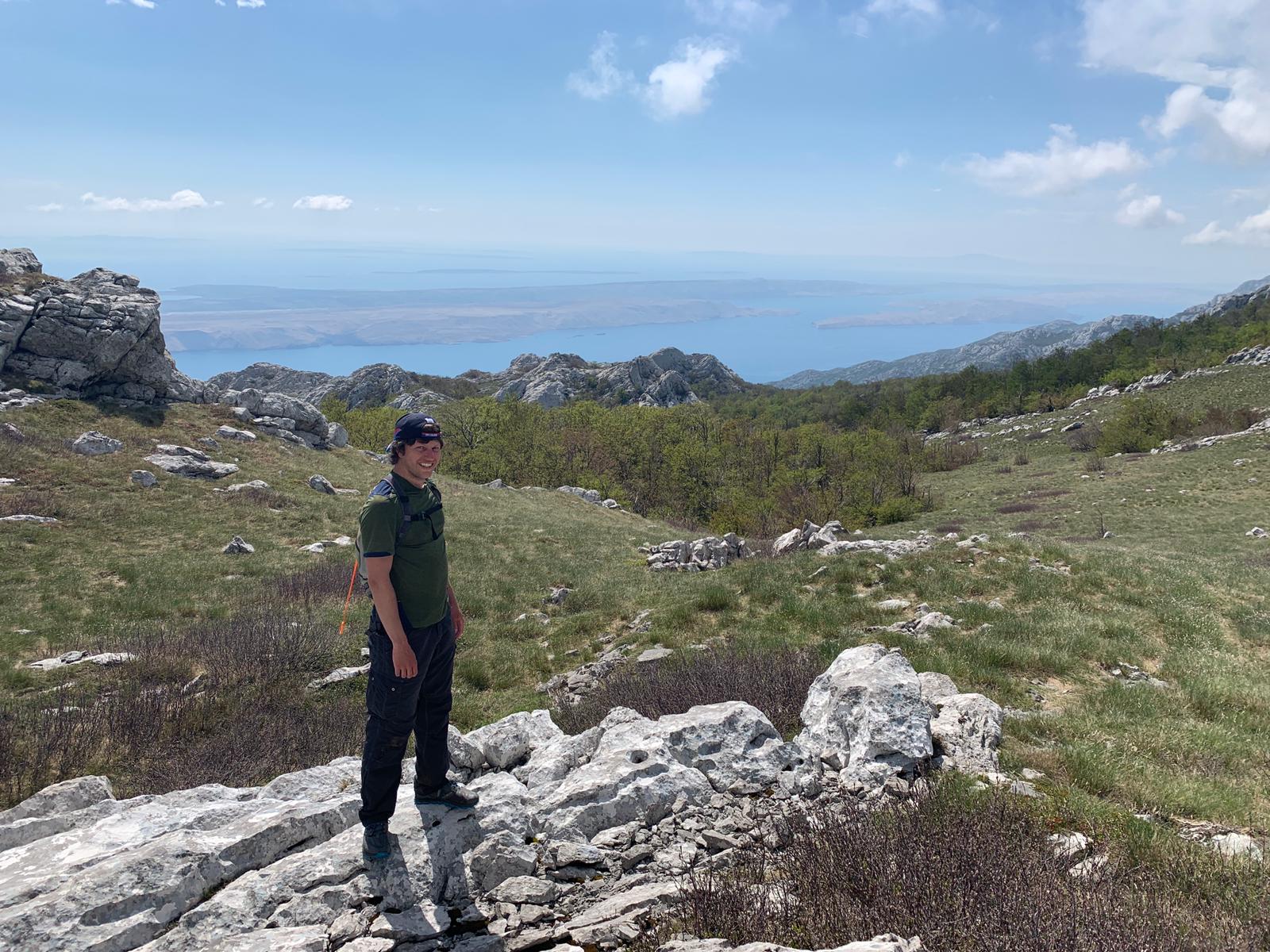
With the Adriatic on one side and the giant karst mountains on the other (and the sun in the sky!), we had a great day. The trail remained mostly flat and appeared well marked. We followed the signs to the tiny village of Baske Ostarije all day expecting to stop for the night at a hut along the way well before reaching the village.
And we did find the hut – a couple miles in the distance down in a valley instead of high up on the ridge line where we were. After extensive consult with the GPS and our highly detailed paper guide we decided that, despite following the signs, we hadn’t followed the right signs and ended up on some sort of alternate trail.
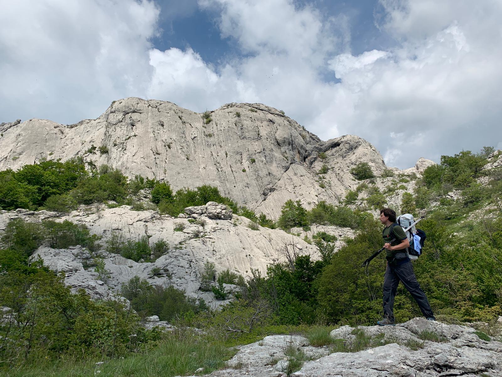
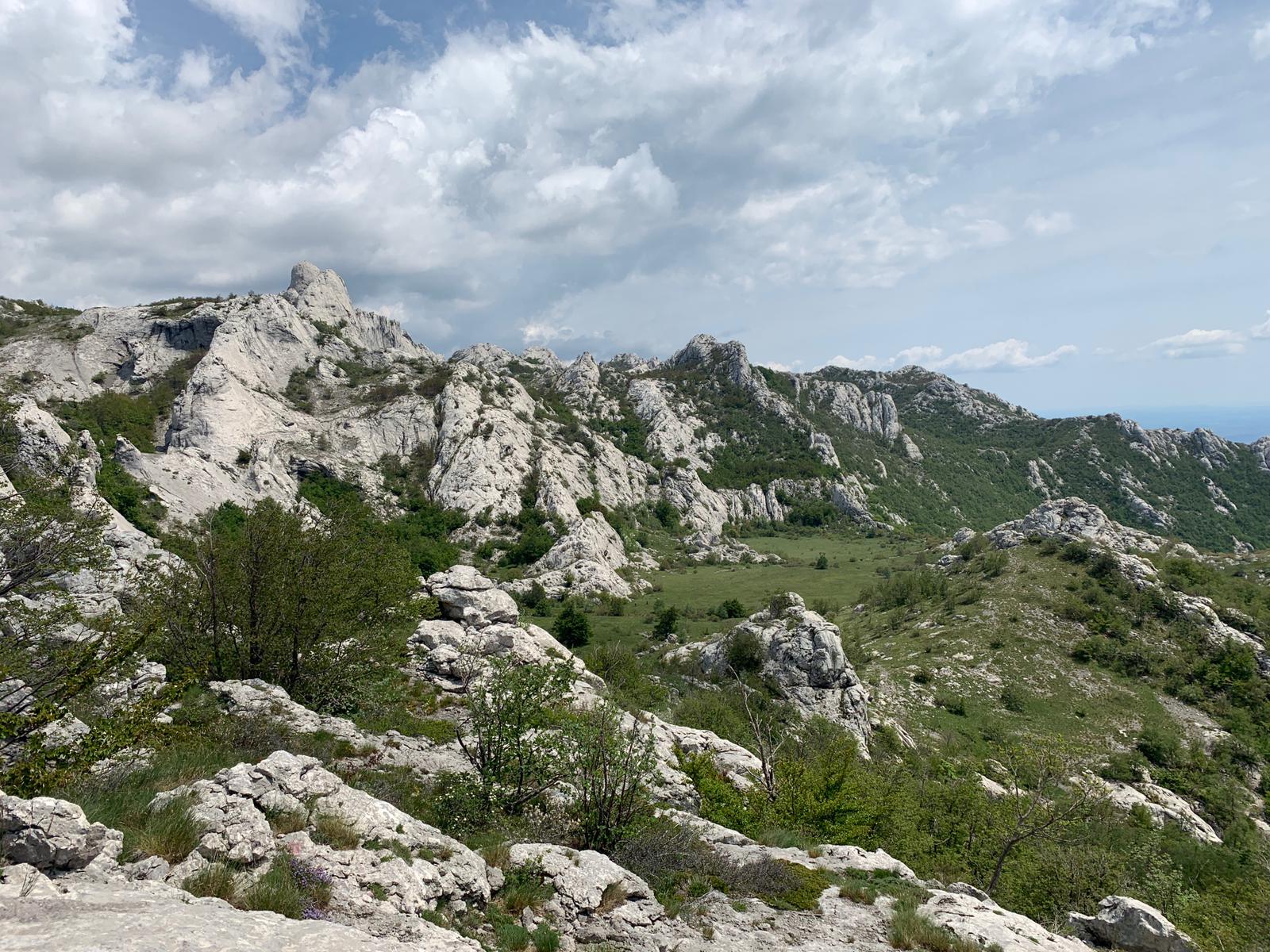
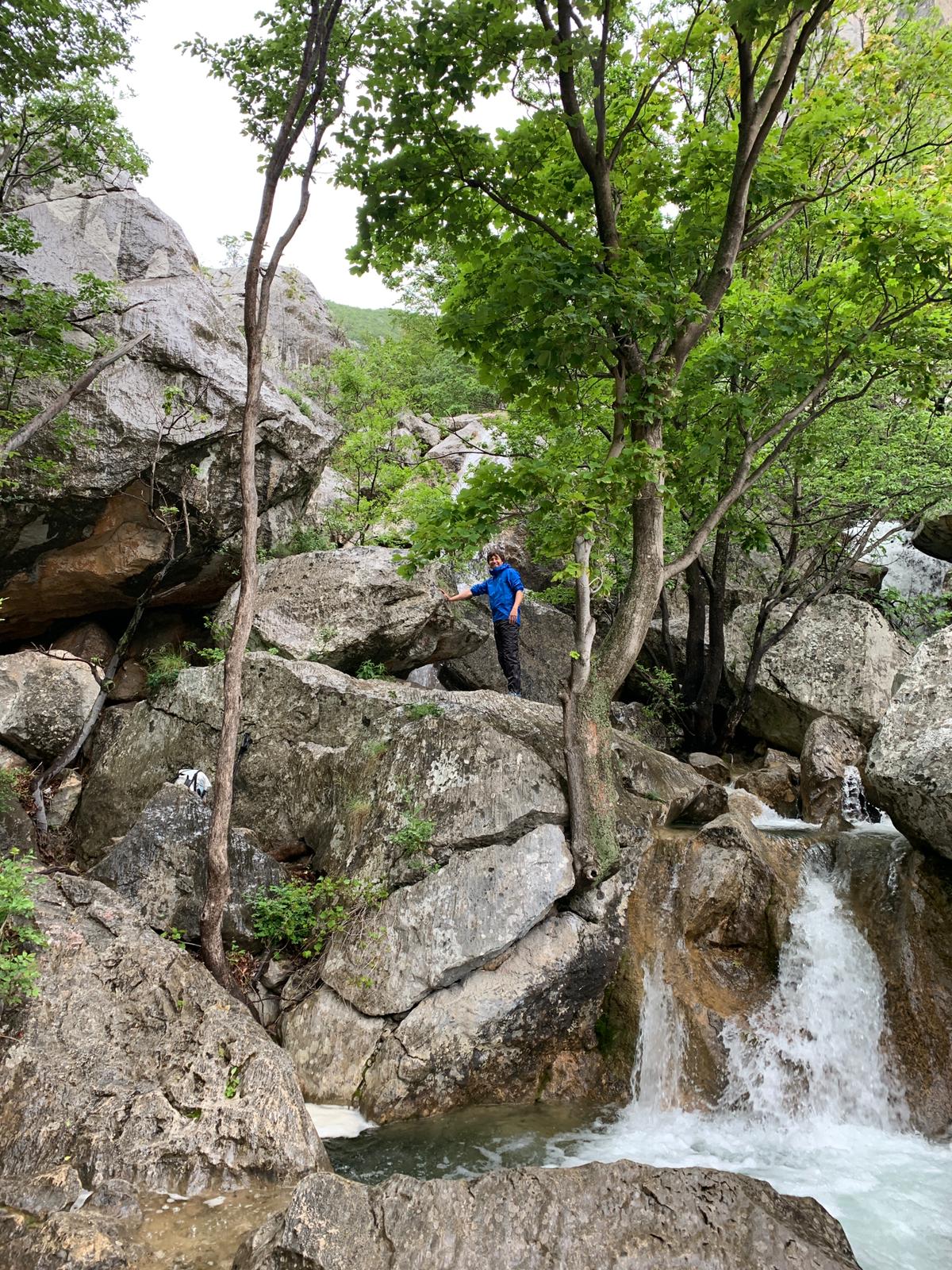
By then it was around 6pm and if we had been in the Smokies we would have just given up walking for the day and camped somewhere nearby. If we had been in the Smokies, though, we wouldn’t have been out of water. One of the most interesting features of the Velebit mountains is the beautiful white rock. It’s a type of limestone, which is of course soluble, and the erosion forms the jagged peaks and deep sinkholes of what’s called a Karst landscape.
But the most fun feature of Karst is that all rain and surface water is funneled immediately in deep underground rivers, so for hikers like us there is absolutely no water outside of rain water cisterns at the huts. Thus, when we missed the trail to the hut we missed the trail to the water, which is how we ended up walking an extra 8 miles beyond our intended destination for something to drink. It worked out though, the Hostel Baske Ostarije was nice and they had beer.

Day 4 – Townie day
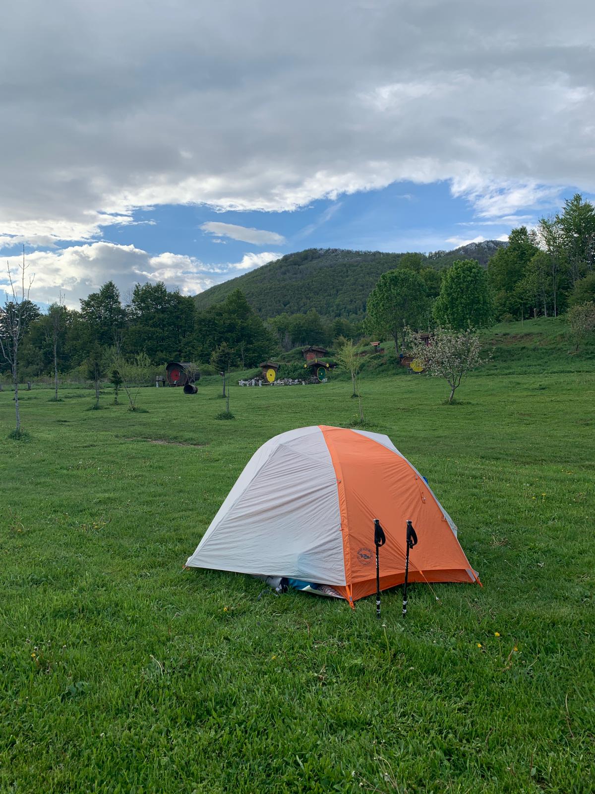
We moved from the hostel to the campsite down the road, then set out to hitchhike down the mountain to the grocery store for resupply. It ended up taking us nearly 2 hours to catch a ride, and then it was opposite the direction we had planned. Nevertheless, we successfully got groceries in Gospic and caught the bus back. It would have been routine, except the bus ended up being a school bus packed with middle schoolers. We didn’t understand this, but the school buses on rural routes are sometimes private contracted buses with the remaining seats bought with regular bus tickets. Now we know when a bus route only goes twice a day at 6:30am and 2:30pm you’re going to share the ride with school kids.
At the campsite that night, the owner’s mother was so sweet and friendly that she brought us some homemade Croatian Rakia to try, which is a kind of fruit brandy kinda like schnapps. She must have been tougher than she looked cause it was powerful, but tasty.
Day 4 – Baske Ostarije to Sugaraka Duliba, ~12 miles
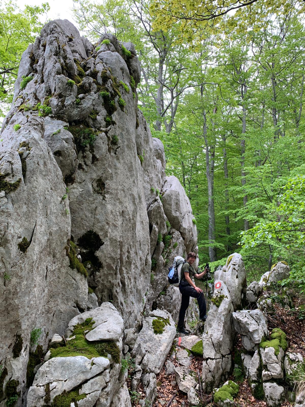
Here’s where things got interesting. The Croatians have this inexplicable method of marking all trails with the exact same blaze – it’s a red ring with a white center and it’s quite distinct, but it’s not helpful to come every 4 way intersection and find all 4 directions marked with the same blaze. Further, they seemed to give up building actual signs and instead opted to spray paint Croatian words and arrows on rocks for directions. Perhaps that would be sufficient if we spoke Croat or had an in depth knowledge of local monuments, but obviously we had neither.
Add that up with the trail being overgrown through the woods, littered with downed trees, and sometimes pretty steep, and we got off track and questioned our route more than a few times despite the aide of GPS. Some trails just simply weren’t on the digital map or were not as they appeared, despite being blazed all the same.
Anyways, a whole day of staggering half lost through the Karst country side later we were pissed off, dehydrated (Jon was particularly triggered by our running out of water),and worn out when we made it to the hut.
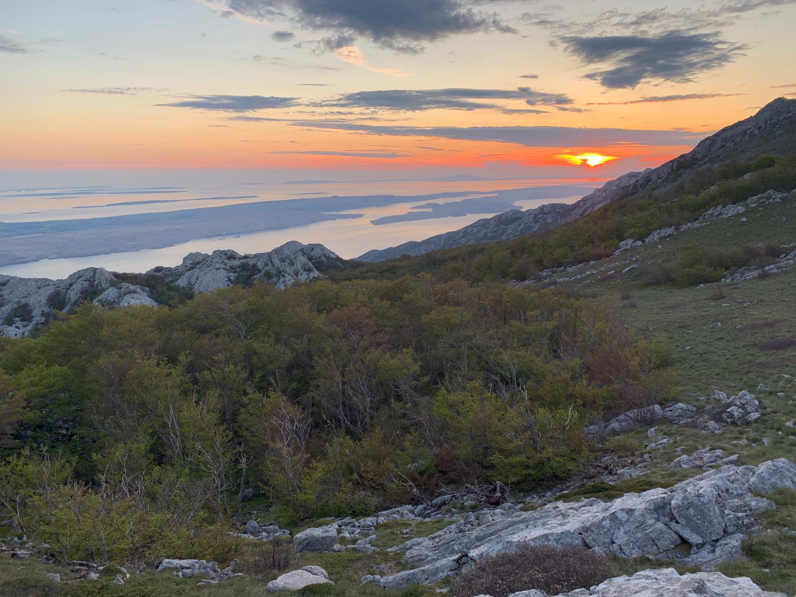
But what a hut it was! This section was about 12 miles by the end, but only the last half mile mattered. The vista even came with a romantic sunset to complete the evening. That night we shared the hut with four other local dudes who spent the evening chopping wood and cooking over a fire, and who were suitably annoyed by the atomically loud crinkling of our air mattresses in the night.
Day 5 – Sugaraka Duliba to wild camping near Stap, ~10 miles
Another day with some stellar views. Like the day before we had some real trail finding difficulty – we actually were completely unable to find the path at one point and had to divert around by logging road, and another time found the blazes but they passed through such rough forest we couldn’t actually follow. Lots of back tracking was required even with the aide of GPS. Luckily Jon knows how to use a map.
Apart from the way finding challenges, the trail passes some really neat terrain and rock formations. A friendly local woman told us the legend that the tall rock, Stapina peak, is supposed to be home to faeries. Local legend is so confident that the faeries are real that if you hike to Stapina but don’t you see the faeries then, it’s said, you simply must have gone to the wrong rock.

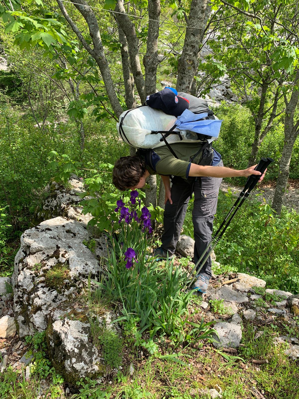
She also pointed out the Croatian national flower, which was in bloom near the hut at Stap. At the end of the day we camped, quite by accident, right where we intended near the entrance to the Kamena Galerija (Stone Gallery).
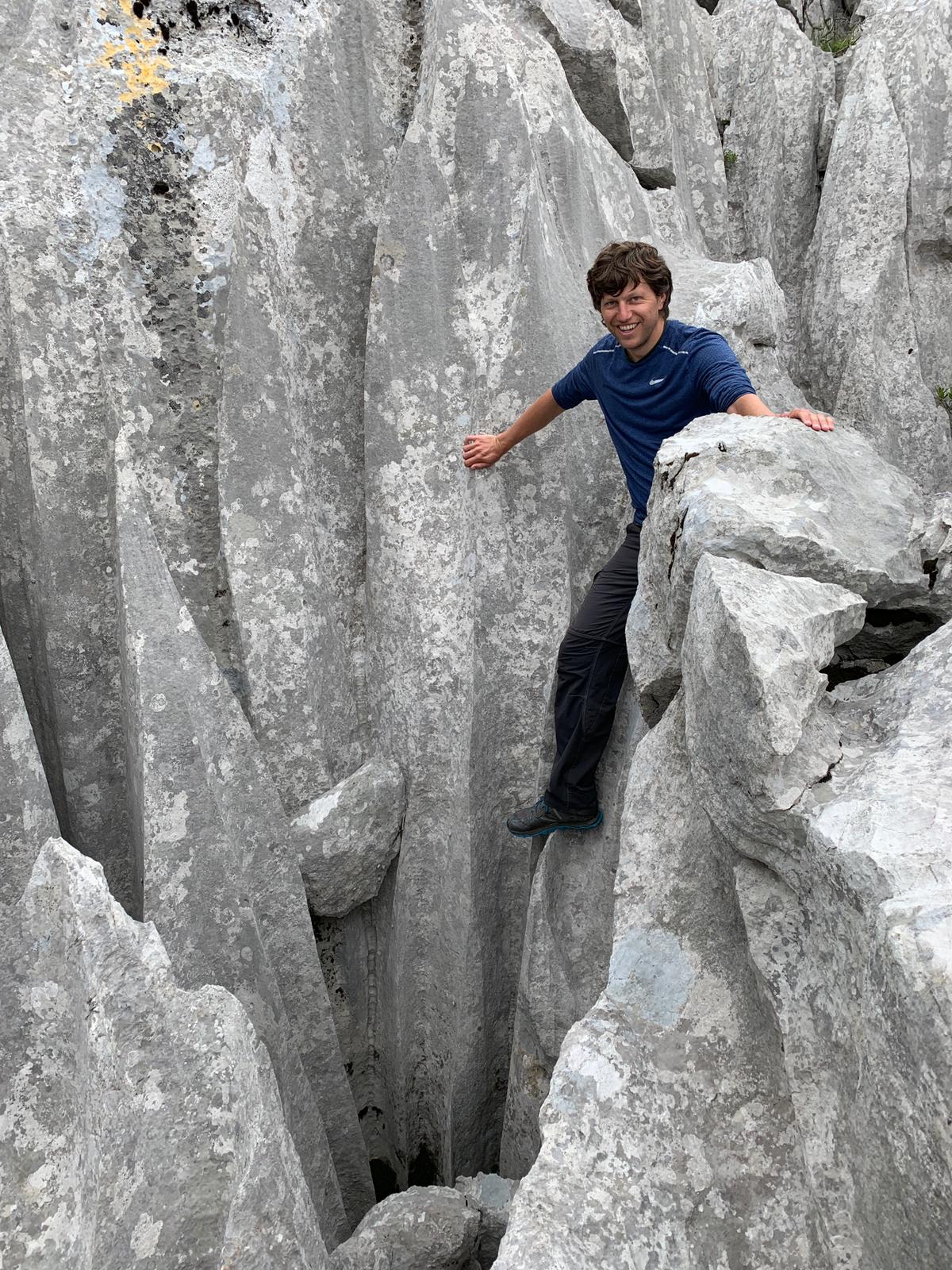
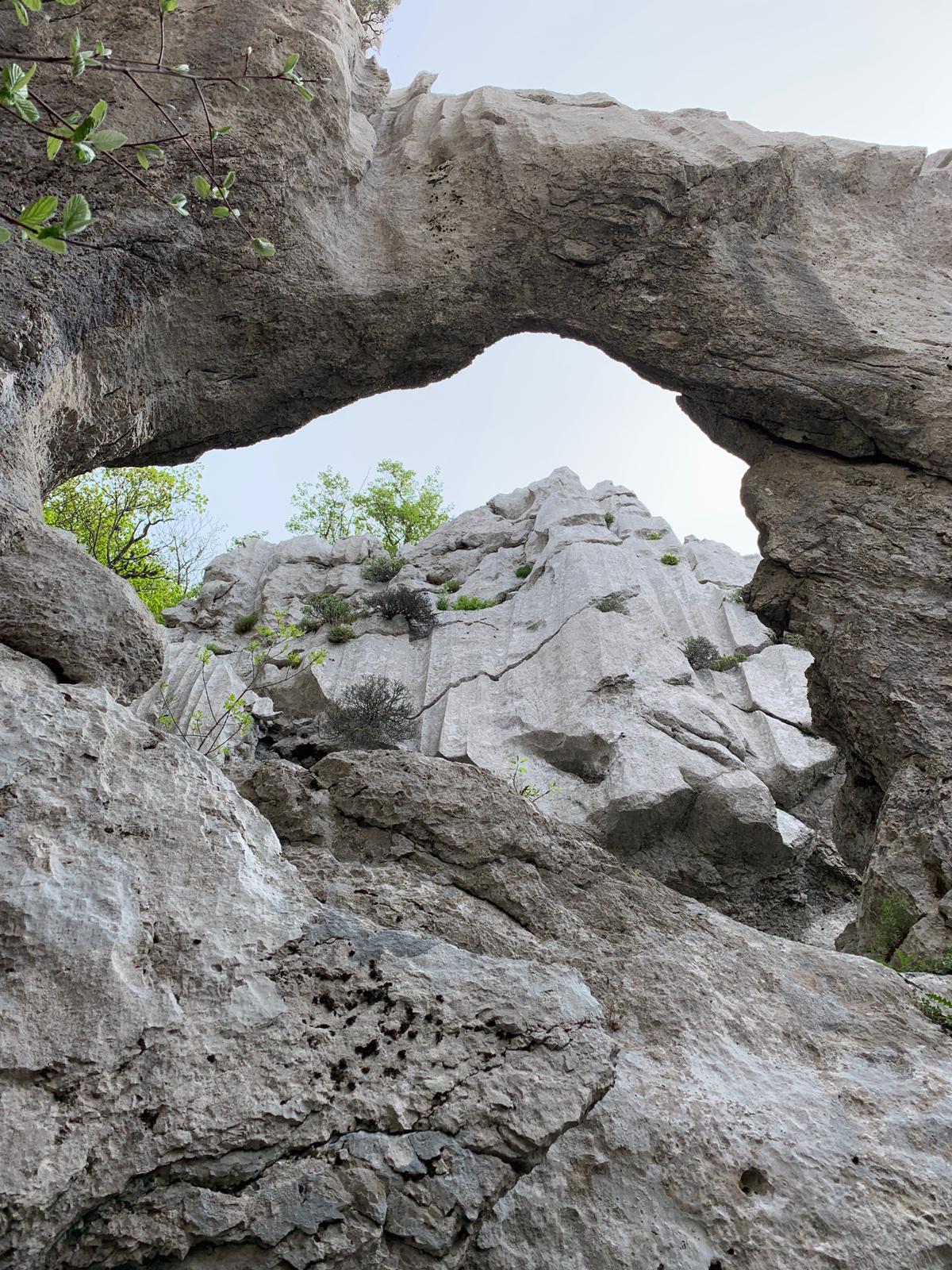
Day 6 – Kamena Galerija to Struge, ~11 miles + Gallery
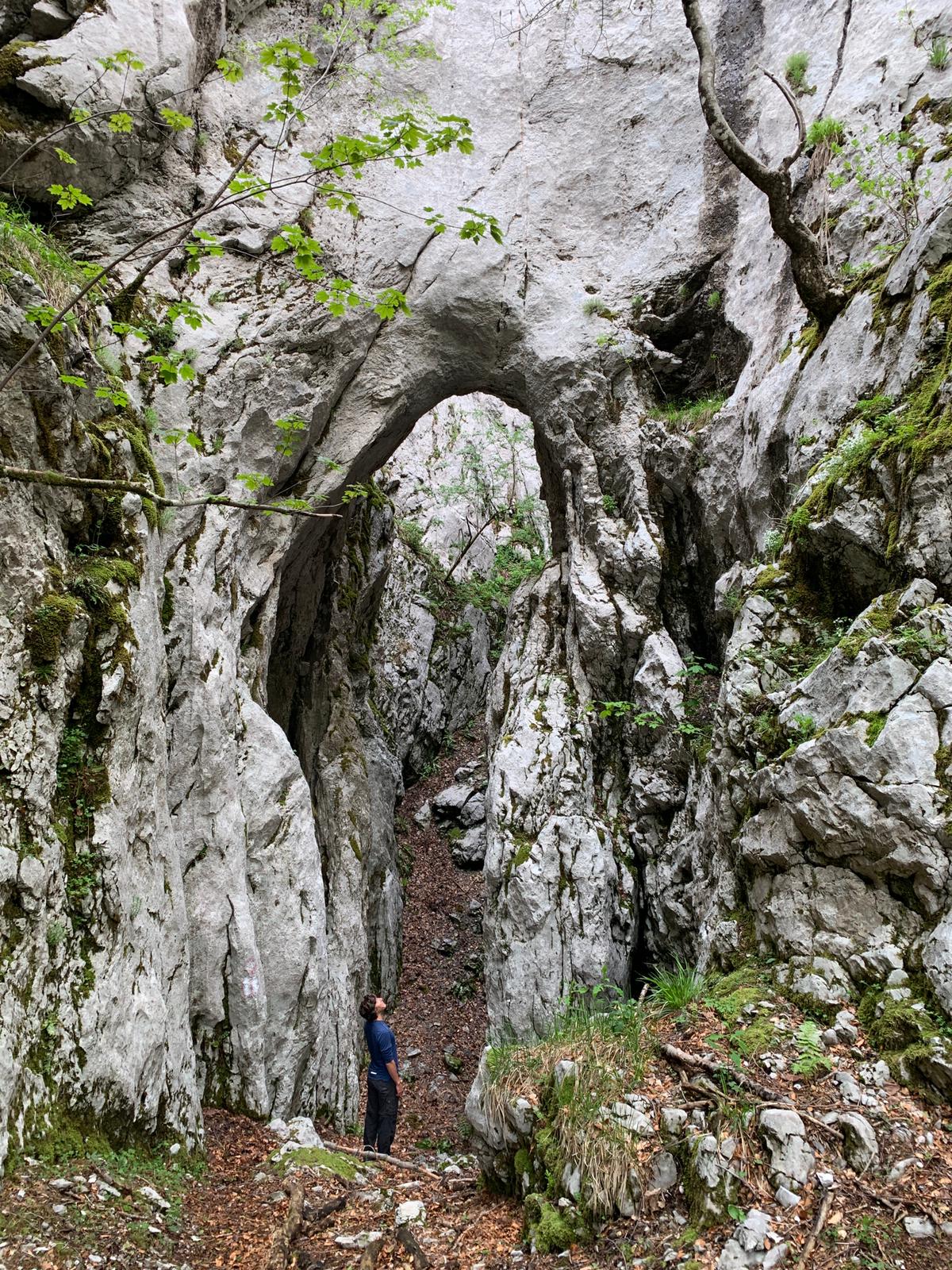
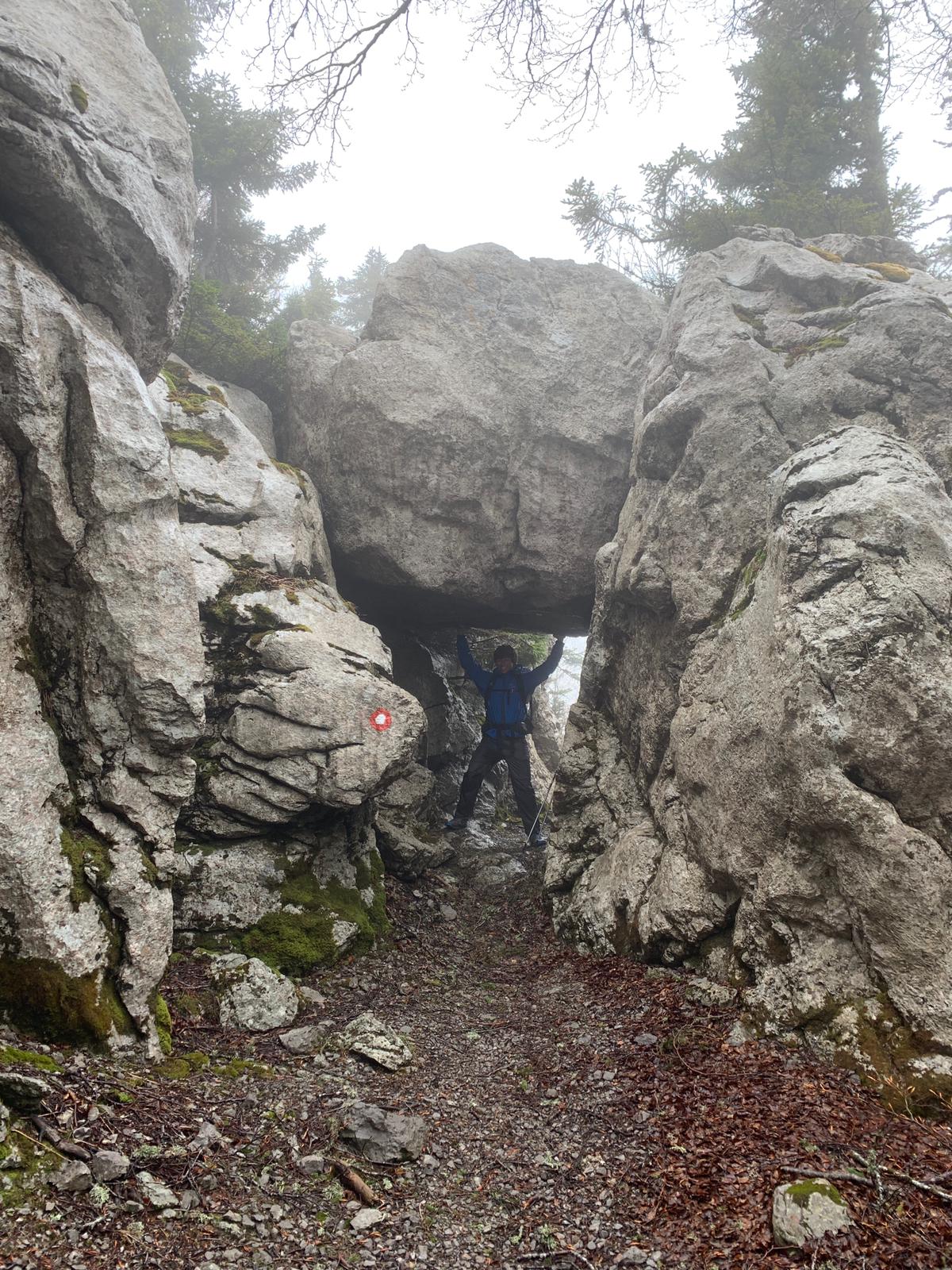
It turns out a Croat Stone Gallery is a remarkable thing, though it’s real confusing. Rock arches, precarious boulders, steep ravines, and thin blades of rocks to walk across suspended over steep drops, it was like a Karst obstacle course. It was unlike anywhere else we have ever hiked, and we were very lucky to accidentally find it.
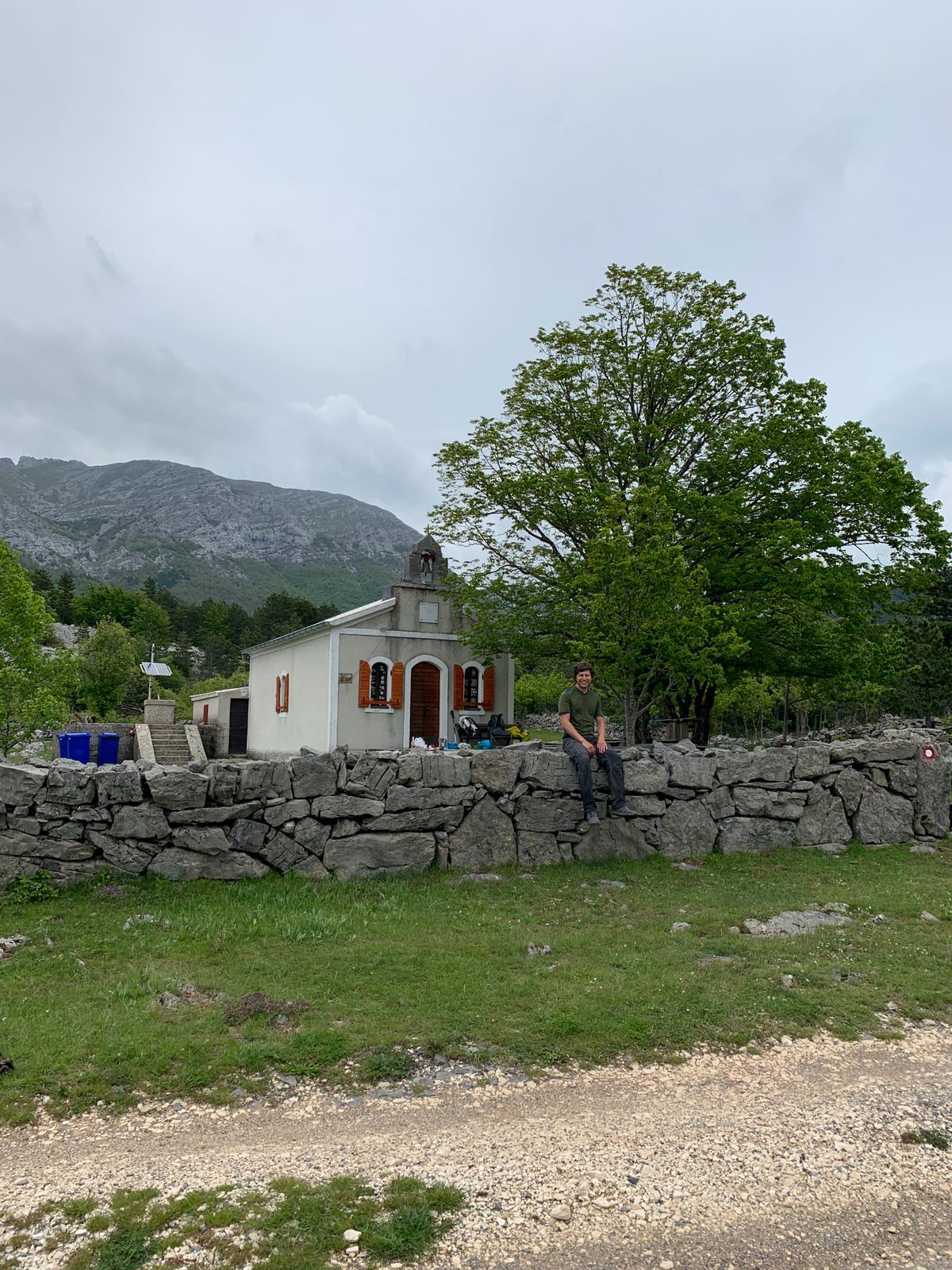
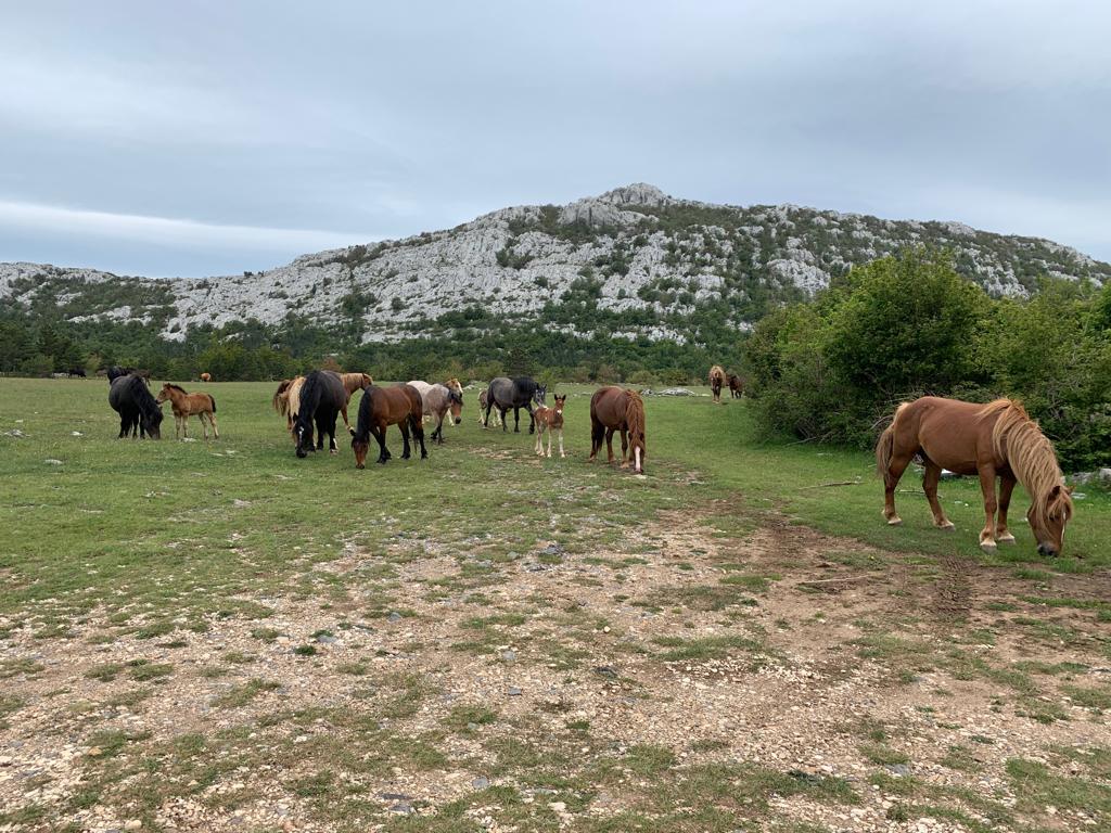
From there we meandered along the ridges before descending into a wide pasture area surrounded by rock walls – it’s easy to forget you’re just a few miles inland from the ocean. The shelter there is the former church of the now defunct farming community of Veliko Rujno. We didn’t get to go inside but we did get to fetch water from the well with a bucket, which was authentic. Seems like it’s still a nice place to be a cow or horse.
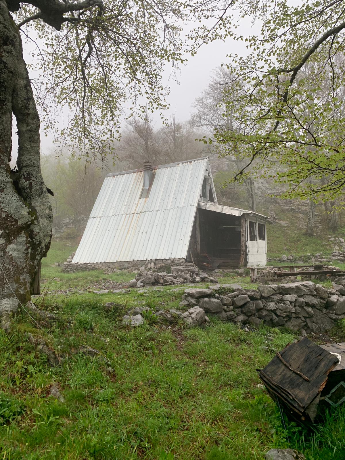
From there we climbed up the ridge and into the next valley over, bringing us into Southern Velebit National Park. The climb totaled almost 600m and, by the time we reached the hut, we transitioned from a mostly sunny day at the bottom to a cloudy, rainy evening at the top. Hut Stuge’s water supply turned out to be a snail covered well oddly located in an open field 20 minutes up the trail. The outhouse turned out the be a shovel.
And, as the sun went down and the rain picked up, Jon kicked over a pot full of boiling pasta on the hut stoop attempting to cook dinner while I failed to start a fire in the wood burning heater even using a starter brick. Shortly thereafter, as we attempted to salvage the evening, we discovered our dried meat wasn’t so dry after all and that I had been carrying around a kilogram of moldy sausage for 3 days. What I’m trying to say is that we were wet, cold, and stupid, but Hut Struge was nice and no one but the mice laughed at our misfortunes.
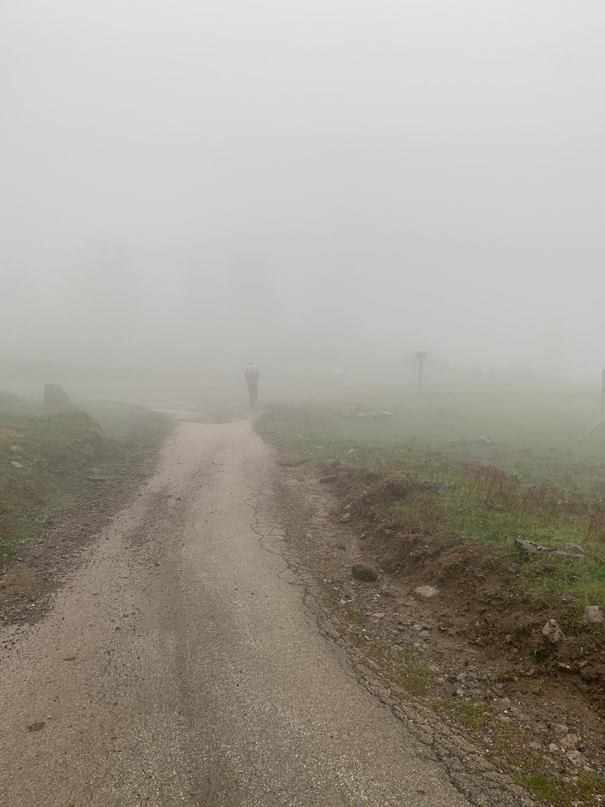
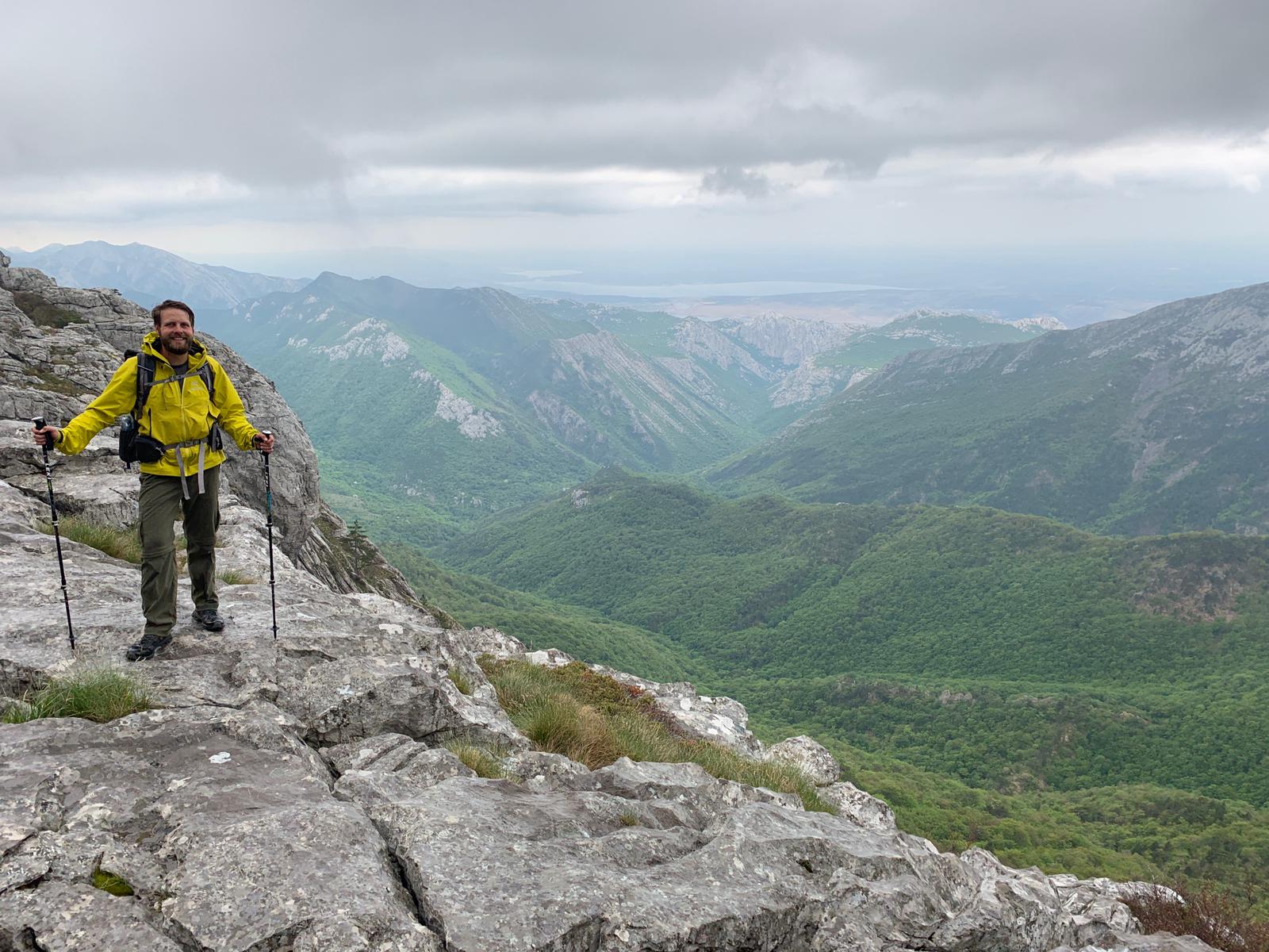
Day 7 – Stuge to Defeat in the Rain, ~10 miles
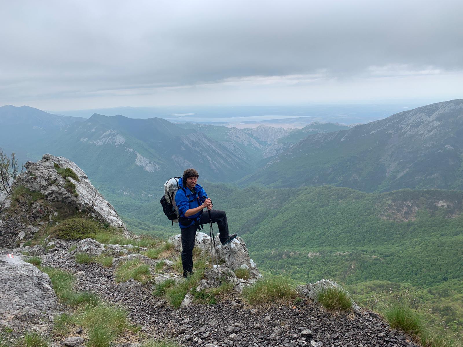
After enjoying a few days of sun we were disappointed to wake up in Struge, once again, in a cloud. Our final hiking day was planned to be through the peaks of Southern Velebit (Sveti Brdo and Vaganski Vrh). Unfortunately, since we were firmly in the rain and fog at the hut at 1400m, we only expected it to be worse on the (completely exposed) peaks at 1750m. Jon wasn’t disappointed because he isn’t disappointed by anything, but I felt bummed bailing out before the big peaks, but eventually we decided to do exactly that.
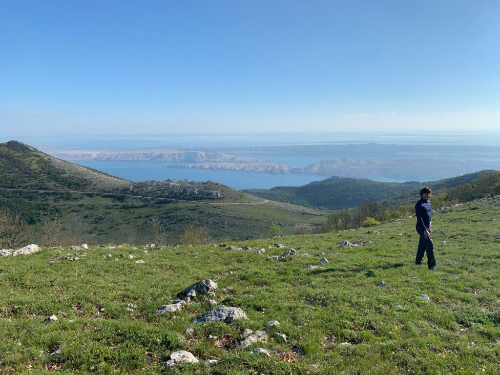
We took a steep shortcut straight down the ridgeline and right out the valley, stopping only for a coffee in the hut at the bottom. It is truly a disjointed feature of the coastal mountains that one can walk from a Winter day in the rain and cold on the mountain top, down to a partly cloudy Spring day on the beach just a few hours later. It was at least some comfort (for me) that, looking up from sea level, the mountains appeared totally socked in above 1000m, so we certainly wouldn’t have seen anything at all on Sveti Brdo had we climbed it. It’s a good excuse to visit again, if one was needed.
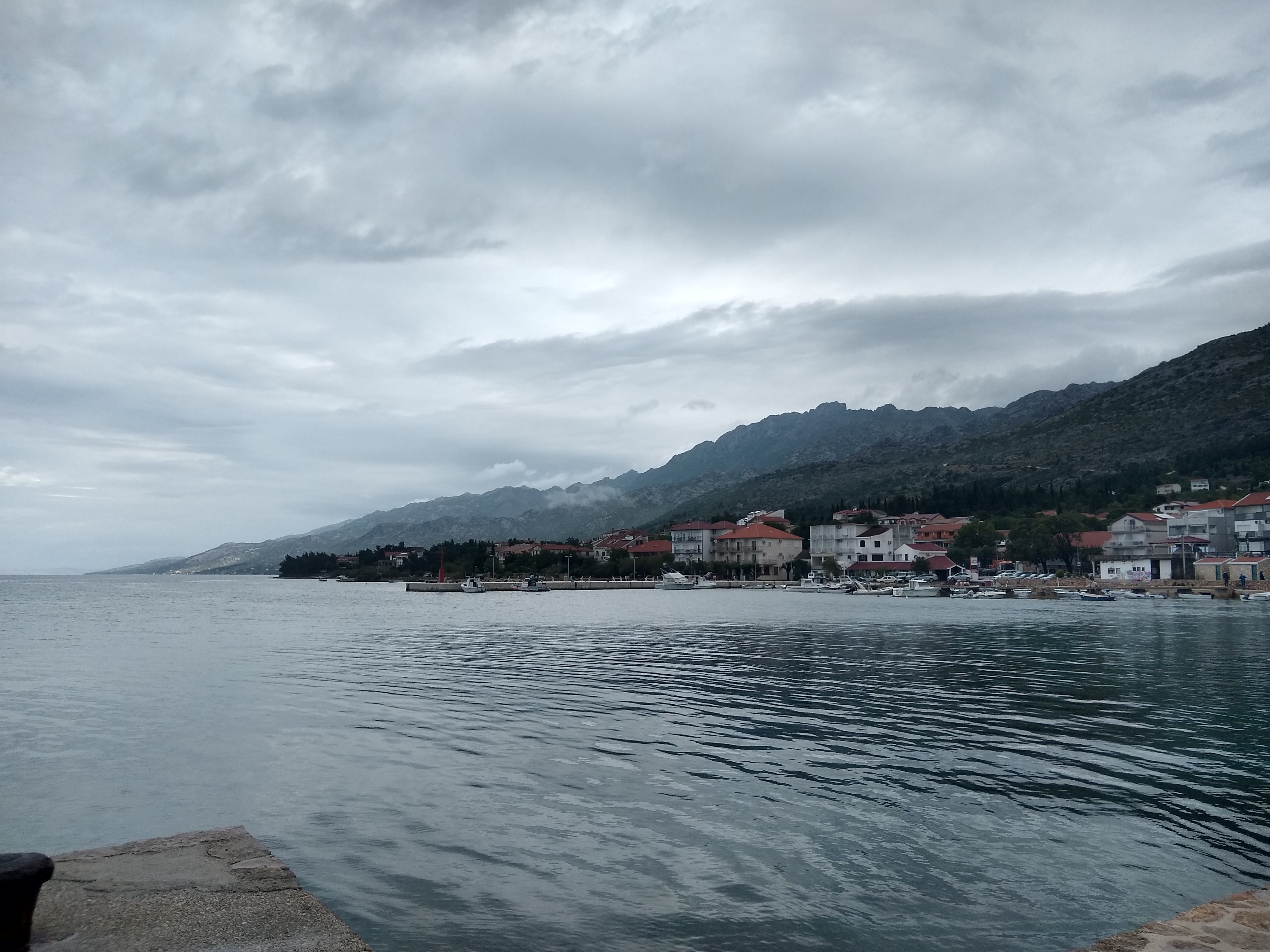
Once back down by the coast we stayed in a sweet old couple’s Airbnb for the night in Starigrad Paklencia before catching a bus to Venice. Bye Croatia!
In the name of the Scythe Lord! You make your kingdom proud Forever Queen and Squire. Venture forth and conquer even more lands, yet tread carefully, for most important is your safe and quick return to your comrades. Your communication has been received and is greatly appreciated. Keep up the reconnaissance, we follow along with great interest and admiration!
Great to see what you are up to and interesting to read about the trail, I have not been convinced to give it a try! As for those trail markers, yes they are hopeless!
Lots of beer but how about the local wines?